 Printable Scholar
Types of Landforms
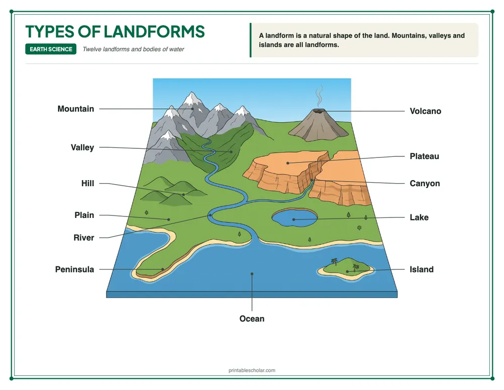
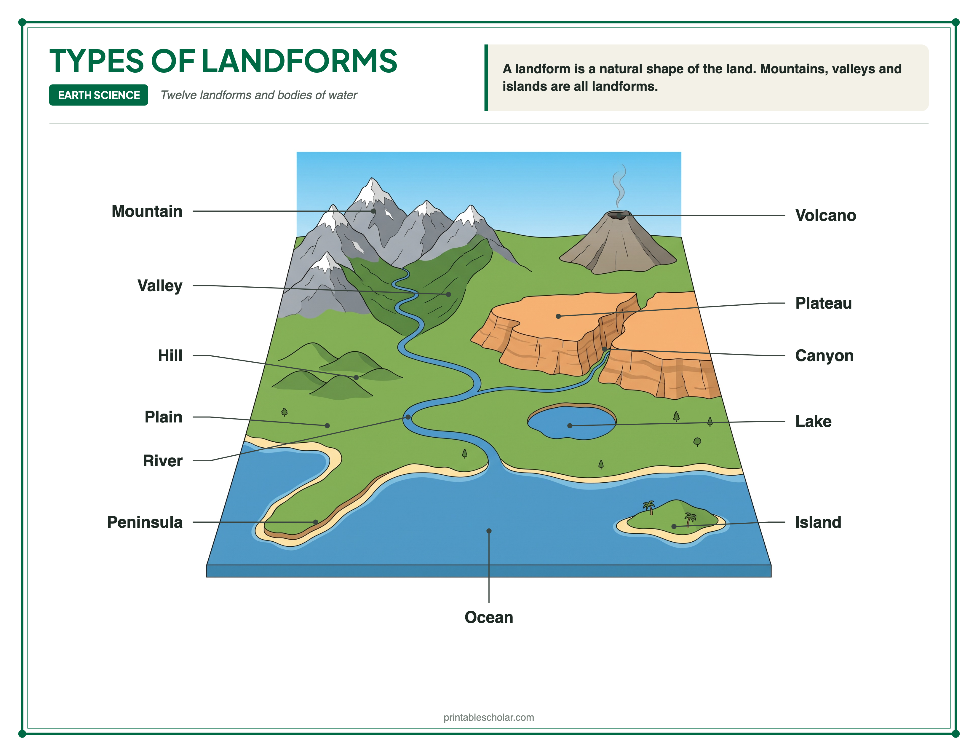
Free printable types of landforms diagram: mountain, hill, valley, plain, plateau, canyon, volcano, island, peninsula and more in one labeled landscape, plus a blank diagram to label. Download a high-resolution PDF or PNG for Letter paper.
Part of the Types of Landforms teaching pack for grades 3 to 5: 22 lesson slides and 8 printables with answer keys. The diagram and the blank one to label are free.
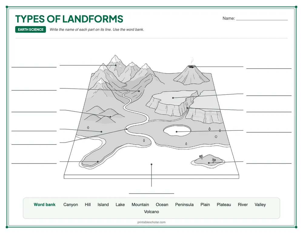
Blank diagram to label
Download blank version + answer key 12 blanks, a word bank, and the answer key on page 2Teaching ideas for Types of Landforms
Pick the ideas that suit your class, then follow the plan or use the sheets in any order.
- Clay landforms. On a tray, students shape a mountain, a hill and a plateau from clay or play dough. They press a hollow and pour in water for a lake, then add water around the edge for an island and a peninsula.
- Map hunt. Give pairs a map or a globe. They find an island, a peninsula, a lake and some mountains, then show the class one they found.
- Landform charades. A student acts out a landform with their arms, like a tall mountain or a flat plateau. The class guesses its name from the diagram.
A plan for the week
| Day 1 | Open with one of the ideas above. Teach the lesson with the slides while students fill in the guided notes. Then students label the blank diagram. | Lesson slides (PowerPoint) (in the pack) Types of Landforms Guided Notes (in the pack) Types of Landforms Diagram Blank Types of Landforms |
| Day 2 | Students match each landform to its description on “Landform Words” and answer the questions. | Landform Words (in the pack) |
| Day 3 | Read “Shapes of the Land” and answer the questions. | Shapes of the Land (in the pack) |
| Day 4 | Students use two clues for each row on “Landform Clues” to tell look-alike landforms apart. | Landform Clues (in the pack) |
| Day 5 | Review with the crossword, then give the quiz. | Types of Landforms Crossword (in the pack) Types of Landforms Quiz (in the pack) |
The sheets marked “in the pack” are in the Types of Landforms teaching pack below.
NGSS standards
- Supports 2-ESS2-2: Develop a model to represent the shapes and kinds of land and bodies of water in an area.
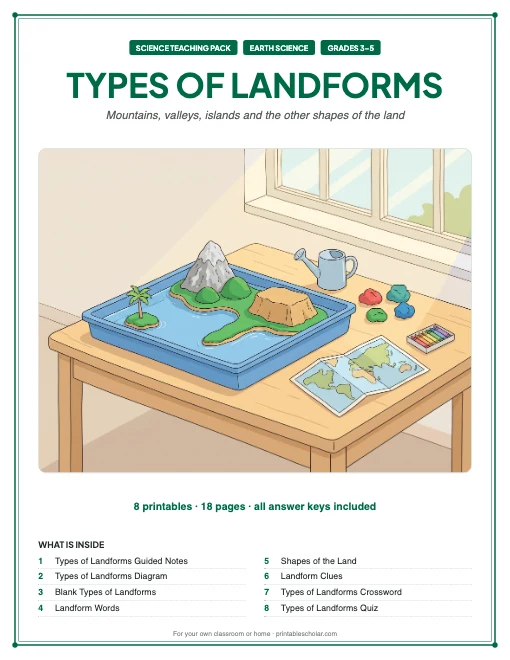
Types of Landforms teaching pack
Teaching landforms? This pack has ready-made lesson slides and 8 printables that cover twelve landforms and bodies of water, in teaching order, with every answer key.
Free on this page: 2 of the 9 printables, marked Download below. The whole pack is $7: 18 pages in one print-ready file, the 22 lesson slides, the practice sheets, the crossword, the quiz and every answer key.
One-time purchase. Instant download. Secure checkout by Stripe. Want to see a whole pack first? The Inside the Earth and Volcanoes pack is free.See all 28 packs in the bundle
- The Microscope
- Photosynthesis
- Parts of a Plant and Flower
- Life Cycle of a Plant
- Life Cycles of a Butterfly and a Frog
- Food Chains and Food Webs
- The Water Cycle
- Skeletal System
- Muscular System
- Digestive System
- Respiratory System
- Heart and Circulation
- Nervous System and Brain
- Eye and Ear
- Parts of a Tooth
- Inside the Earth and Volcanoes
- Rocks and the Rock Cycle
- Layers of the Atmosphere
- Types of Clouds
- Weathering, Erosion and Deposition
- Types of Landforms (this pack)
- The Solar System
- The Seasons
- Moon Phases and Eclipses
- States of Matter
- Forms of Energy
- Simple Machines
- Magnets and Magnetic Fields
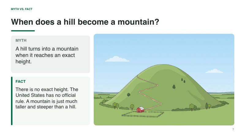
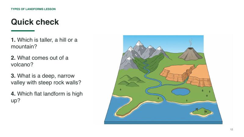
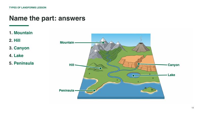
Teach Types of Landforms with 22 ready-made slides
Open the PowerPoint and teach: an opening question, the parts one at a time on the diagram, quick checks and an exit question. Your notes for each slide are in the speaker notes. Students fill in the guided notes sheet as you go.
The slides (PowerPoint and a PDF copy) and the guided notes sheet come with the pack.What is in the pack, in teaching order
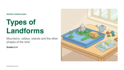 In the pack
1. TeachLesson Slides22 slides to present, with your notes for each one.In the $7 pack
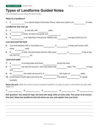 In the pack
1. TeachTypes of Landforms Guided NotesStudents fill in the blanks as you present. With answer key.In the $7 pack
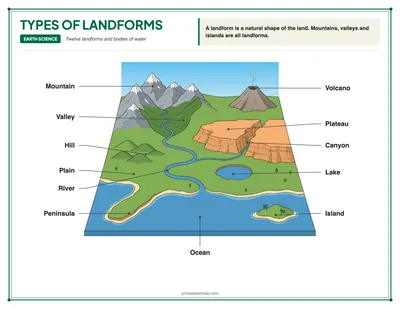 Free
1. TeachTypes of Landforms DiagramThe labeled diagram, 12 landforms and bodies of water.Download free PDF
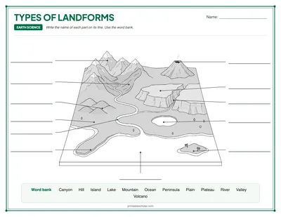 Free
2. LabelBlank Types of LandformsStudents label 12 landforms and bodies of water from a word bank.Download free PDF
 In the pack
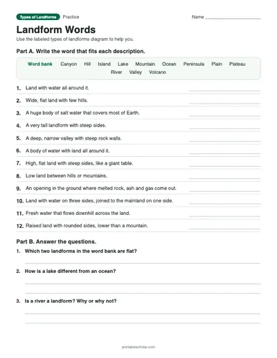
3. MatchLandform WordsMatch the 12 landforms and bodies of water to their descriptions, then answer three questions.In the $7 pack
 In the pack
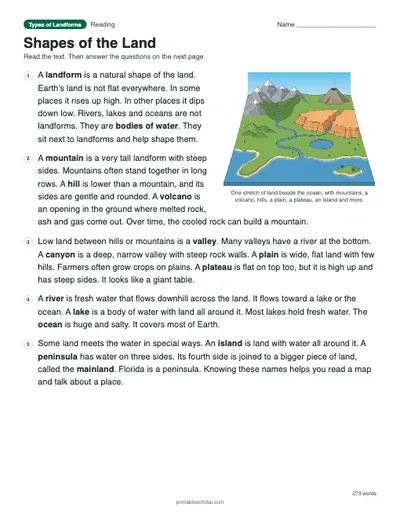
4. ReadShapes of the LandA one-page text on the shapes of the land and the bodies of water beside them, with eight questions.In the $7 pack
 In the pack
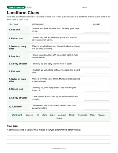
5. ApplyLandform CluesRead two clues and name each landform or body of water, telling five look-alike pairs apart.In the $7 pack
 In the pack
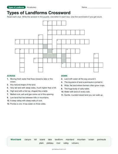
6. ReviewTypes of Landforms CrosswordFourteen landform words with clues and a word bank.In the $7 pack
 In the pack
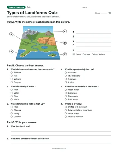
7. CheckTypes of Landforms QuizLabel five landforms, six multiple choice and two written answers. Scored out of 13.In the $7 pack
Types of Landforms worksheets, crossword and quiz
The Types of Landforms teaching pack is 22 lesson slides (PowerPoint and PDF) and 8 printables with answer keys for grades 3 to 5, in the order you would teach them: the guided notes for the lesson slides, the labeled diagram and the blank one to label, then “Landform Words” (a worksheet), “Shapes of the Land” (a reading passage), “Landform Clues” (a clue table), a vocabulary crossword and a quiz.
The sheets are in a suggested teaching order: teach the lesson, have students label the blank diagram, then work through the practice sheets and finish with the quiz. Use them all over a week or pick the ones you need. The answer keys are together at the back.
The diagram and the blank one to label are free to download on this page. The other sheets come with the pack ($7), which is also in the Elementary Science bundle (grades 3 to 6).
Earth’s surface is not flat. It rises into mountains and hills, drops into valleys and canyons, and spreads out into wide plains. Some landforms are made by forces deep inside the Earth, like volcanoes and mountains. Others are carved by water, wind and ice over a very long time, like canyons and valleys. Bodies of water such as rivers, lakes and oceans are not landforms, but they sit beside them and help shape them. Knowing the names of landforms helps you read maps and describe places.
Twelve landforms and bodies of water
A landform is a natural shape of the land, like a mountain, a valley or an island. Rivers, lakes and oceans are bodies of water that shape the land around them. Here is what happens at each labeled part of the diagram:
| Feature | What it does | Why it matters |
|---|---|---|
| Mountain | A very tall landform with steep sides that rises high above the land around it. | Mountains often come in long rows called ranges. The tallest mountain on Earth is Mount Everest, about 29,000 feet (8,849 meters) high. High mountains can be so cold that snow stays on their tops all year. |
| Hill | A raised, rounded landform that is lower and gentler than a mountain. | There is no exact height where a hill becomes a mountain. Hills usually have gentle slopes you can walk up, and many are covered in grass or trees. |
| Valley | A low area of land between hills or mountains. | Many valleys have a river or stream running along the bottom. Rivers carve narrow valleys shaped like the letter V, and glaciers carve wide valleys shaped like the letter U. |
| Plain | A wide, flat area of land with few hills. | Plains are good for farming and building towns because the land is flat. The Great Plains in the middle of the United States stretch for hundreds of miles. |
| Plateau | A large, high area of land with a flat top and steep sides. | A plateau is like a giant table of land. It rises high above the land around it but is flat on top like a plain. The Colorado Plateau in the western United States is famous for its red rock. |
| Canyon | A deep, narrow valley with steep rock walls, usually carved by a river. | A river slowly cuts down into the rock over millions of years. The Grand Canyon in Arizona was carved by the Colorado River and is about a mile deep. |
| Volcano | An opening in the Earth’s crust where melted rock, ash and gas come out. Over time, the cooled rock can build a mountain. | Melted rock deep underground is called magma. When it comes out of a volcano it is called lava, and it cools into new rock. Some volcanoes are quiet for hundreds of years between eruptions. |
| River | A large stream of fresh water that flows across the land, usually toward an ocean or lake. | Rivers flow downhill, often starting high in the mountains. They carry water, sand and mud, and over time they carve valleys and canyons. |
| Lake | A large body of water with land all around it. | Most lakes hold fresh water. Some are fed by rivers and streams, and some by rain and melting snow. The Great Lakes between the United States and Canada are some of the largest lakes in the world. |
| Ocean | A huge body of salt water that covers much of the Earth. | Oceans cover about 71 percent of Earth’s surface. There are five oceans: the Pacific, Atlantic, Indian, Southern and Arctic. |
| Island | A piece of land with water all around it. | Islands can be found in oceans, lakes and rivers. Some, like Hawaii, were made by volcanoes. Greenland is the largest island in the world. |
| Peninsula | A piece of land with water on three sides, joined to the mainland on the fourth side. | Florida is a peninsula: it has water on the east, the west and the south, and joins the rest of the United States in the north. |
How to print
Choose Download PDF for a ready-to-print file that fits US Letter paper (8.5 × 11") in landscape, or Download PNG for the high-resolution image.
Frequently asked questions
What is a landform?
A landform is a natural shape of the Earth’s surface, such as a mountain, hill, valley, plain, plateau, canyon or island.
What is the difference between an island and a peninsula?
An island has water all the way around it. A peninsula has water on three sides and is joined to the mainland on the fourth side.
What is the difference between a hill and a mountain?
A mountain is much taller and steeper than a hill. A hill is lower and more rounded. There is no exact height that separates the two.
What paper size should I print this on?
The diagram is sized for standard US Letter paper (8.5 × 11") in landscape orientation. Use "Download PDF" for a print-ready file that fits the page automatically.
Are there Types of Landforms worksheets to go with the diagram?
Yes. The Types of Landforms teaching pack, for grades 3 to 5, has 22 lesson slides and 8 printables with answer keys: the guided notes for the lesson slides, the labeled diagram and the blank one to label, then “Landform Words” (a worksheet), “Shapes of the Land” (a reading passage), “Landform Clues” (a clue table), a vocabulary crossword and a quiz. The diagram and the blank one to label are free to download on this page. The other sheets come with the pack ($7), which is also in the Elementary Science bundle (grades 3 to 6).