Ring of Fire Map Worksheet
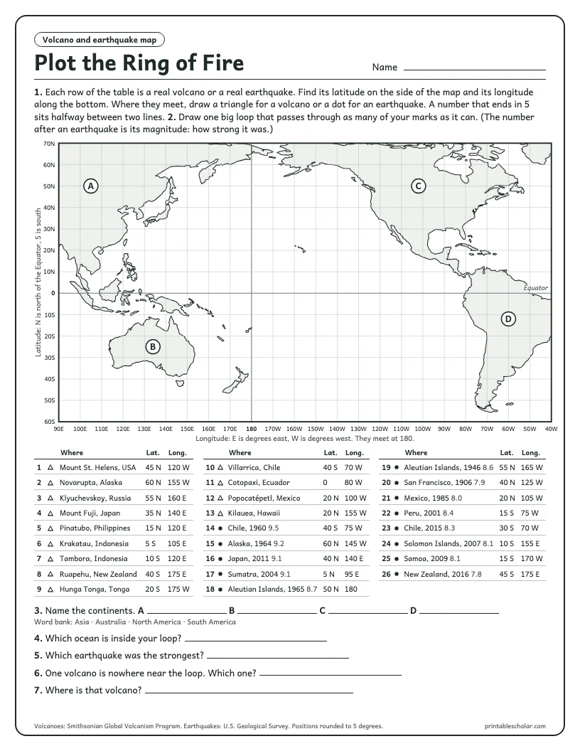
Plot 13 real volcanoes and 13 real earthquakes on a world map with the Pacific Ocean in the middle. Nobody tells students the pattern. The ring appears as the marks go down.
Download the worksheet (PDF)What students do
- Plot 26 real places by latitude and longitude: a triangle for each volcano, a dot for each earthquake.
- Draw one loop through the marks and see that it circles the Pacific Ocean.
- Name four continents marked on the map.
- Find the one volcano that is nowhere near the ring, and say where it is.
- Pick out the strongest earthquake from its magnitude.
Answer key
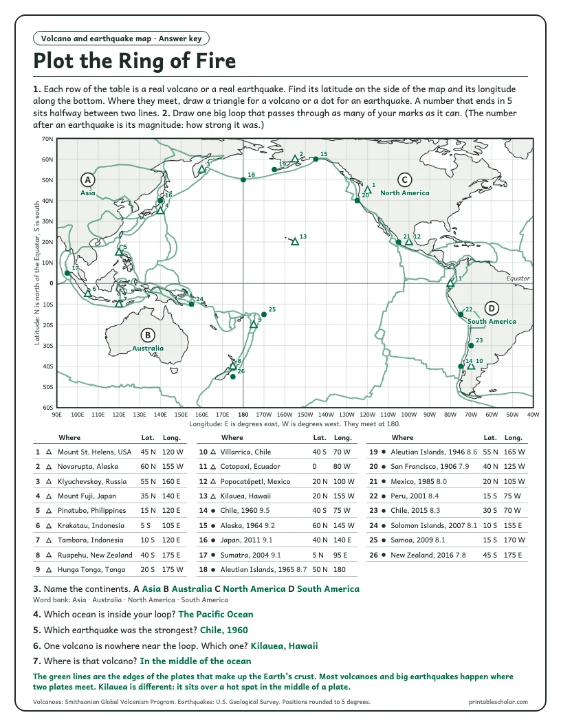
The second page of the PDF is the answer key: every mark in place, the answers, and the real plate boundaries drawn in green.
How to use it
The map has a line every 10 degrees, and every position in the table is rounded to the nearest 5, so each mark lands on a line or halfway between two. The Pacific sits in the middle of the map, so longitude runs from degrees east on the left, through 180, to degrees west on the right.
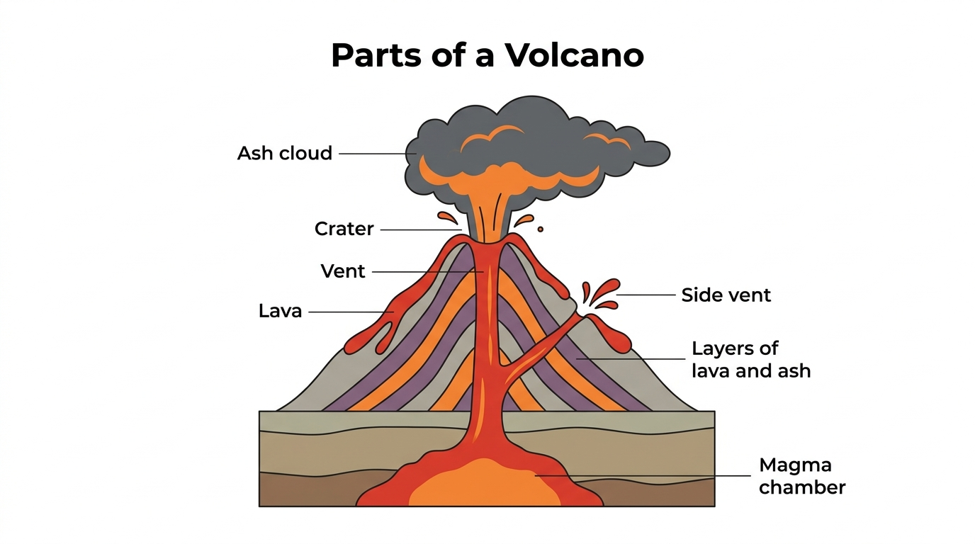
Hand out the sheet before explaining the Ring of Fire, not after. The answer key adds the real plate boundaries in green, which shows why the marks fall where they do. It pairs with the volcano diagram and the tectonic plate map.
Where the numbers come from
Volcano positions are from the Smithsonian Institution’s Global Volcanism Program. Earthquake positions and magnitudes are from the United States Geological Survey earthquake catalog. Plate boundaries on the answer key are the same published set the tectonic plate map uses. Land outlines are from Natural Earth.
Goes well with