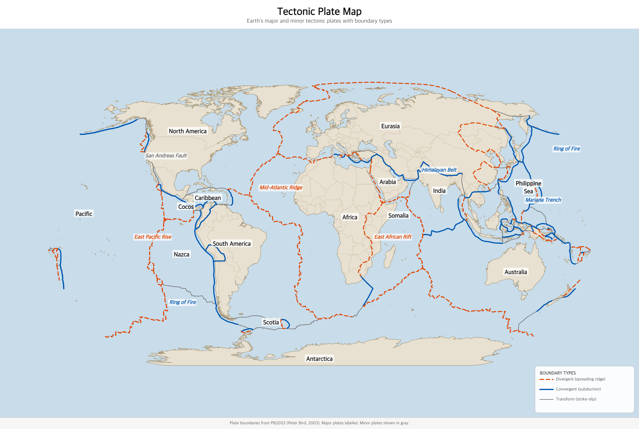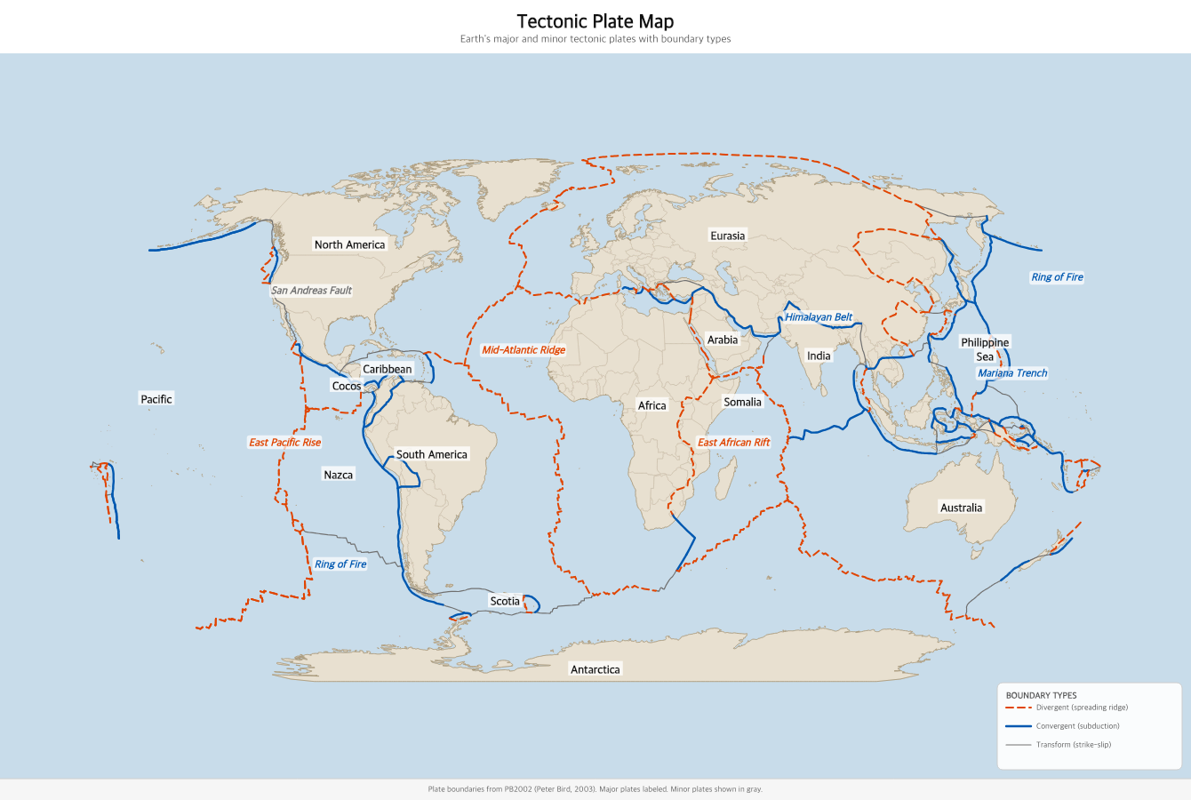
Earth's major and minor tectonic plates, with divergent, convergent, and transform boundaries clearly distinguished. Free to download and print.
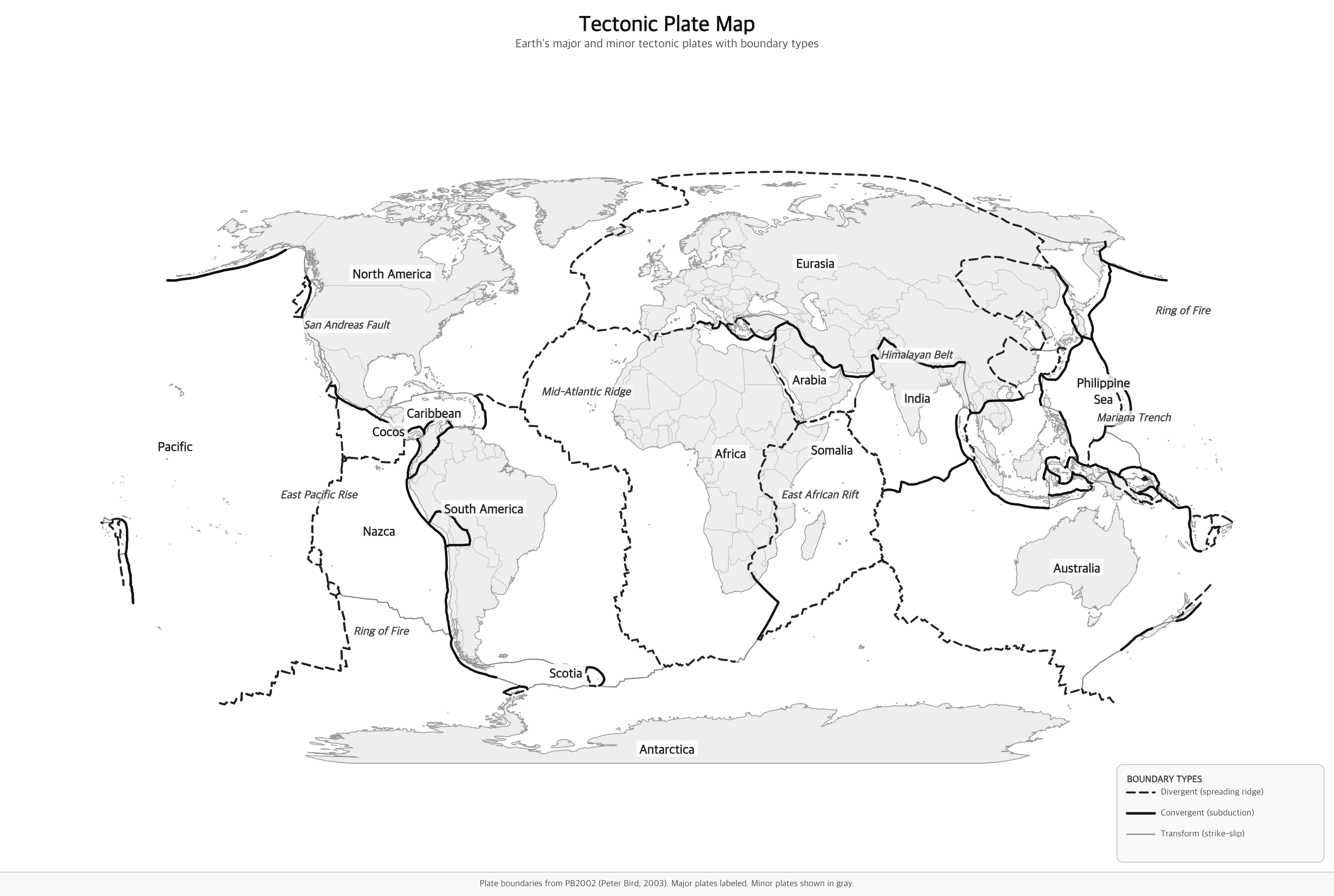
Black & White versions
Earth's outer shell — the lithosphere — is not a single solid piece. It's broken into roughly 20 major and minor tectonic plates that fit together like a cracked eggshell. These plates, ranging in thickness from 5 to 200 kilometers, float on the hot, partially molten rock of the asthenosphere below. Driven by heat convection currents rising from Earth's interior, they move a few centimeters every year — about the rate your fingernails grow.
The theory that explains this movement is called plate tectonics, first fully developed in the 1960s. It unified decades of puzzling observations: why the continents look like jigsaw pieces, why earthquakes and volcanoes cluster along specific belts, why fossils of the same species appear on opposite sides of the Atlantic Ocean. Plate tectonics is now the fundamental framework of modern geology.
Plates pull apart, creating new ocean floor at mid-ocean spreading ridges. The Mid-Atlantic Ridge is a classic example — Iceland sits atop it.
Plates collide. Denser oceanic plates dive beneath lighter ones (subduction), forming deep trenches and volcanic arcs. Two continental plates collide to form mountain ranges like the Himalayas.
Plates slide past each other horizontally, generating large earthquakes. The San Andreas Fault in California runs along a transform boundary between the Pacific and North American plates.
Earth has seven major plates: the Pacific, North American, South American, Eurasian, African, Antarctic, and Australian (or Indo-Australian) plates. These account for most of Earth's surface area. The Pacific Plate is the largest, covering most of the Pacific Ocean. The next tier of plates — Arabian, Caribbean, Cocos, Indian, Juan de Fuca, Nazca, Philippine Sea, and Scotia — are significant but smaller. Dozens of micro-plates fill the remaining gaps, particularly in the complex tectonics of Southeast Asia and the Mediterranean.
The boundaries between plates are where Earth's most dramatic geology happens. About 90% of all earthquakes occur along plate boundaries, as do more than 75% of active volcanoes. The "Ring of Fire" — a horseshoe-shaped zone of intense seismic and volcanic activity around the Pacific Ocean — marks the boundaries of the Pacific Plate with its neighbors.
A tectonic plate is a massive, rigid slab of Earth's lithosphere — the crust and uppermost mantle — that floats on the semi-fluid asthenosphere below. Earth's surface is divided into about a dozen major plates and many smaller ones that move a few centimeters per year, driven by heat convection in the mantle. Where these plates meet, interact, and pull apart, we find earthquakes, volcanoes, and mountain ranges.
Divergent boundaries (shown in orange-red) are where plates pull apart — new ocean floor is created at mid-ocean ridges like the Mid-Atlantic Ridge. Convergent boundaries (blue) are where plates collide — one often dives beneath the other in a subduction zone, creating deep ocean trenches and volcanic arcs; where two continental plates collide, mountains like the Himalayas rise. Transform boundaries (gray) are where plates slide past each other horizontally — the San Andreas Fault in California is a classic example.
This map is sized for standard US Letter paper (8.5 × 11 in.). Use the Download PDF button for a print-ready file, or the Download PNG button for a high-resolution image. The black-and-white version is ideal for classroom coloring or labeling exercises.