Free Printable Ottoman Empire Map
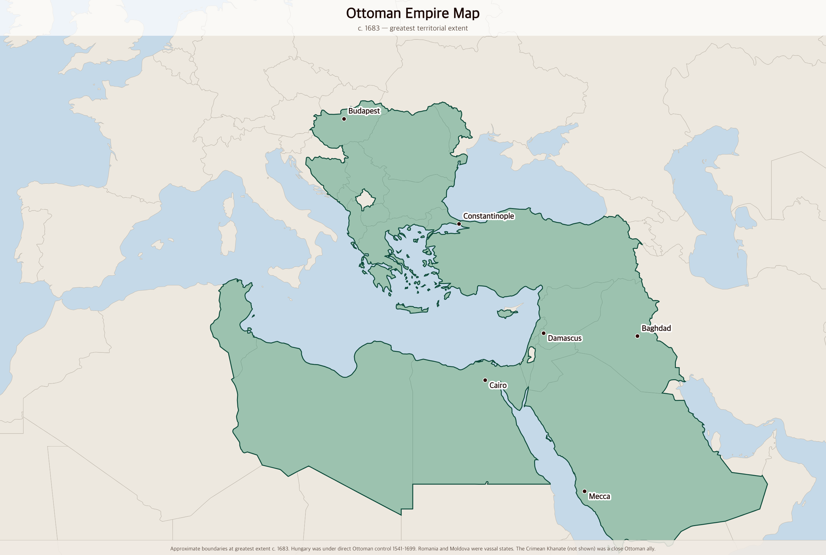
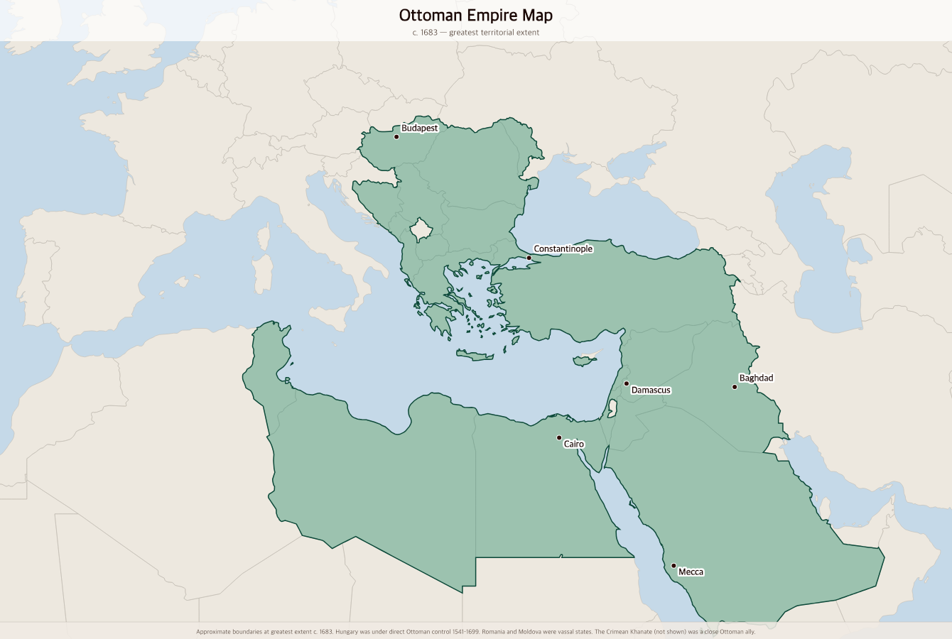
Free printable map of the Ottoman Empire at its greatest extent around 1683, stretching from Hungary and the Black Sea to Egypt, the Levant, and the Arabian Peninsula.
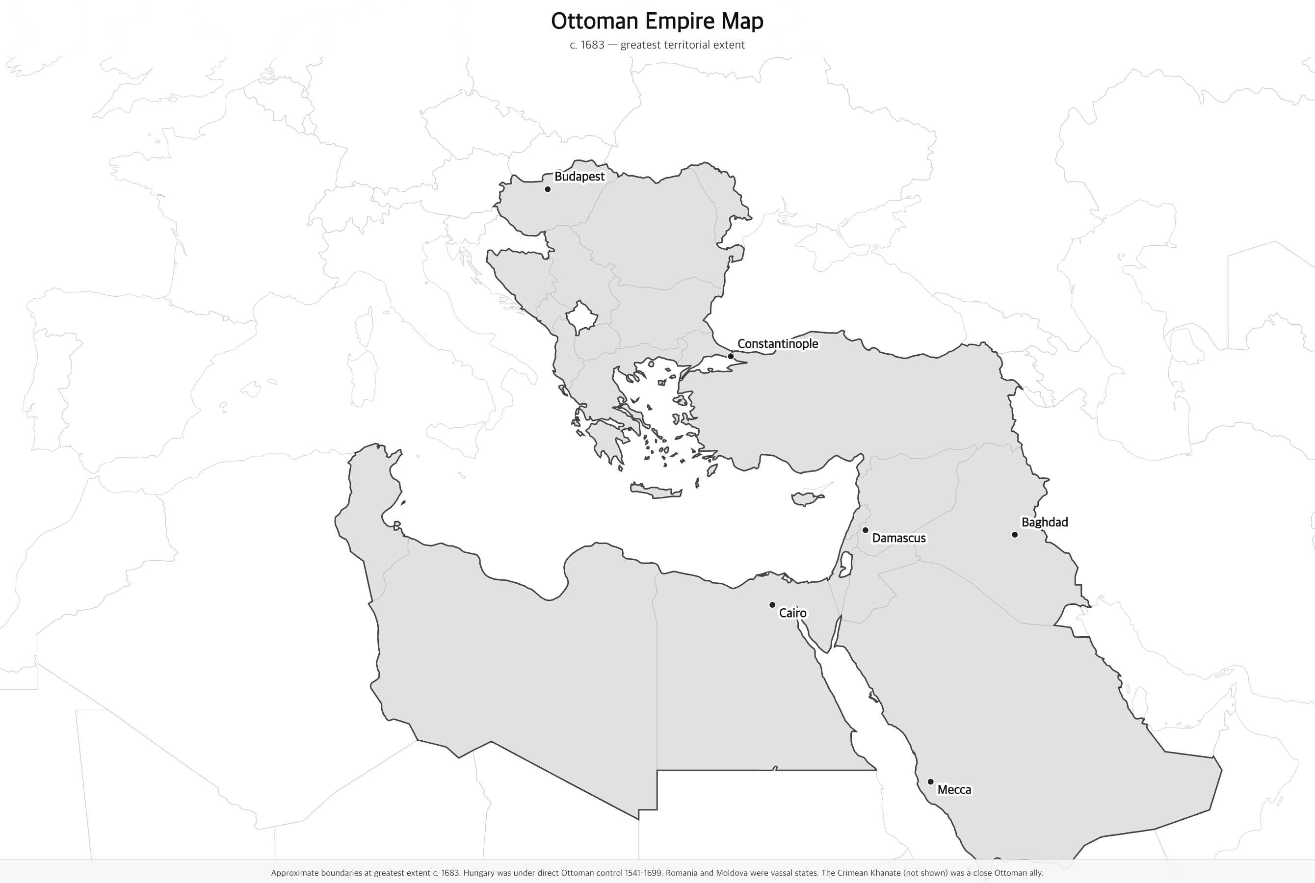
Black & white version
About This Map
Free printable map of the Ottoman Empire at its greatest extent around 1683, stretching from Hungary and the Black Sea to Egypt, the Levant, and the Arabian Peninsula.
The History Behind This Map
The Ottoman Empire was one of the most powerful and long-lived states in history, ruling for over six centuries from 1299 to 1922. Founded by Osman I in northwestern Anatolia, it expanded relentlessly — crossing into Europe in the 1350s, conquering Constantinople in 1453, and absorbing Egypt and the Arab heartland in the early 1500s. Under Sultan Suleiman the Magnificent (1520–1566), the empire reached its cultural and military zenith, from Hungary in the west to the Persian Gulf in the east.
At its greatest territorial extent around 1683, the empire stretched across three continents — southeastern Europe from Hungary to Greece, all of Anatolia, the entire Arab world from Syria and Iraq to Egypt and the Libyan coast, and the holy cities of Mecca and Medina on the Arabian Peninsula. Constantinople (renamed Istanbul) was the imperial capital and one of the world's great cities, home to the spectacular Topkapı Palace and the Süleymaniye Mosque.
The failed second siege of Vienna in 1683 marked the beginning of Ottoman retreat from Europe. The empire survived for another two and a half centuries but gradually lost territory to Austria, Russia, and rising nationalist movements. It entered World War I on the German side and collapsed with its defeat. The Republic of Turkey was proclaimed in 1923 under Mustafa Kemal Atatürk, who abolished the sultanate and launched sweeping modernization reforms.
How to Use
Print this map on standard US Letter paper (8.5" × 11"). Click "Download PDF" for a print-ready file that automatically fits your page in landscape orientation, or "Download PNG" for the high-resolution image file. Works great for world history lessons, geography units, or display on a classroom whiteboard.
Frequently Asked Questions
How big was the Ottoman Empire at its peak?
At its greatest extent around 1683, the Ottoman Empire covered approximately 5.2 million square kilometers. It ruled over a diverse population across southeastern Europe, all of Anatolia, the Levant, Mesopotamia, Egypt, North Africa, and the Hejaz region of the Arabian Peninsula — one of the most geographically and culturally diverse empires in history.
Which modern countries were part of the Ottoman Empire?
The Ottoman Empire covered modern-day Turkey, Greece, Bulgaria, Serbia, Bosnia, Albania, North Macedonia, Hungary, Romania, Moldova, Cyprus, Syria, Lebanon, Israel, Jordan, Iraq, Egypt, Libya, Tunisia, and the Hejaz region of Saudi Arabia (including Mecca and Medina).
When did the Ottoman Empire fall?
The Ottoman Empire formally ended in 1922 when the last sultan, Mehmed VI, went into exile. The Republic of Turkey was proclaimed on October 29, 1923, under Mustafa Kemal Atatürk. The empire had been in gradual decline since the failed siege of Vienna in 1683, accelerated by nationalist revolutions in the 19th century and defeat in World War I.
Why did the Ottomans control Mecca and Medina?
Sultan Selim I conquered Egypt and the Hejaz region of Arabia in 1517, bringing the holy cities of Mecca and Medina under Ottoman control. This gave the Ottoman sultans enormous religious prestige — they took the title "Custodian of the Two Holy Mosques" and organized the annual Hajj pilgrimage for over 400 years.