 Printable Scholar
Medieval Europe Map
A free printable map of Europe in the Middle Ages, about AD 1200, drawn on real terrain, with every kingdom in its own color: England and the English king’s lands in France, the Kingdom of France, the Holy Roman Empire, the Papal States, the Spanish kingdoms, the Byzantine Empire and the crusader states. It comes in color, in black and white, and blank.

Choose your version
Black and white, color or blank.
All three are free PDFs sized for US Letter paper.

Black and white
Every kingdom and city named on a plain outline map with dark borders and no terrain. No color ink needed.
downloadBlack and white PDF
Color
Every kingdom in its own color, on shaded relief, with the cities, seas and rivers named.
downloadColor PDF
Blank
The borders and city markers with no names, for labeling practice.
downloadBlank PDF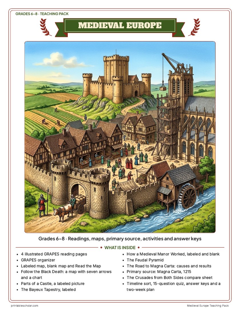
Teaching pack · Grades 6–8
Teaching Medieval Europe? The whole unit, ready to teach.
Two weeks of lessons in one download: slides to present, notes for students to fill in, and printable pages that use these maps and pictures.
Every slide comes with teacher notes: what to say, what to ask, and sample answers.
- 47 lesson slides (PowerPoint you can edit) and 2 pages of guided notes
- 4 illustrated reading pages and a GRAPES organizer
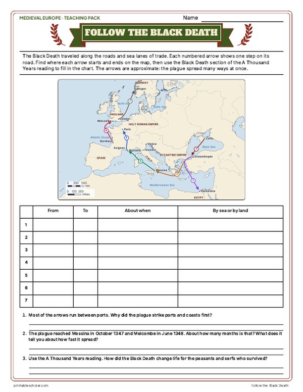
- Maps: Europe about 1200 labeled and blank, Read and Measure the Map, and "Follow the Black Death": trace the plague from Caffa to Bergen on a real map and fill in the chart
- Activities: Parts of a Castle (labeled), the real Bayeux Tapestry, how a medieval manor worked (labeled and blank), the feudal pyramid, the road to Magna Carta, Magna Carta as a primary source, the Crusades from both sides, and a timeline sort
- A 15-question quiz, a teacher guide with a two-week plan, and answer keys for everything
Every answer is in the pack. The readings, slides, maps and pictures teach everything the sheets and quiz ask, so no textbook is needed.
Get the Medieval Europe pack for $7Teaching more than one? Get all five medieval world packs (West Africa, the Silk Road, the Byzantines, Medieval Europe and the Ottomans) for $24, with a bonus chart comparing all five: about ten weeks of lessons.
Get all 5 packs for $24See all five packsOr get every history pack (19) in one download:Get all 19 for $49
One-time purchase. Instant download. Color and ink-saving black-and-white editions. Secure checkout by Stripe.
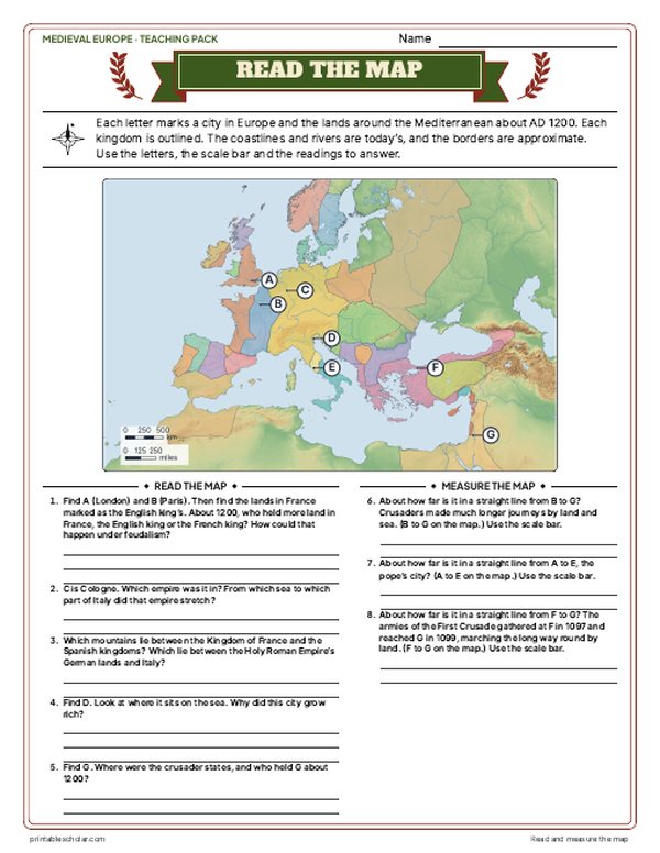
Europe about AD 1200
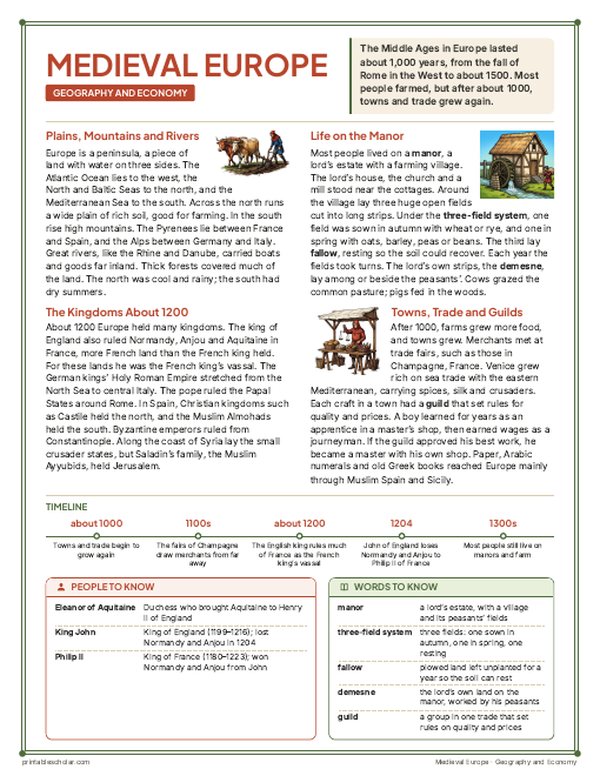
The Middle Ages in Europe lasted about a thousand years, from the fall of the Western Roman Empire in 476 to about 1500. This map shows Europe about AD 1200, in the High Middle Ages. Western Europe was divided into kingdoms whose kings depended on nobles and knights who owed them service in return for land, the system later called feudalism. The king of England also held more than half of France as a vassal of the French king, and the east of Ireland as its lord, so those lands share England’s color. In the middle of Europe the Holy Roman Empire joined Germany, Burgundy and northern Italy under one emperor, while the pope ruled the Papal States around Rome. In Spain and Portugal, Christian kingdoms were pushing south into the lands of the Almohads, a Muslim empire based in North Africa. In the east, the Byzantine Empire still ruled from Constantinople, and the Seljuk Turks held most of Anatolia. Along the coast of Syria and Palestine lay the crusader states, set up after the First Crusade of 1096 to 1099. Jerusalem itself had been retaken by Saladin in 1187, and his family, the Ayyubids, ruled Egypt and Syria.
On the map
- Paris: capital of the kings of France
- London: the largest city in England
- Rome: home of the pope, in the Papal States
- Constantinople: capital of the Byzantine Empire
- Venice: a trading city whose ships carried crusaders and goods
- Toledo: taken by Castile in 1085, a center of learning
- Acre and Jerusalem: the crusader port and the holy city retaken by Saladin in 1187
Find it on the map
- The English king’s lands in France, larger than the French king’s own
- The Holy Roman Empire stretching from the North Sea to Rome
- The crusader states, a thin strip along the eastern Mediterranean coast
Borders about 1200 are approximate, adapted from the historical-basemaps dataset by A. Ourednik (GPL-3.0) with corrections: the Spanish kingdoms, the Papal States, the Kingdom of Sicily, the Seljuk Sultanate of Rum, the crusader states and the Ayyubid lands are drawn by hand from historical atlases. Many lords inside a kingdom ruled their own lands, so a border shows whose overlordship they owed, not who governed each village. Coastlines and rivers are shown as they are today.
Frequently asked questions
What were the main kingdoms of Europe in the Middle Ages?
About 1200 the largest were England (whose king also held much of western France), the Kingdom of France, the Holy Roman Empire, the Spanish kingdoms of Castile, Leon, Aragon, Navarre and Portugal, Hungary, Poland, Denmark, Norway, Sweden, Scotland, the Kingdom of Sicily, the Rus principalities and the Byzantine Empire. The pope ruled the Papal States in central Italy.
When were the Middle Ages?
Historians usually date the Middle Ages in Europe from the end of the Western Roman Empire in 476 to about 1500. They are often split into the Early (about 500 to 1000), High (about 1000 to 1300) and Late (about 1300 to 1500) Middle Ages.
What were the crusader states?
Four states set up by crusaders from western Europe after the First Crusade took Jerusalem in 1099: the County of Edessa, the Principality of Antioch, the County of Tripoli and the Kingdom of Jerusalem. By 1200 Edessa and Jerusalem itself had been lost, and the kingdom was a strip of coast with its capital at Acre. The last crusader city, Acre, fell in 1291.
Why did the king of England rule so much of France?
Henry II, king of England from 1154, had inherited Normandy and Anjou and married Eleanor of Aquitaine, so he held more of France than the French king did. He held those lands as a vassal of the king of France. His son King John lost Normandy and Anjou to King Philip II in 1204.