Printable Scholar
Byzantine Empire Map
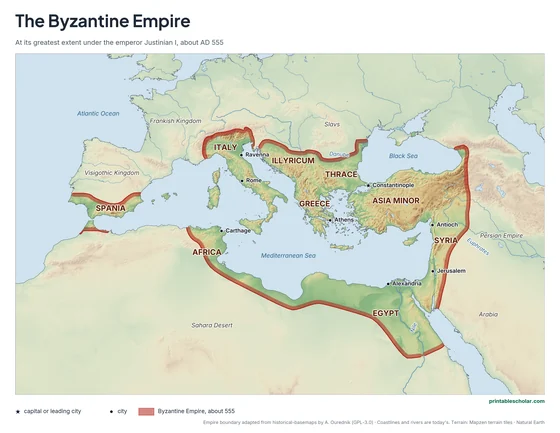
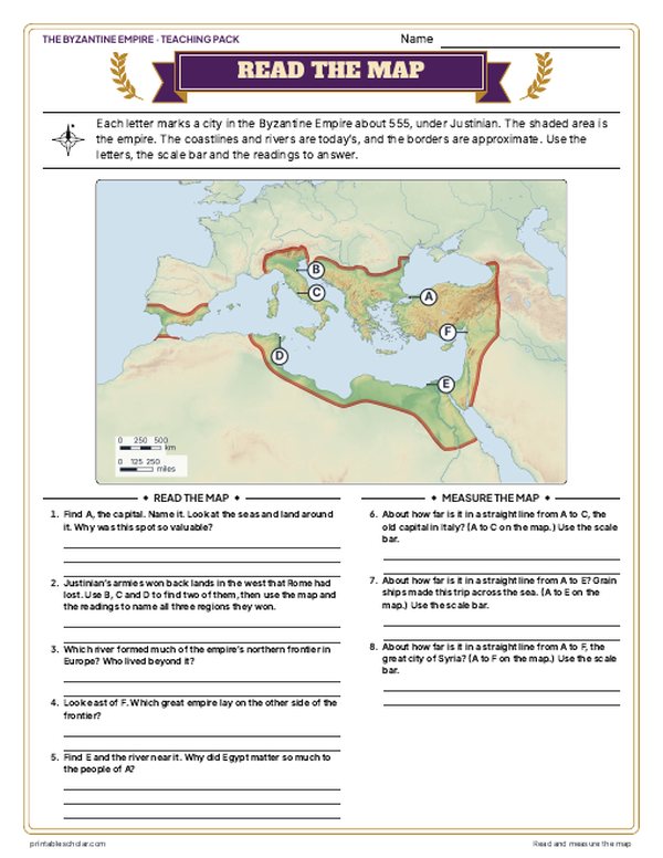
Free printable map of the Byzantine Empire at its greatest extent under Emperor Justinian I in AD 555, showing the empire’s reach across the Mediterranean — from Italy and North Africa to Egypt and the Levant.

Choose your version
Labeled or blank.
Both are free PDFs sized for US Letter paper.
Labeled
Regions, cities, rivers and seas named, on shaded relief.
downloadLabeled PDF
Blank
The same terrain, border and city markers with no names, for labeling practice.
downloadBlank PDFInk-saving black and white
The same map with no terrain shading: white land, the empire in light gray, the cities and lands around it named. The blank one keeps the city markers with no names.

Black and white
Labeled, with no terrain shading.
downloadBlack and white PDF
Black and white blank
City markers with no names, for labeling practice.
downloadBlack and white blank PDF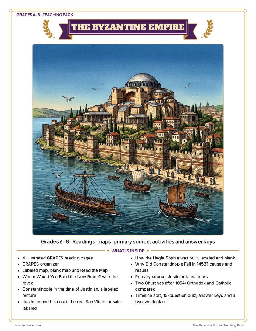
Teaching pack · Grades 6–8
Teaching the Byzantine Empire? The whole unit, ready to teach.
Two weeks of lessons in one download: slides to present, notes for students to fill in, and printable pages that use these maps and pictures.
- 41 lesson slides (PowerPoint you can edit, teacher notes on every slide) and 2 pages of guided notes
- 4 illustrated reading pages and a GRAPES organizer
- Maps: labeled, blank, Read and Measure the Map, and "Where Would You Build the New Rome?": choose a site for Constantine's capital on a real relief map of the straits, then the reveal
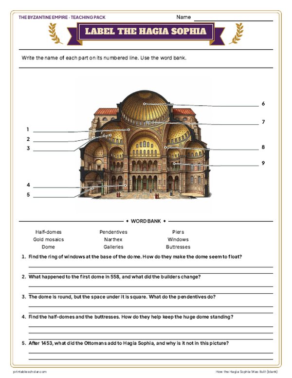
- Activities: a labeled view of Constantinople about 565, Justinian and his court on the real San Vitale mosaic, how the Hagia Sophia was built (labeled and blank), why Constantinople fell in 1453, Justinian's Institutes as a primary source, the Orthodox and Catholic churches after 1054 compared, and a timeline sort
- A 15-question quiz, a teacher guide with a two-week plan, and answer keys for everything
Every answer is in the pack. The readings, slides, maps and pictures teach everything the sheets and quiz ask, so no textbook is needed.
Get the Byzantine Empire pack for $7Teaching more than one? Get all four medieval world packs (West Africa, the Silk Road, the Byzantines and the Ottomans) for $19, with a bonus chart comparing all four: about eight weeks of lessons.
Get all 4 packs for $19See all four packsOr get every history pack (18) in one download:Get all 18 for $49
One-time purchase. Instant download. Color and ink-saving black-and-white editions. Secure checkout by Stripe.
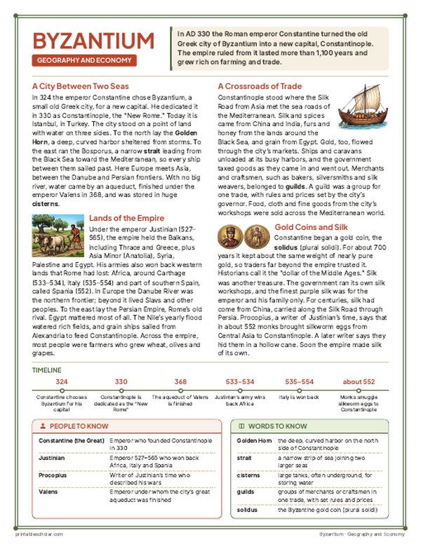
The Byzantine Empire
The Byzantine Empire was the continuation of the eastern Roman Empire, centered in Constantinople (modern Istanbul). While the western half of Rome fell in 476 AD, the east survived for nearly another thousand years. Under Emperor Justinian I (527–565 AD), the empire reached its greatest medieval extent, briefly reconquering Italy from the Ostrogoths, North Africa from the Vandals, and parts of Spain from the Visigoths.
Justinian is best remembered for the Hagia Sophia — one of the greatest buildings ever constructed, still standing in Istanbul today — and for the Justinian Code, a compilation of Roman law that became the foundation for legal systems across Europe. His campaigns, led by the general Belisarius, temporarily restored the old Roman Mediterranean world.
The reconquests were short-lived. After Justinian’s death in 565 AD, the empire quickly lost Italy to the Lombards. In the 7th century, Arab armies conquered Egypt, Syria, and the Levant. The Byzantines survived as a Greek-speaking Christian state centered on Anatolia and the Balkans until Constantinople finally fell to the Ottoman Turks on May 29, 1453 — nearly a thousand years after the fall of Rome.

Pair it with a timeline
Add the dates to the geography with the free printable The Crusades Timeline.
The Crusades TimelineFind it on the map
- Constantinople, on the strait between Europe and Asia
- Italy and North Africa, won back under Justinian
- The Danube River along the northern frontier
The empire boundary is approximate, adapted from the open historical-basemaps dataset by A. Ourednik (GPL-3.0) with corrections. The source has no map for 555, so this uses its outline for AD 600 with all of Italy added and the eastern frontier of 555 (Dara and Lazica in, Iberia out). Coastlines and rivers are shown as they are today.
Frequently asked questions
What is the Byzantine Empire?
The Byzantine Empire was the eastern half of the Roman Empire, which continued after the western half collapsed in 476 AD. Based in Constantinople (modern Istanbul), it preserved Roman law, Greek culture, and Christian religion for nearly 1,000 years until the Ottoman conquest in 1453.
How big was the Byzantine Empire under Justinian?
At its peak under Justinian I around AD 555, the Byzantine Empire covered about 3.5 million square kilometers, including all of modern Turkey, Greece, the western Balkans, Italy, Tunisia, Libya, Egypt, and the Levant (Syria, Lebanon, Israel, Jordan).
How is the Byzantine Empire different from the Roman Empire?
The Byzantine Empire was the surviving eastern portion of the Roman Empire. Over centuries it became distinctly Greek in language and culture, and deeply Christian in religion, rather than Latin. Historians use "Byzantine Empire" to describe the eastern Roman state from around the 4th century onward, though the Byzantines themselves called it the Roman Empire.
When did the Byzantine Empire end?
The Byzantine Empire ended on May 29, 1453, when Ottoman Sultan Mehmed II conquered Constantinople after a 53-day siege. It had lasted over 1,000 years after the fall of the Western Roman Empire, making it one of history’s longest-lived states.