Real cartographic data
Northeast States Map
Free printable maps of the 11 states of the Northeast. The labeled map names every state and its capital. The blank map shows the outlines and capital stars for students to fill in.

Choose your version
Labeled or blank.
Both are free PDFs sized for US Letter paper.
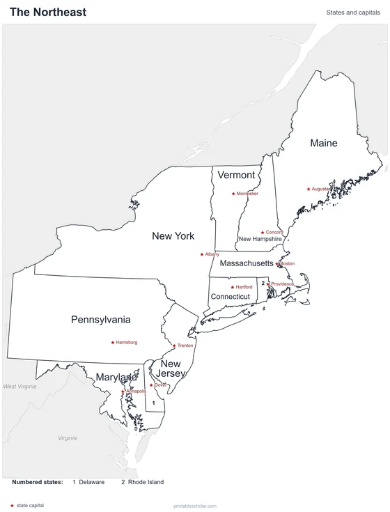
Labeled
Every state and capital named.
downloadLabeled PDF
Blank
State outlines and capital stars, with a name line, for quizzes.
downloadBlank PDFThe Northeast states
The Northeast is the smallest region in area but one of the most crowded. It runs from Maine down the Atlantic coast to Maryland. The six New England states are in the north, and the Mid-Atlantic states, including New York and Pennsylvania, are to the south. The Appalachian Mountains cross the region, and many of the country’s oldest and largest cities line the coast.
States and capitals
- Connecticut: Hartford
- Delaware: Dover
- Maine: Augusta
- Maryland: Annapolis
- Massachusetts: Boston
- New Hampshire: Concord
- New Jersey: Trenton
- New York: Albany
- Pennsylvania: Harrisburg
- Rhode Island: Providence
- Vermont: Montpelier
Find it on the map
- The six small New England states in the northeast corner
- Long Island reaching east from New York City
- Chesapeake Bay dividing Maryland