
Maryland State Report Kit
Everything a student needs to research and write a report on Maryland: the reading, the maps and the pages to fill in. Nothing else to look up.
- 3 reading pages: Maryland fun facts, History, and Land and Work
- 5 maps: landmarks, cities, county, outline, and rivers and lakes
- An 8-page My State Report booklet, from fast facts to a trip plan and a license plate to design
- A pennant to cut out and hang, two map skills sheets and a 10-question reading quiz
- Answer keys for the quiz, the fast facts and the map sheets
- One print-ready PDF, 23 pages, black and white, US Letter
Look inside
Read it, map it, write it.
The reading pages and maps hold every answer the booklet asks for. About one third of the booklet is looking things up. The rest asks students to choose, plan and explain.

What is in the Maryland kit
To read and study
- Maryland fun facts: six short true stories, By the Numbers and Did You Know
- History: the state’s story in order, with a timeline, people to know and words to know
- Land and Work: the land and climate, what the state grows, makes and mines, and how one leads to the other
- Five maps, including a rivers, lakes and neighbors map with a letter key
To fill in and make
- My State Report booklet: cover, Fast Facts, My Map, State Symbols, My Trip, Think Like a Geographer, Design a License Plate and Dig Deeper
- A pennant with the state’s name and outline, to color, cut out and hang
- Name the Cities and Name the Rivers and Lakes sheets, each with a word bank
- A 10-question reading quiz, with answer keys for everything that has one right answer
Free: the Maryland History reading page
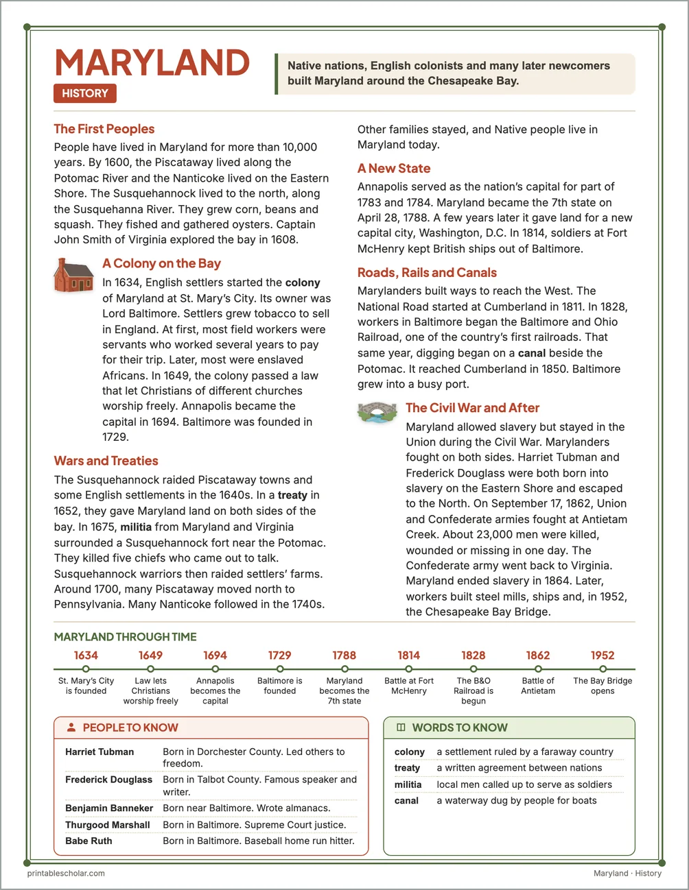
One page on the history of Maryland for grades 3 to 5, free to print in color or black and white. It is the second reading page in the kit.
The First Peoples
People have lived in Maryland for more than 10,000 years. By 1600, the Piscataway lived along the Potomac River and the Nanticoke lived on the Eastern Shore. The Susquehannock lived to the north, along the Susquehanna River. They grew corn, beans and squash. They fished and gathered oysters. Captain John Smith of Virginia explored the bay in 1608.
A Colony on the Bay
In 1634, English settlers started the colony of Maryland at St. Mary’s City. Its owner was Lord Baltimore. Settlers grew tobacco to sell in England. At first, most field workers were servants who worked several years to pay for their trip. Later, most were enslaved Africans. In 1649, the colony passed a law that let Christians of different churches worship freely. Annapolis became the capital in 1694. Baltimore was founded in 1729.
Wars and Treaties
The Susquehannock raided Piscataway towns and some English settlements in the 1640s. In a treaty in 1652, they gave Maryland land on both sides of the bay. In 1675, militia from Maryland and Virginia surrounded a Susquehannock fort near the Potomac. They killed five chiefs who came out to talk. Susquehannock warriors then raided settlers’ farms. Around 1700, many Piscataway moved north to Pennsylvania. Many Nanticoke followed in the 1740s. Other families stayed, and Native people live in Maryland today.
A New State
Annapolis served as the nation’s capital for part of 1783 and 1784. Maryland became the 7th state on April 28, 1788. A few years later it gave land for a new capital city, Washington, D.C. In 1814, soldiers at Fort McHenry kept British ships out of Baltimore.
Roads, Rails and Canals
Marylanders built ways to reach the West. The National Road started at Cumberland in 1811. In 1828, workers in Baltimore began the Baltimore and Ohio Railroad, one of the country’s first railroads. That same year, digging began on a canal beside the Potomac. It reached Cumberland in 1850. Baltimore grew into a busy port.
The Civil War and After
Maryland allowed slavery but stayed in the Union during the Civil War. Marylanders fought on both sides. Harriet Tubman and Frederick Douglass were both born into slavery on the Eastern Shore and escaped to the North. On September 17, 1862, Union and Confederate armies fought at Antietam Creek. About 23,000 men were killed, wounded or missing in one day. The Confederate army went back to Virginia. Maryland ended slavery in 1864. Later, workers built steel mills, ships and, in 1952, the Chesapeake Bay Bridge.
Maryland through time
- 1634 St. Mary’s City is founded
- 1649 Law lets Christians worship freely
- 1694 Annapolis becomes the capital
- 1729 Baltimore is founded
- 1788 Maryland becomes the 7th state
- 1814 Battle at Fort McHenry
- 1828 The B&O Railroad is begun
- 1862 Battle of Antietam
- 1952 The Bay Bridge opens
People to know
- Harriet Tubman: Born in Dorchester County. Led others to freedom.
- Frederick Douglass: Born in Talbot County. Famous speaker and writer.
- Benjamin Banneker: Born near Baltimore. Wrote almanacs.
- Thurgood Marshall: Born in Baltimore. Supreme Court justice.
- Babe Ruth: Born in Baltimore. Baseball home run hitter.
Free Maryland maps
Each of these maps is free to print on its own page. The kit puts them in one file with the reading pages and the booklet.