Maryland Landmarks Map
A free printable illustrated map of Maryland for kids. It shows 8 landmarks and natural places and 4 industries where they really are, along with the state symbols, 5 cities and a box of key facts. It comes in color and in ink-saving black and white, sized for US Letter paper.
downloadColor PDF downloadBlack and white PDF
Choose your version
Color or black and white.
Both are free, sized for US Letter paper, and come as a PDF to print or a PNG image for slides.
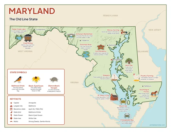
Color
The full-color map, for a wall display or a color printer.

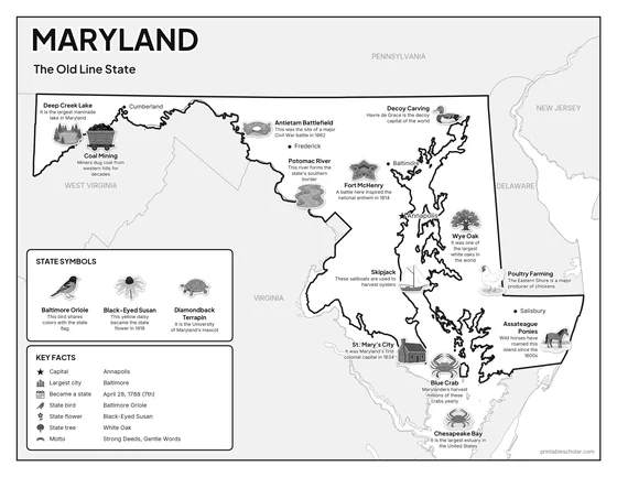
Black and white
The same map with no color or shading. Prints cleanly on a classroom printer and saves ink.

What is on the Maryland map
Every picture sits at its real location in Maryland, with a one-line fact beside it. Annapolis, the capital, is marked with a star.
Landmarks and natural places
- Deep Creek Lake: It is the largest manmade lake in Maryland.
- Potomac River: This river forms the state’s southern border.
- Assateague Ponies: Wild horses have roamed this island since the 1600s.
- Chesapeake Bay: It is the largest estuary in the United States.
- Fort McHenry: A battle here inspired the national anthem in 1814.
- Antietam Battlefield: This was the site of a major Civil War battle in 1862.
- St. Mary’s City: It was Maryland’s first colonial capital in 1634.
- Decoy Carving: Havre de Grace is the decoy capital of the world.
What Maryland makes and grows
- Blue Crab: Marylanders harvest millions of these crabs yearly.
- Skipjack: These sailboats are used to harvest oysters.
- Coal Mining: Miners dug coal from western hills for decades.
- Poultry Farming: The Eastern Shore is a major producer of chickens.
State symbols
- Wye Oak: It was one of the largest white oaks in the world.
- Baltimore Oriole: This bird shares colors with the state flag.
- Black-Eyed Susan: This yellow daisy became the state flower in 1918.
- Diamondback Terrapin: It is the University of Maryland’s mascot.
Maryland key facts
From the box on the map
- Nickname
- The Old Line State
- Capital
- Annapolis
- Largest city
- Baltimore
- Became a state
- April 28, 1788 (7th)
- State bird
- Baltimore Oriole
- State flower
- Black-Eyed Susan
- State tree
- White Oak
- Motto
- Strong Deeds, Gentle Words
Cities shown
- Annapolis (capital)
- Baltimore
- Frederick
- Salisbury
- Cumberland
The outline, rivers and cities are drawn from map data. Pictures of crops and industries are placed in a part of the state where each is typical.