
New Hampshire State Report Kit
Everything a student needs to research and write a report on New Hampshire: the reading, the maps and the pages to fill in. Nothing else to look up.
- 3 reading pages: New Hampshire fun facts, History, and Land and Work
- 5 maps: landmarks, cities, county, outline, and rivers and lakes
- An 8-page My State Report booklet, from fast facts to a trip plan and a license plate to design
- A pennant to cut out and hang, two map skills sheets and a 10-question reading quiz
- Answer keys for the quiz, the fast facts and the map sheets
- One print-ready PDF, 23 pages, black and white, US Letter
Teaching all 50 states? Get every kit for $39.
Look inside
Read it, map it, write it.
The reading pages and maps hold every answer the booklet asks for. About one third of the booklet is looking things up. The rest asks students to choose, plan and explain.

What is in the New Hampshire kit
To read and study
- New Hampshire fun facts: six short true stories, By the Numbers and Did You Know
- History: the state’s story in order, with a timeline, people to know and words to know
- Land and Work: the land and climate, what the state grows, makes and mines, and how one leads to the other
- Five maps, including a rivers, lakes and neighbors map with a letter key
To fill in and make
- My State Report booklet: cover, Fast Facts, My Map, State Symbols, My Trip, Think Like a Geographer, Design a License Plate and Dig Deeper
- A pennant with the state’s name and outline, to color, cut out and hang
- Name the Cities and Name the Rivers and Lakes sheets, each with a word bank
- A 10-question reading quiz, with answer keys for everything that has one right answer
Free: the New Hampshire History reading page
One page on the history of New Hampshire for grades 3 to 5, free to print in color or black and white. It is the second reading page in the kit.
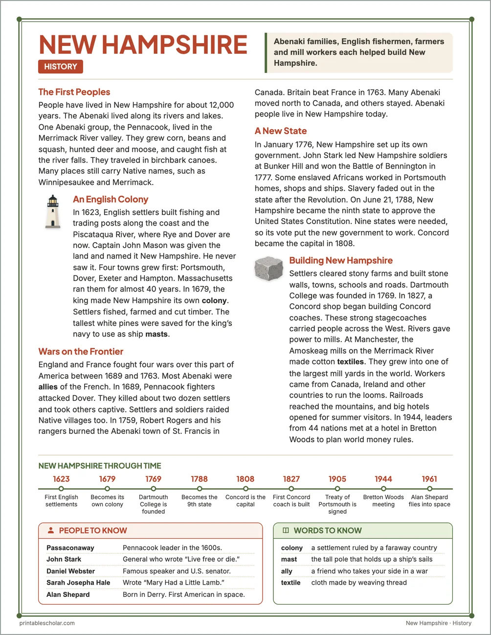
The First Peoples
People have lived in New Hampshire for about 12,000 years. The Abenaki lived along its rivers and lakes. One Abenaki group, the Pennacook, lived in the Merrimack River valley. They grew corn, beans and squash, hunted deer and moose, and caught fish at the river falls. They traveled in birchbark canoes. Many places still carry Native names, such as Winnipesaukee and Merrimack.
An English Colony
In 1623, English settlers built fishing and trading posts along the coast and the Piscataqua River, where Rye and Dover are now. Captain John Mason was given the land and named it New Hampshire. He never saw it. Four towns grew first: Portsmouth, Dover, Exeter and Hampton. Massachusetts ran them for almost 40 years. In 1679, the king made New Hampshire its own colony. Settlers fished, farmed and cut timber. The tallest white pines were saved for the king’s navy to use as ship masts.
Wars on the Frontier
England and France fought four wars over this part of America between 1689 and 1763. Most Abenaki were allies of the French. In 1689, Pennacook fighters attacked Dover. They killed about two dozen settlers and took others captive. Settlers and soldiers raided Native villages too. In 1759, Robert Rogers and his rangers burned the Abenaki town of St. Francis in Canada. Britain beat France in 1763. Many Abenaki moved north to Canada, and others stayed. Abenaki people live in New Hampshire today.
A New State
In January 1776, New Hampshire set up its own government. John Stark led New Hampshire soldiers at Bunker Hill and won the Battle of Bennington in 1777. Some enslaved Africans worked in Portsmouth homes, shops and ships. Slavery faded out in the state after the Revolution. On June 21, 1788, New Hampshire became the ninth state to approve the United States Constitution. Nine states were needed, so its vote put the new government to work. Concord became the capital in 1808.
Building New Hampshire
Settlers cleared stony farms and built stone walls, towns, schools and roads. Dartmouth College was founded in 1769. In 1827, a Concord shop began building Concord coaches. These strong stagecoaches carried people across the West. Rivers gave power to mills. At Manchester, the Amoskeag mills on the Merrimack River made cotton textiles. They grew into one of the largest mill yards in the world. Workers came from Canada, Ireland and other countries to run the looms. Railroads reached the mountains, and big hotels opened for summer visitors. In 1944, leaders from 44 nations met at a hotel in Bretton Woods to plan world money rules.
New Hampshire through time
- 1623 First English settlements
- 1679 Becomes its own colony
- 1769 Dartmouth College is founded
- 1788 Becomes the 9th state
- 1808 Concord is the capital
- 1827 First Concord coach is built
- 1905 Treaty of Portsmouth is signed
- 1944 Bretton Woods meeting
- 1961 Alan Shepard flies into space
People to know
- Passaconaway: Pennacook leader in the 1600s.
- John Stark: General who wrote "Live free or die."
- Daniel Webster: Famous speaker and U.S. senator.
- Sarah Josepha Hale: Wrote "Mary Had a Little Lamb."
- Alan Shepard: Born in Derry. First American in space.
Free New Hampshire maps
Each of these maps is free to print on its own page. The kit puts them in one file with the reading pages and the booklet.