New Hampshire Landmarks Map
A free printable illustrated map of New Hampshire for kids. It shows 8 landmarks and natural places and 3 industries where they really are, along with the state symbols, 6 cities and a box of key facts. It comes in color and in ink-saving black and white, sized for US Letter paper.
downloadColor PDF downloadBlack and white PDF
Choose your version
Color or black and white.
Both are free, sized for US Letter paper, and come as a PDF to print or a PNG image for slides.
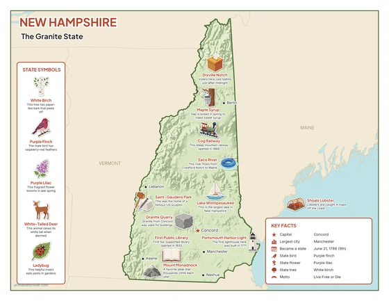
Color
The full-color map, for a wall display or a color printer.

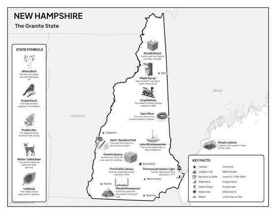
Black and white
The same map with no color or shading. Prints cleanly on a classroom printer and saves ink.

What is on the New Hampshire map
Every picture sits at its real location in New Hampshire, with a one-line fact beside it. Concord, the capital, is marked with a star.
Landmarks and natural places
- Saco River: This river flows from Crawford Notch to Maine.
- Lake Winnipesaukee: This is the largest lake in New Hampshire.
- Mount Monadnock: A favorite peak that thousands climb each year.
- Dixville Notch: Voters here cast ballots just after midnight.
- Cog Railway: This steep mountain railway opened in 1869.
- Saint-Gaudens Park: This was the home of a famous US sculptor.
- Portsmouth Harbor Light: The first lighthouse here was built in 1771.
- First Public Library: First tax-supported library opened in 1833.
What New Hampshire makes and grows
- Maple Syrup: Sap is boiled in spring to make sweet syrup.
- Granite Quarry: Granite from Concord was used for buildings.
- Shoals Lobster: Lobsters are caught in traps off the coast.
State symbols
- White Birch: This tree has paper-like bark that peels off.
- Purple Finch: The male bird has raspberry-red feathers.
- Purple Lilac: This fragrant flower blooms in late spring.
- White-Tailed Deer: This animal raises its white tail when alarmed.
- Ladybug: This helpful insect eats pests in gardens.
New Hampshire key facts
From the box on the map
- Nickname
- The Granite State
- Capital
- Concord
- Largest city
- Manchester
- Became a state
- June 21, 1788 (9th)
- State bird
- Purple finch
- State flower
- Purple lilac
- State tree
- White birch
- Motto
- Live Free or Die
Cities shown
- Concord (capital)
- Manchester
- Nashua
- Berlin
- Lebanon
- Keene
The outline, rivers and cities are drawn from map data. Pictures of crops and industries are placed in a part of the state where each is typical.