
Rhode Island State Report Kit
Everything a student needs to research and write a report on Rhode Island: the reading, the maps and the pages to fill in. Nothing else to look up.
- 3 reading pages: Rhode Island fun facts, History, and Land and Work
- 5 maps: landmarks, cities, county, outline, and rivers and lakes
- An 8-page My State Report booklet, from fast facts to a trip plan and a license plate to design
- A pennant to cut out and hang, two map skills sheets and a 10-question reading quiz
- Answer keys for the quiz, the fast facts and the map sheets
- One print-ready PDF, 23 pages, black and white, US Letter
Teaching all 50 states? Get every kit for $39.
Look inside
Read it, map it, write it.
The reading pages and maps hold every answer the booklet asks for. About one third of the booklet is looking things up. The rest asks students to choose, plan and explain.

What is in the Rhode Island kit
To read and study
- Rhode Island fun facts: six short true stories, By the Numbers and Did You Know
- History: the state’s story in order, with a timeline, people to know and words to know
- Land and Work: the land and climate, what the state grows, makes and mines, and how one leads to the other
- Five maps, including a rivers, lakes and neighbors map with a letter key
To fill in and make
- My State Report booklet: cover, Fast Facts, My Map, State Symbols, My Trip, Think Like a Geographer, Design a License Plate and Dig Deeper
- A pennant with the state’s name and outline, to color, cut out and hang
- Name the Cities and Name the Rivers and Lakes sheets, each with a word bank
- A 10-question reading quiz, with answer keys for everything that has one right answer
Free: the Rhode Island History reading page
One page on the history of Rhode Island for grades 3 to 5, free to print in color or black and white. It is the second reading page in the kit.
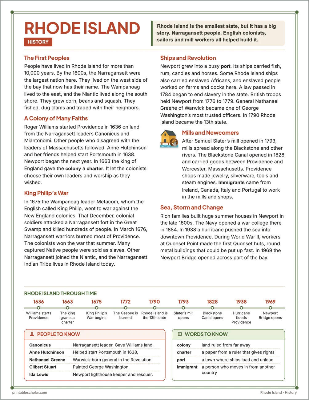
The First Peoples
People have lived in Rhode Island for more than 10,000 years. By the 1600s, the Narragansett were the largest nation here. They lived on the west side of the bay that now has their name. The Wampanoag lived to the east, and the Niantic lived along the south shore. They grew corn, beans and squash. They fished, dug clams and traded with their neighbors.
A Colony of Many Faiths
Roger Williams started Providence in 1636 on land from the Narragansett leaders Canonicus and Miantonomi. Other people who disagreed with the leaders of Massachusetts followed. Anne Hutchinson and her friends helped start Portsmouth in 1638. Newport began the next year. In 1663 the king of England gave the colony a charter. It let the colonists choose their own leaders and worship as they wished.
King Philip’s War
In 1675 the Wampanoag leader Metacom, whom the English called King Philip, went to war against the New England colonies. That December, colonial soldiers attacked a Narragansett fort in the Great Swamp and killed hundreds of people. In March 1676, Narragansett warriors burned most of Providence. The colonists won the war that summer. Many captured Native people were sold as slaves. Other Narragansett joined the Niantic, and the Narragansett Indian Tribe lives in Rhode Island today.
Ships and Revolution
Newport grew into a busy port. Its ships carried fish, rum, candles and horses. Some Rhode Island ships also carried enslaved Africans, and enslaved people worked on farms and docks here. A law passed in 1784 began to end slavery in the state. British troops held Newport from 1776 to 1779. General Nathanael Greene of Warwick became one of George Washington’s most trusted officers. In 1790 Rhode Island became the 13th state.
Mills and Newcomers
After Samuel Slater’s mill opened in 1793, mills spread along the Blackstone and other rivers. The Blackstone Canal opened in 1828 and carried goods between Providence and Worcester, Massachusetts. Providence shops made jewelry, silverware, tools and steam engines. Immigrants came from Ireland, Canada, Italy and Portugal to work in the mills and shops.
Sea, Storm and Change
Rich families built huge summer houses in Newport in the late 1800s. The Navy opened a war college there in 1884. In 1938 a hurricane pushed the sea into downtown Providence. During World War II, workers at Quonset Point made the first Quonset huts, round metal buildings that could be put up fast. In 1969 the Newport Bridge opened across part of the bay.
Rhode Island through time
- 1636 Williams starts Providence
- 1663 The king grants a charter
- 1675 King Philip’s War begins
- 1772 The Gaspee is burned
- 1790 Rhode Island is the 13th state
- 1793 Slater’s mill opens
- 1828 Blackstone Canal opens
- 1938 Hurricane floods Providence
- 1969 Newport Bridge opens
People to know
- Canonicus: Narragansett leader. Gave Williams land.
- Anne Hutchinson: Helped start Portsmouth in 1638.
- Nathanael Greene: Warwick-born general in the Revolution.
- Gilbert Stuart: Painted George Washington.
- Ida Lewis: Newport lighthouse keeper and rescuer.
Free Rhode Island maps
Each of these maps is free to print on its own page. The kit puts them in one file with the reading pages and the booklet.