
Maine State Report Kit
Everything a student needs to research and write a report on Maine: the reading, the maps and the pages to fill in. Nothing else to look up.
- 3 reading pages: Maine fun facts, History, and Land and Work
- 5 maps: landmarks, cities, county, outline, and rivers and lakes
- An 8-page My State Report booklet, from fast facts to a trip plan and a license plate to design
- A pennant to cut out and hang, two map skills sheets and a 10-question reading quiz
- Answer keys for the quiz, the fast facts and the map sheets
- One print-ready PDF, 23 pages, black and white, US Letter
Look inside
Read it, map it, write it.
The reading pages and maps hold every answer the booklet asks for. About one third of the booklet is looking things up. The rest asks students to choose, plan and explain.

What is in the Maine kit
To read and study
- Maine fun facts: six short true stories, By the Numbers and Did You Know
- History: the state’s story in order, with a timeline, people to know and words to know
- Land and Work: the land and climate, what the state grows, makes and mines, and how one leads to the other
- Five maps, including a rivers, lakes and neighbors map with a letter key
To fill in and make
- My State Report booklet: cover, Fast Facts, My Map, State Symbols, My Trip, Think Like a Geographer, Design a License Plate and Dig Deeper
- A pennant with the state’s name and outline, to color, cut out and hang
- Name the Cities and Name the Rivers and Lakes sheets, each with a word bank
- A 10-question reading quiz, with answer keys for everything that has one right answer
Free: the Maine History reading page
One page on the history of Maine for grades 3 to 5, free to print in color or black and white. It is the second reading page in the kit.
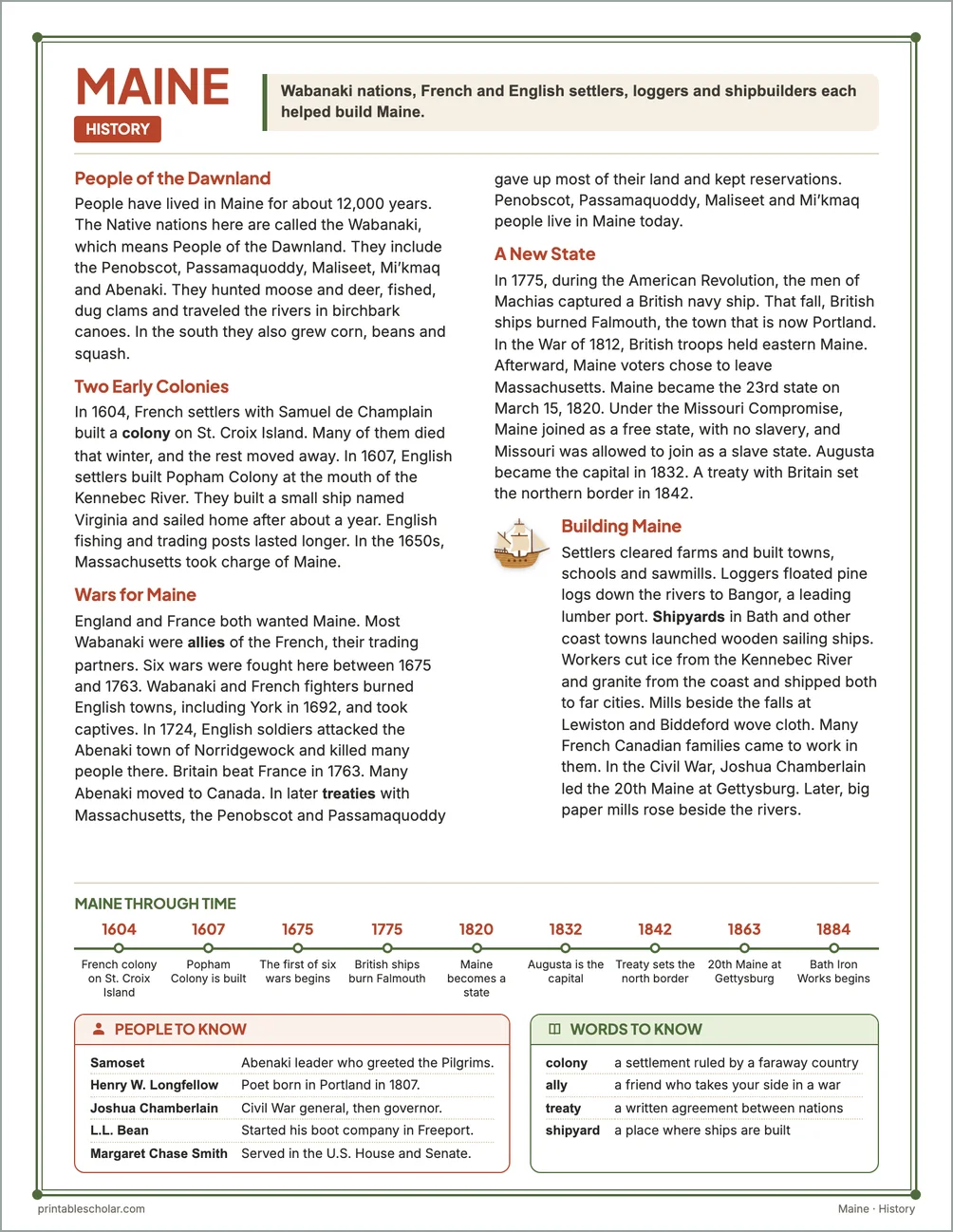
People of the Dawnland
People have lived in Maine for about 12,000 years. The Native nations here are called the Wabanaki, which means People of the Dawnland. They include the Penobscot, Passamaquoddy, Maliseet, Mi’kmaq and Abenaki. They hunted moose and deer, fished, dug clams and traveled the rivers in birchbark canoes. In the south they also grew corn, beans and squash.
Two Early Colonies
In 1604, French settlers with Samuel de Champlain built a colony on St. Croix Island. Many of them died that winter, and the rest moved away. In 1607, English settlers built Popham Colony at the mouth of the Kennebec River. They built a small ship named Virginia and sailed home after about a year. English fishing and trading posts lasted longer. In the 1650s, Massachusetts took charge of Maine.
Wars for Maine
England and France both wanted Maine. Most Wabanaki were allies of the French, their trading partners. Six wars were fought here between 1675 and 1763. Wabanaki and French fighters burned English towns, including York in 1692, and took captives. In 1724, English soldiers attacked the Abenaki town of Norridgewock and killed many people there. Britain beat France in 1763. Many Abenaki moved to Canada. In later treaties with Massachusetts, the Penobscot and Passamaquoddy gave up most of their land and kept reservations. Penobscot, Passamaquoddy, Maliseet and Mi’kmaq people live in Maine today.
A New State
In 1775, during the American Revolution, the men of Machias captured a British navy ship. That fall, British ships burned Falmouth, the town that is now Portland. In the War of 1812, British troops held eastern Maine. Afterward, Maine voters chose to leave Massachusetts. Maine became the 23rd state on March 15, 1820. Under the Missouri Compromise, Maine joined as a free state, with no slavery, and Missouri was allowed to join as a slave state. Augusta became the capital in 1832. A treaty with Britain set the northern border in 1842.
Building Maine
Settlers cleared farms and built towns, schools and sawmills. Loggers floated pine logs down the rivers to Bangor, a leading lumber port. Shipyards in Bath and other coast towns launched wooden sailing ships. Workers cut ice from the Kennebec River and granite from the coast and shipped both to far cities. Mills beside the falls at Lewiston and Biddeford wove cloth. Many French Canadian families came to work in them. In the Civil War, Joshua Chamberlain led the 20th Maine at Gettysburg. Later, big paper mills rose beside the rivers.
Maine through time
- 1604 French colony on St. Croix Island
- 1607 Popham Colony is built
- 1675 The first of six wars begins
- 1775 British ships burn Falmouth
- 1820 Maine becomes a state
- 1832 Augusta is the capital
- 1842 Treaty sets the north border
- 1863 20th Maine at Gettysburg
- 1884 Bath Iron Works begins
People to know
- Samoset: Abenaki leader who greeted the Pilgrims.
- Henry W. Longfellow: Poet born in Portland in 1807.
- Joshua Chamberlain: Civil War general, then governor.
- L.L. Bean: Started his boot company in Freeport.
- Margaret Chase Smith: Served in the U.S. House and Senate.
Free Maine maps
Each of these maps is free to print on its own page. The kit puts them in one file with the reading pages and the booklet.