Printable Scholar
Northeast Region Physical Map
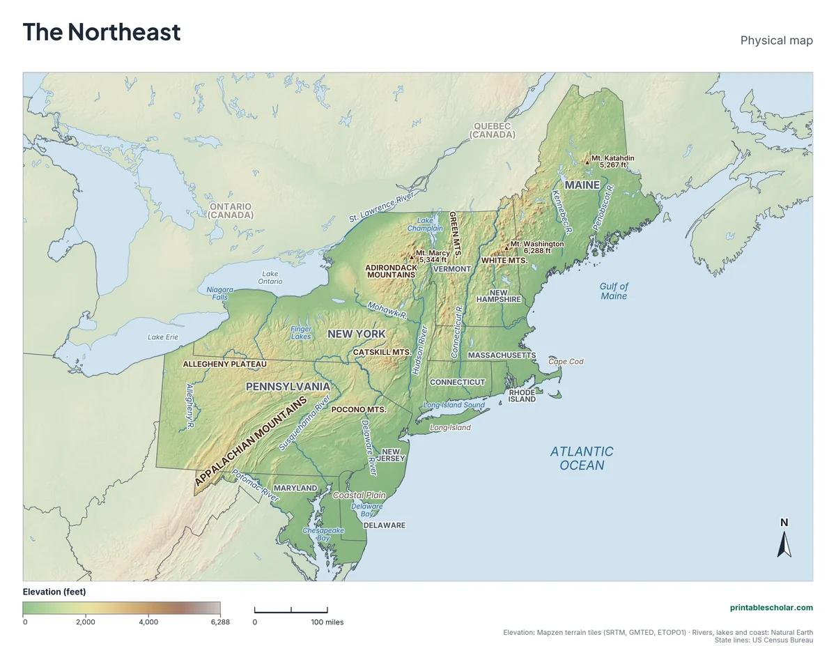
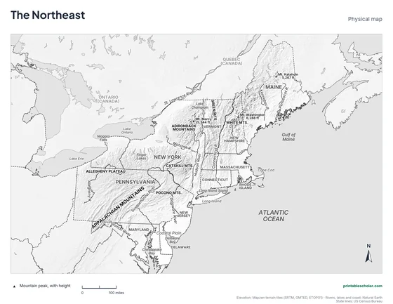
A free printable physical map of the Northeast region of the United States, the 11 states from Maine to Maryland. It names the rivers, the Appalachian, Adirondack, Catskill, White and Green mountains, the highest peaks, the lakes and bays. It comes in black and white or color, and as a blank map with a word bank.
Choose your version
Black and white, color or blank.
All three are free PDFs sized for US Letter paper.
Black and white
States, rivers, mountains, peaks, lakes and landforms named on gray shaded relief. No color ink needed.
downloadBlack and white PDF
Color
The same map in elevation colors, green lowlands to brown highlands, with blue water.
downloadColor PDF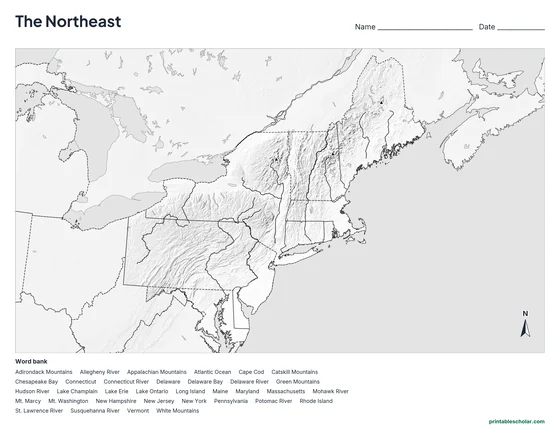
Blank
No names, with peak markers and an alphabetical word bank. Black and white.
downloadBlank PDFThe physical geography of the Northeast
The Appalachian Mountains run through the Northeast from Pennsylvania to Maine. In Pennsylvania they form long parallel ridges and valleys; to the north and west is the Allegheny Plateau, a high land cut by deep river valleys. In New England the mountains become the Green Mountains of Vermont and the White Mountains of New Hampshire, where Mt. Washington, 6,288 feet, is the highest point in the Northeast. The Adirondack Mountains of northern New York are a separate round dome of very old rock, topped by Mt. Marcy.
The region’s rivers made it the center of early American trade and industry. The Hudson River flows south from the Adirondacks to New York City, and the Mohawk joins it from the west, making a low route through the mountains that the Erie Canal later followed. The Delaware River forms the border between Pennsylvania and New Jersey, and the Susquehanna runs through Pennsylvania into Chesapeake Bay, the largest estuary in the United States.
Glaciers shaped the northern half of the region, scraping the land and leaving thousands of lakes, including New York’s long, thin Finger Lakes. Lake Erie and Lake Ontario form part of the northern border, joined by the Niagara River and Niagara Falls. Along the Atlantic, the land drops to a flat coastal plain in New Jersey, Delaware and Maryland, while the New England coast is rocky, with Cape Cod and Long Island built from glacier-dropped sand.
Highest peaks on the map
- Mt. Washington, New Hampshire: 6,288 ft
- Mt. Marcy, New York: 5,344 ft
- Mt. Katahdin, Maine: 5,267 ft
Find it on the map
- The Appalachian Mountains crossing Pennsylvania in long ridges
- The Hudson River running south to New York City
- Niagara Falls, between Lake Erie and Lake Ontario
Elevation is from the Mapzen terrain tiles (SRTM, GMTED, ETOPO1). Rivers, lakes and coastlines are from Natural Earth; state lines from the US Census Bureau. Peak heights are from the US Geological Survey. Landform label positions are approximate.
Frequently asked questions
What are the main physical features of the Northeast?
The Appalachian Mountains and the Allegheny Plateau, the Adirondack Mountains, the White and Green Mountains of New England, the Hudson, Delaware and Susquehanna rivers, Lake Erie and Lake Ontario, and an Atlantic coast with Chesapeake Bay, Long Island and Cape Cod.
What is the highest mountain in the Northeast?
Mt. Washington in the White Mountains of New Hampshire, at 6,288 feet.
What are the major rivers of the Northeast?
The Hudson, Delaware, Susquehanna, Connecticut and Potomac rivers flow to the Atlantic. The Allegheny flows west to join the Ohio River, and the St. Lawrence carries water from the Great Lakes along the northern border.
How do students use the blank map?
The blank map shows the same land, rivers, lakes and peak markers with no names, and an alphabetical word bank of the states and features. Students write each name in place. The labeled map is the answer key.