Printable Scholar
Southeast Region Physical Map
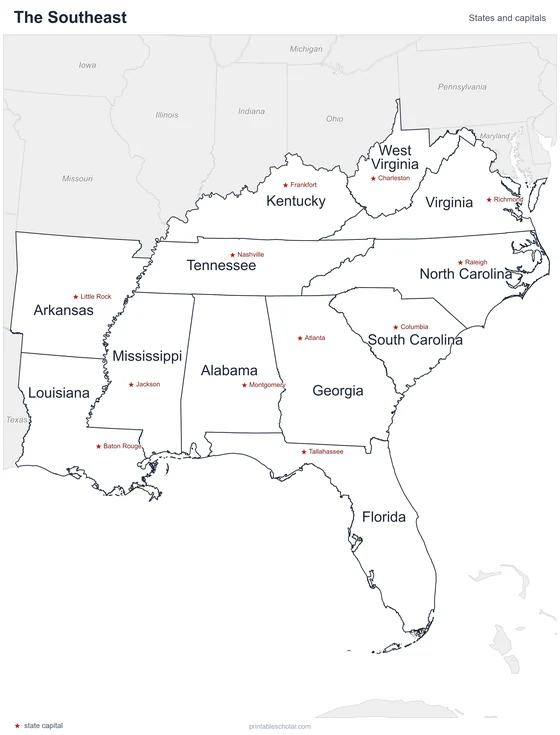
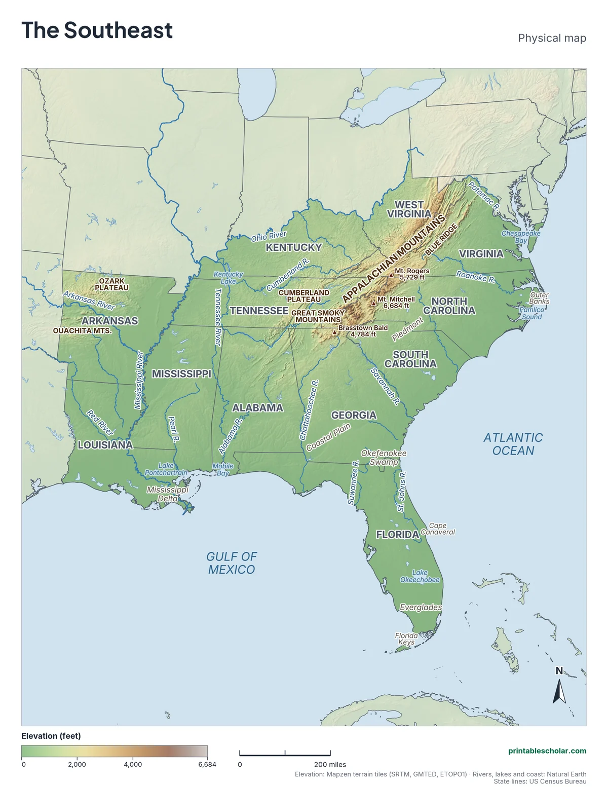
A free printable physical map of the Southeast region of the United States, the 12 states from Virginia and Kentucky to Florida and Louisiana. It names the rivers, the Appalachian Mountains, Blue Ridge and Great Smoky Mountains, the highest peaks, the Piedmont and Coastal Plain, the lakes, swamps and coast. It comes in black and white or color, and as a blank map with a word bank.
Choose your version
Black and white, color or blank.
All three are free PDFs sized for US Letter paper.
Black and white
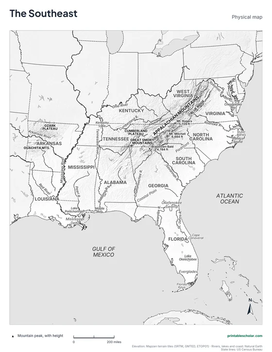
States, rivers, mountains, peaks, lakes and landforms named on gray shaded relief. No color ink needed.
downloadBlack and white PDF
Color
The same map in elevation colors, green lowlands to brown highlands, with blue water.
downloadColor PDF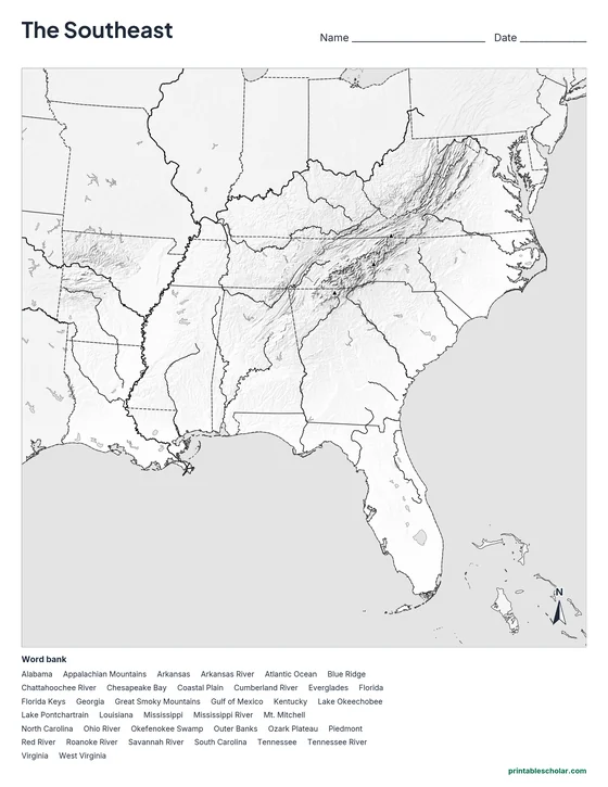
Blank
No names, with peak markers and an alphabetical word bank. Black and white.
downloadBlank PDFThe physical geography of the Southeast
The Appalachian Mountains reach their highest point in the Southeast. Mt. Mitchell in North Carolina, 6,684 feet, is the highest peak east of the Mississippi River. The Blue Ridge forms the eastern edge of the mountains from Virginia to Georgia, and the Great Smoky Mountains on the Tennessee-North Carolina border are named for the blue haze that hangs over their forests. West of the mountains lies the Cumberland Plateau.
East of the mountains the land steps down. First comes the Piedmont, a band of rolling hills. Where the Piedmont meets the flat Coastal Plain, rivers drop over rapids and small falls, and many cities, such as Richmond, Raleigh and Columbia, grew up along that line. The Coastal Plain covers most of the region, from the Atlantic to the Gulf of Mexico, and all of Florida, whose highest point is only 345 feet.
The Mississippi River forms the western edge of much of the region and ends in a great delta in Louisiana. The Ohio, Tennessee and Cumberland rivers drain the north, while the Savannah, Chattahoochee and Alabama rivers flow south and east. The region is rich in wetlands: the Everglades and Lake Okeechobee in southern Florida, the Okefenokee Swamp on the Georgia-Florida border, and the bayous of the Louisiana coast.
Highest peaks on the map
- Mt. Mitchell, North Carolina: 6,684 ft
- Mt. Rogers, Virginia: 5,729 ft
- Brasstown Bald, Georgia: 4,784 ft
Find it on the map
- The Appalachian Mountains, highest along the North Carolina-Tennessee border
- The Mississippi River ending in its delta in Louisiana
- The Everglades and Lake Okeechobee in southern Florida
Elevation is from the Mapzen terrain tiles (SRTM, GMTED, ETOPO1). Rivers, lakes and coastlines are from Natural Earth; state lines from the US Census Bureau. Peak heights are from the US Geological Survey. Landform label positions are approximate.
Frequently asked questions
What are the main physical features of the Southeast?
The Appalachian Mountains with the Blue Ridge and Great Smoky Mountains, the Piedmont, the wide Coastal Plain, the Mississippi River and its delta, the Ozark Plateau and Ouachita Mountains in Arkansas, the Florida peninsula, the Everglades and the Atlantic and Gulf coasts.
What is the highest mountain in the Southeast?
Mt. Mitchell in North Carolina, at 6,684 feet. It is the highest peak in the United States east of the Mississippi River.
What is the Piedmont?
The Piedmont is the region of rolling hills between the Appalachian Mountains and the flat Coastal Plain. It runs from Virginia through the Carolinas and Georgia into Alabama.
How do students use the blank map?
The blank map shows the same land, rivers, lakes and peak markers with no names, and an alphabetical word bank of the states and features. Students write each name in place. The labeled map is the answer key.