Real cartographic data
Southeast States Map
Free printable maps of the 12 states of the Southeast. The labeled map names every state and its capital. The blank map shows the outlines and capital stars for students to fill in.

Choose your version
Labeled or blank.
Both are free PDFs sized for US Letter paper.
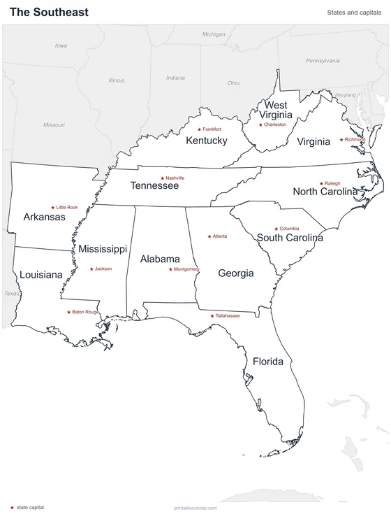
Labeled
Every state and capital named.
downloadLabeled PDF
Blank
State outlines and capital stars, with a name line, for quizzes.
downloadBlank PDFThe Southeast states
The Southeast stretches from Virginia and Kentucky south to Florida and west to Arkansas and Louisiana. The Appalachian Mountains run through its northern part. A wide coastal plain borders the Atlantic Ocean and the Gulf of Mexico, and the Mississippi River forms much of the region’s western side. Florida is a long peninsula between the Atlantic and the Gulf.
States and capitals
- Alabama: Montgomery
- Arkansas: Little Rock
- Florida: Tallahassee
- Georgia: Atlanta
- Kentucky: Frankfort
- Louisiana: Baton Rouge
- Mississippi: Jackson
- North Carolina: Raleigh
- South Carolina: Columbia
- Tennessee: Nashville
- Virginia: Richmond
- West Virginia: Charleston
Find it on the map
- The Florida peninsula
- The Mississippi River along the western states
- The long, narrow shape of Tennessee