
Kentucky State Report Kit
Everything a student needs to research and write a report on Kentucky: the reading, the maps and the pages to fill in. Nothing else to look up.
- 3 reading pages: Kentucky fun facts, History, and Land and Work
- 5 maps: landmarks, cities, county, outline, and rivers and lakes
- An 8-page My State Report booklet, from fast facts to a trip plan and a license plate to design
- A pennant to cut out and hang, two map skills sheets and a 10-question reading quiz
- Answer keys for the quiz, the fast facts and the map sheets
- One print-ready PDF, 23 pages, black and white, US Letter
Look inside
Read it, map it, write it.
The reading pages and maps hold every answer the booklet asks for. About one third of the booklet is looking things up. The rest asks students to choose, plan and explain.

What is in the Kentucky kit
To read and study
- Kentucky fun facts: six short true stories, By the Numbers and Did You Know
- History: the state’s story in order, with a timeline, people to know and words to know
- Land and Work: the land and climate, what the state grows, makes and mines, and how one leads to the other
- Five maps, including a rivers, lakes and neighbors map with a letter key
To fill in and make
- My State Report booklet: cover, Fast Facts, My Map, State Symbols, My Trip, Think Like a Geographer, Design a License Plate and Dig Deeper
- A pennant with the state’s name and outline, to color, cut out and hang
- Name the Cities and Name the Rivers and Lakes sheets, each with a word bank
- A 10-question reading quiz, with answer keys for everything that has one right answer
Free: the Kentucky History reading page
One page on the history of Kentucky for grades 3 to 5, free to print in color or black and white. It is the second reading page in the kit.
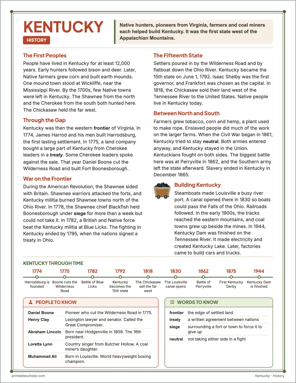
The First Peoples
People have lived in Kentucky for at least 12,000 years. Early hunters followed bison and deer. Later, Native farmers grew corn and built earth mounds. One mound town stood at Wickliffe, near the Mississippi River. By the 1700s, few Native towns were left in Kentucky. The Shawnee from the north and the Cherokee from the south both hunted here. The Chickasaw held the far west.
Through the Gap
Kentucky was then the western frontier of Virginia. In 1774, James Harrod and his men built Harrodsburg, the first lasting settlement. In 1775, a land company bought a large part of Kentucky from Cherokee leaders in a treaty. Some Cherokee leaders spoke against the sale. That year Daniel Boone cut the Wilderness Road and built Fort Boonesborough.
War on the Frontier
During the American Revolution, the Shawnee sided with Britain. Shawnee warriors attacked the forts, and Kentucky militia burned Shawnee towns north of the Ohio River. In 1778, the Shawnee chief Blackfish held Boonesborough under siege for more than a week but could not take it. In 1782, a British and Native force beat the Kentucky militia at Blue Licks. The fighting in Kentucky ended by 1795, when the nations signed a treaty in Ohio.
The Fifteenth State
Settlers poured in by the Wilderness Road and by flatboat down the Ohio River. Kentucky became the 15th state on June 1, 1792. Isaac Shelby was the first governor, and Frankfort was chosen as the capital. In 1818, the Chickasaw sold their land west of the Tennessee River to the United States. Native people live in Kentucky today.
Between North and South
Farmers grew tobacco, corn and hemp, a plant used to make rope. Enslaved people did much of the work on the larger farms. When the Civil War began in 1861, Kentucky tried to stay neutral. Both armies entered anyway, and Kentucky stayed in the Union. Kentuckians fought on both sides. The biggest battle here was at Perryville in 1862, and the Southern army left the state afterward. Slavery ended in Kentucky in December 1865.
Building Kentucky
Steamboats made Louisville a busy river port. A canal opened there in 1830 so boats could pass the Falls of the Ohio. Railroads followed. In the early 1900s, the tracks reached the eastern mountains, and coal towns grew up beside the mines. In 1944, Kentucky Dam was finished on the Tennessee River. It made electricity and created Kentucky Lake. Later, factories came to build cars and trucks.
Kentucky through time
- 1774 Harrodsburg is founded
- 1775 Boone cuts the Wilderness Road
- 1782 Battle of Blue Licks
- 1792 Kentucky becomes the 15th state
- 1818 The Chickasaw sell the far west
- 1830 The Louisville canal opens
- 1862 Battle of Perryville
- 1875 First Kentucky Derby
- 1944 Kentucky Dam is finished
People to know
- Daniel Boone: Pioneer who cut the Wilderness Road in 1775.
- Henry Clay: Lexington lawyer and senator. Called the Great Compromiser.
- Abraham Lincoln: Born near Hodgenville in 1809. The 16th president.
- Loretta Lynn: Country singer from Butcher Hollow. A coal miner’s daughter.
- Muhammad Ali: Born in Louisville. World heavyweight boxing champion.
Free Kentucky maps
Each of these maps is free to print on its own page. The kit puts them in one file with the reading pages and the booklet.