 Printable Scholar
West Virginia State Report Kit
Everything a student needs to research and write a report on West Virginia: the reading, the maps and the pages to fill in. Nothing else to look up.
- 3 reading pages: West Virginia fun facts, History, and Land and Work
- 5 maps: landmarks, cities, county, outline, and rivers and lakes
- An 8-page My State Report booklet, from fast facts to a trip plan and a license plate to design
- A pennant to cut out and hang, two map skills sheets and a 10-question reading quiz
- Answer keys for the quiz, the fast facts and the map sheets
- One print-ready PDF, 23 pages, black and white, US Letter
Teaching all 50 states? Get every kit for $39.
Look inside
Read it, map it, write it.
The reading pages and maps hold every answer the booklet asks for. About one third of the booklet is looking things up. The rest asks students to choose, plan and explain.

What is in the West Virginia kit
To read and study
- West Virginia fun facts: six short true stories, By the Numbers and Did You Know
- History: the state’s story in order, with a timeline, people to know and words to know
- Land and Work: the land and climate, what the state grows, makes and mines, and how one leads to the other
- Five maps, including a rivers, lakes and neighbors map with a letter key
To fill in and make
- My State Report booklet: cover, Fast Facts, My Map, State Symbols, My Trip, Think Like a Geographer, Design a License Plate and Dig Deeper
- A pennant with the state’s name and outline, to color, cut out and hang
- Name the Cities and Name the Rivers and Lakes sheets, each with a word bank
- A 10-question reading quiz, with answer keys for everything that has one right answer
Free: the West Virginia History reading page
One page on the history of West Virginia for grades 3 to 5, free to print in color or black and white. It is the second reading page in the kit.
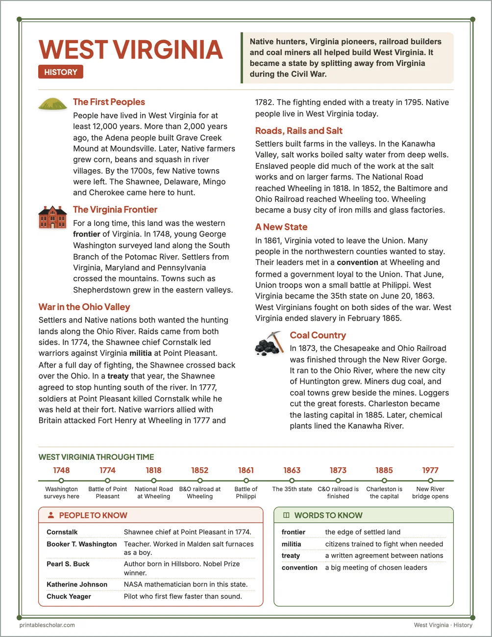
The First Peoples
People have lived in West Virginia for at least 12,000 years. More than 2,000 years ago, the Adena people built Grave Creek Mound at Moundsville. Later, Native farmers grew corn, beans and squash in river villages. By the 1700s, few Native towns were left. The Shawnee, Delaware, Mingo and Cherokee came here to hunt.
The Virginia Frontier
For a long time, this land was the western frontier of Virginia. In 1748, young George Washington surveyed land along the South Branch of the Potomac River. Settlers from Virginia, Maryland and Pennsylvania crossed the mountains. Towns such as Shepherdstown grew in the eastern valleys.
War in the Ohio Valley
Settlers and Native nations both wanted the hunting lands along the Ohio River. Raids came from both sides. In 1774, the Shawnee chief Cornstalk led warriors against Virginia militia at Point Pleasant. After a full day of fighting, the Shawnee crossed back over the Ohio. In a treaty that year, the Shawnee agreed to stop hunting south of the river. In 1777, soldiers at Point Pleasant killed Cornstalk while he was held at their fort. Native warriors allied with Britain attacked Fort Henry at Wheeling in 1777 and 1782. The fighting ended with a treaty in 1795. Native people live in West Virginia today.
Roads, Rails and Salt
Settlers built farms in the valleys. In the Kanawha Valley, salt works boiled salty water from deep wells. Enslaved people did much of the work at the salt works and on larger farms. The National Road reached Wheeling in 1818. In 1852, the Baltimore and Ohio Railroad reached Wheeling too. Wheeling became a busy city of iron mills and glass factories.
A New State
In 1861, Virginia voted to leave the Union. Many people in the northwestern counties wanted to stay. Their leaders met in a convention at Wheeling and formed a government loyal to the Union. That June, Union troops won a small battle at Philippi. West Virginia became the 35th state on June 20, 1863. West Virginians fought on both sides of the war. West Virginia ended slavery in February 1865.
Coal Country
In 1873, the Chesapeake and Ohio Railroad was finished through the New River Gorge. It ran to the Ohio River, where the new city of Huntington grew. Miners dug coal, and coal towns grew beside the mines. Loggers cut the great forests. Charleston became the lasting capital in 1885. Later, chemical plants lined the Kanawha River.
West Virginia through time
- 1748 Washington surveys here
- 1774 Battle of Point Pleasant
- 1818 National Road at Wheeling
- 1852 B&O railroad at Wheeling
- 1861 Battle of Philippi
- 1863 The 35th state
- 1873 C&O railroad is finished
- 1885 Charleston is the capital
- 1977 New River bridge opens
People to know
- Cornstalk: Shawnee chief at Point Pleasant in 1774.
- Booker T. Washington: Teacher. Worked in Malden salt furnaces as a boy.
- Pearl S. Buck: Author born in Hillsboro. Nobel Prize winner.
- Katherine Johnson: NASA mathematician born in this state.
- Chuck Yeager: Pilot who first flew faster than sound.
Free West Virginia maps
Each of these maps is free to print on its own page. The kit puts them in one file with the reading pages and the booklet.