West Virginia Landmarks Map
A free printable illustrated map of West Virginia for kids. It shows 8 landmarks and natural places and 4 industries where they really are, along with the state symbols, 6 cities and a box of key facts. It comes in color and in ink-saving black and white, sized for US Letter paper.
downloadColor PDF downloadBlack and white PDF
Choose your version
Color or black and white.
Both are free, sized for US Letter paper, and come as a PDF to print or a PNG image for slides.
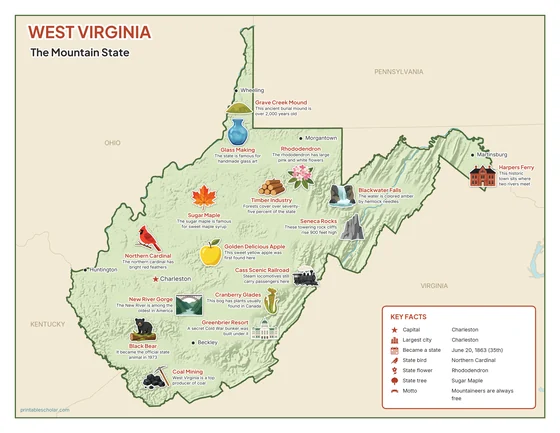
Color
The full-color map, for a wall display or a color printer.

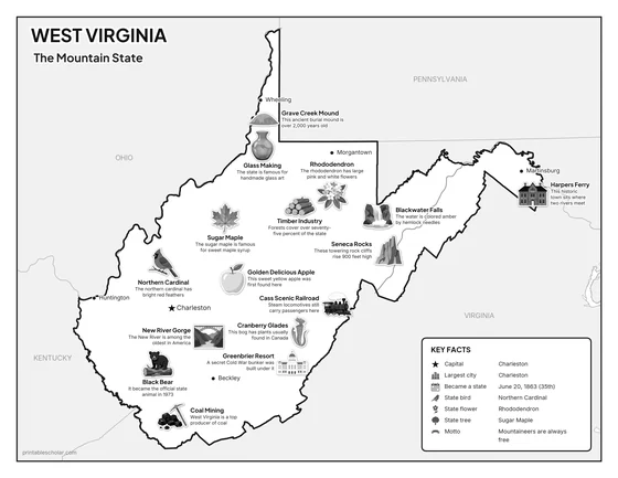
Black and white
The same map with no color or shading. Prints cleanly on a classroom printer and saves ink.

What is on the West Virginia map
Every picture sits at its real location in West Virginia, with a one-line fact beside it. Charleston, the capital, is marked with a star.
Landmarks and natural places
- Grave Creek Mound: This ancient burial mound is over 2,000 years old.
- Harpers Ferry: This historic town sits where two rivers meet.
- Seneca Rocks: These towering rock cliffs rise 900 feet high.
- Blackwater Falls: The water is colored amber by hemlock needles.
- Cass Scenic Railroad: Steam locomotives still carry passengers here.
- Cranberry Glades: This bog has plants usually found in Canada.
- New River Gorge: The New River is among the oldest in America.
- Greenbrier Resort: A secret Cold War bunker was built under it.
What West Virginia makes and grows
- Glass Making: The state is famous for handmade glass art.
- Timber Industry: Forests cover over seventy-five percent of the state.
- Golden Delicious Apple: This sweet yellow apple was first found here.
- Coal Mining: West Virginia is a top producer of coal.
State symbols
- Sugar Maple: The sugar maple is famous for sweet maple syrup.
- Rhododendron: The rhododendron has large pink and white flowers.
- Northern Cardinal: The northern cardinal has bright red feathers.
- Black Bear: It became the official state animal in 1973.
West Virginia key facts
From the box on the map
- Nickname
- The Mountain State
- Capital
- Charleston
- Largest city
- Charleston
- Became a state
- June 20, 1863 (35th)
- State bird
- Northern Cardinal
- State flower
- Rhododendron
- State tree
- Sugar Maple
- Motto
- Mountaineers are always free
Cities shown
- Charleston (capital)
- Huntington
- Morgantown
- Wheeling
- Beckley
- Martinsburg
The outline, rivers and cities are drawn from map data. Pictures of crops and industries are placed in a part of the state where each is typical.