
North Carolina State Report Kit
Everything a student needs to research and write a report on North Carolina: the reading, the maps and the pages to fill in. Nothing else to look up.
- 3 reading pages: North Carolina fun facts, History, and Land and Work
- 5 maps: landmarks, cities, county, outline, and rivers and lakes
- An 8-page My State Report booklet, from fast facts to a trip plan and a license plate to design
- A pennant to cut out and hang, two map skills sheets and a 10-question reading quiz
- Answer keys for the quiz, the fast facts and the map sheets
- One print-ready PDF, 23 pages, black and white, US Letter
Teaching all 50 states? Get every kit for $39.
Look inside
Read it, map it, write it.
The reading pages and maps hold every answer the booklet asks for. About one third of the booklet is looking things up. The rest asks students to choose, plan and explain.

What is in the North Carolina kit
To read and study
- North Carolina fun facts: six short true stories, By the Numbers and Did You Know
- History: the state’s story in order, with a timeline, people to know and words to know
- Land and Work: the land and climate, what the state grows, makes and mines, and how one leads to the other
- Five maps, including a rivers, lakes and neighbors map with a letter key
To fill in and make
- My State Report booklet: cover, Fast Facts, My Map, State Symbols, My Trip, Think Like a Geographer, Design a License Plate and Dig Deeper
- A pennant with the state’s name and outline, to color, cut out and hang
- Name the Cities and Name the Rivers and Lakes sheets, each with a word bank
- A 10-question reading quiz, with answer keys for everything that has one right answer
Free: the North Carolina History reading page
One page on the history of North Carolina for grades 3 to 5, free to print in color or black and white. It is the second reading page in the kit.
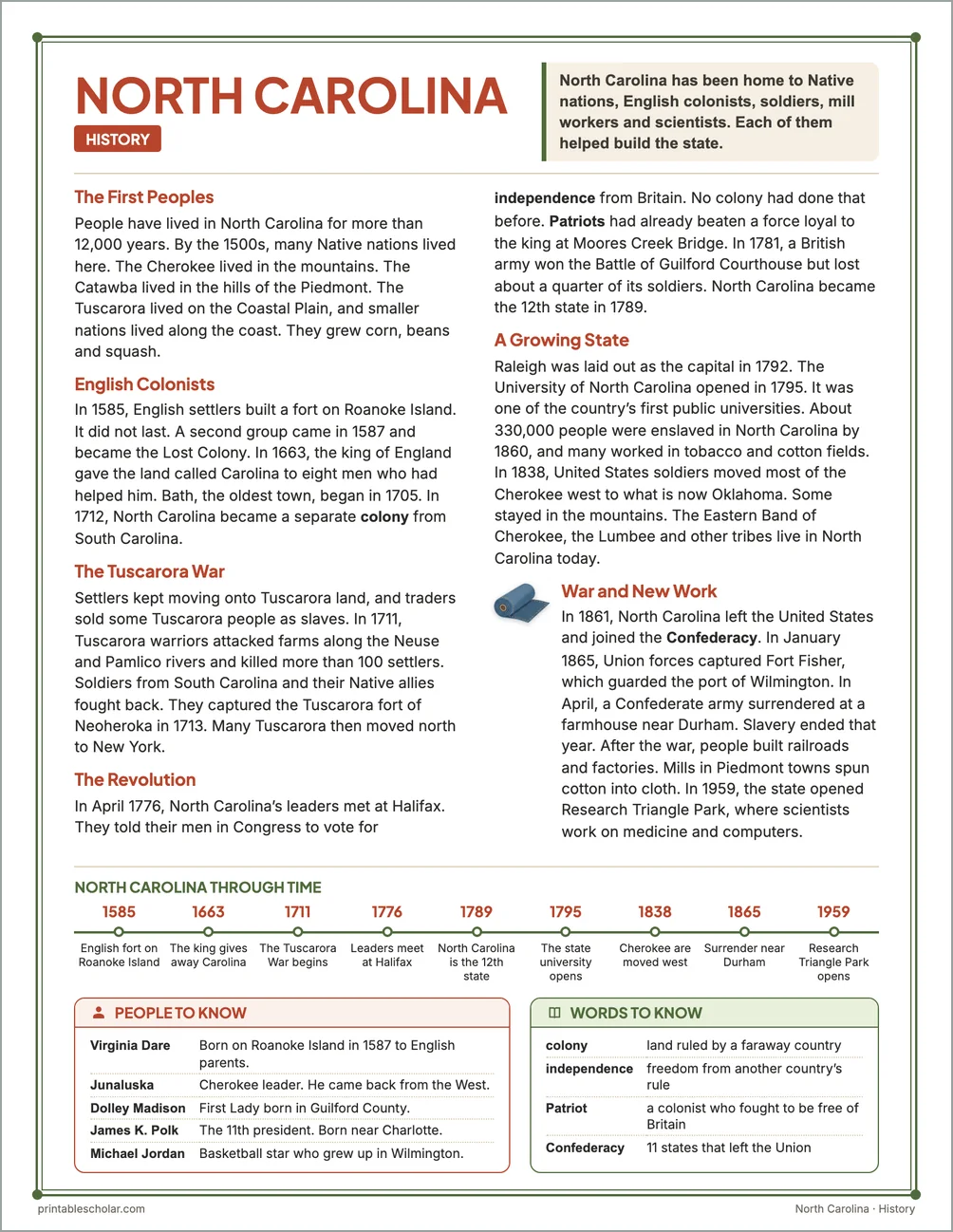
The First Peoples
People have lived in North Carolina for more than 12,000 years. By the 1500s, many Native nations lived here. The Cherokee lived in the mountains. The Catawba lived in the hills of the Piedmont. The Tuscarora lived on the Coastal Plain, and smaller nations lived along the coast. They grew corn, beans and squash.
English Colonists
In 1585, English settlers built a fort on Roanoke Island. It did not last. A second group came in 1587 and became the Lost Colony. In 1663, the king of England gave the land called Carolina to eight men who had helped him. Bath, the oldest town, began in 1705. In 1712, North Carolina became a separate colony from South Carolina.
The Tuscarora War
Settlers kept moving onto Tuscarora land, and traders sold some Tuscarora people as slaves. In 1711, Tuscarora warriors attacked farms along the Neuse and Pamlico rivers and killed more than 100 settlers. Soldiers from South Carolina and their Native allies fought back. They captured the Tuscarora fort of Neoheroka in 1713. Many Tuscarora then moved north to New York.
The Revolution
In April 1776, North Carolina’s leaders met at Halifax. They told their men in Congress to vote for independence from Britain. No colony had done that before. Patriots had already beaten a force loyal to the king at Moores Creek Bridge. In 1781, a British army won the Battle of Guilford Courthouse but lost about a quarter of its soldiers. North Carolina became the 12th state in 1789.
A Growing State
Raleigh was laid out as the capital in 1792. The University of North Carolina opened in 1795. It was one of the country’s first public universities. About 330,000 people were enslaved in North Carolina by 1860, and many worked in tobacco and cotton fields. In 1838, United States soldiers moved most of the Cherokee west to what is now Oklahoma. Some stayed in the mountains. The Eastern Band of Cherokee, the Lumbee and other tribes live in North Carolina today.
War and New Work
In 1861, North Carolina left the United States and joined the Confederacy. In January 1865, Union forces captured Fort Fisher, which guarded the port of Wilmington. In April, a Confederate army surrendered at a farmhouse near Durham. Slavery ended that year. After the war, people built railroads and factories. Mills in Piedmont towns spun cotton into cloth. In 1959, the state opened Research Triangle Park, where scientists work on medicine and computers.
North Carolina through time
- 1585 English fort on Roanoke Island
- 1663 The king gives away Carolina
- 1711 The Tuscarora War begins
- 1776 Leaders meet at Halifax
- 1789 North Carolina is the 12th state
- 1795 The state university opens
- 1838 Cherokee are moved west
- 1865 Surrender near Durham
- 1959 Research Triangle Park opens
People to know
- Virginia Dare: Born on Roanoke Island in 1587 to English parents.
- Junaluska: Cherokee leader. He came back from the West.
- Dolley Madison: First Lady born in Guilford County.
- James K. Polk: The 11th president. Born near Charlotte.
- Michael Jordan: Basketball star who grew up in Wilmington.
Free North Carolina maps
Each of these maps is free to print on its own page. The kit puts them in one file with the reading pages and the booklet.