Printable Scholar
Southwest Region Physical Map
A free printable physical map of the Southwest region of the United States: Arizona, New Mexico, Oklahoma and Texas. It names the rivers, the Rocky Mountains and smaller ranges, the highest peaks, the Grand Canyon, the Colorado Plateau, the deserts and the plains. It comes in black and white or color, and as a blank map with a word bank.
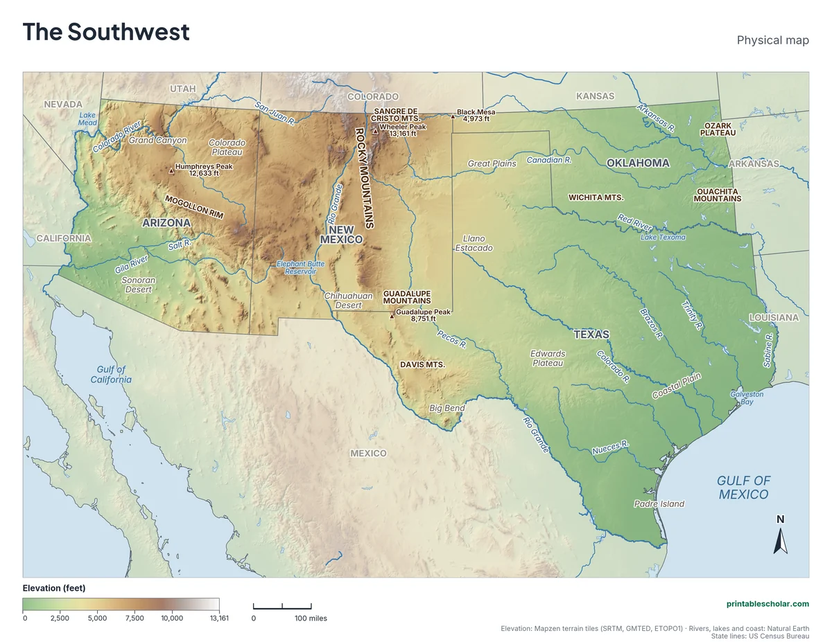
Choose your version
Black and white, color or blank.
All three are free PDFs sized for US Letter paper.
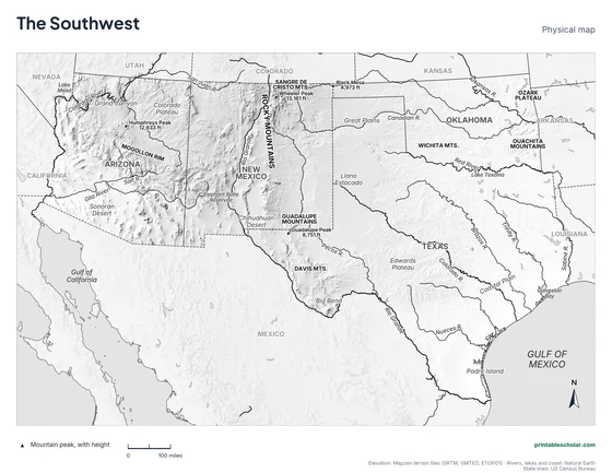
Black and white
States, rivers, mountains, peaks, lakes and landforms named on gray shaded relief. No color ink needed.
downloadBlack and white PDF
Color
The same map in elevation colors, green lowlands to brown highlands, with blue water.
downloadColor PDF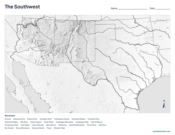
Blank
No names, with peak markers and an alphabetical word bank. Black and white.
downloadBlank PDFThe physical geography of the Southwest
The western Southwest is high and dry. Northern Arizona and New Mexico sit on the Colorado Plateau, a land of mesas and canyons more than a mile above sea level. The Colorado River cut the Grand Canyon through it, about 277 miles long and in places more than a mile deep. The Mogollon Rim, a long cliff across central Arizona, marks the plateau’s southern edge. The southern end of the Rocky Mountains reaches into northern New Mexico, where Wheeler Peak, 13,161 feet, is the highest point in the region.
Two deserts cover the south. The Sonoran Desert of southern Arizona is home to the giant saguaro cactus. The Chihuahuan Desert stretches across southern New Mexico and West Texas into Mexico. The Rio Grande runs south through New Mexico and then forms the border between Texas and Mexico for about 1,250 miles, curving around Big Bend.
East of the mountains the land slopes gently down across the Great Plains and the Llano Estacado, a vast flat tableland, to the Gulf of Mexico. Central Texas has the hilly Edwards Plateau, and eastern Oklahoma has the Ozark Plateau and Ouachita Mountains. The Red River forms most of the border between Oklahoma and Texas, and rivers such as the Brazos, Colorado and Trinity cross Texas to the Gulf.
Highest peaks on the map
- Wheeler Peak, New Mexico: 13,161 ft
- Humphreys Peak, Arizona: 12,633 ft
- Guadalupe Peak, Texas: 8,751 ft
- Black Mesa, Oklahoma: 4,973 ft
Find it on the map
- The Grand Canyon in northern Arizona
- The Rio Grande along the border between Texas and Mexico
- The two Colorado Rivers: one in Arizona, one in central Texas
Elevation is from the Mapzen terrain tiles (SRTM, GMTED, ETOPO1). Rivers, lakes and coastlines are from Natural Earth; state lines from the US Census Bureau. Peak heights are from the US Geological Survey. Landform label positions are approximate.
Frequently asked questions
What are the main physical features of the Southwest?
The Colorado Plateau and Grand Canyon, the southern Rocky Mountains, the Sonoran and Chihuahuan deserts, the Rio Grande, the Great Plains and Llano Estacado, the Edwards Plateau and the Gulf of Mexico coast.
What is the highest mountain in the Southwest?
Wheeler Peak in New Mexico, at 13,161 feet, in the Sangre de Cristo Mountains at the southern end of the Rockies.
Which river forms the border between Texas and Mexico?
The Rio Grande, for about 1,250 miles from El Paso to the Gulf of Mexico.
How do students use the blank map?
The blank map shows the same land, rivers, lakes and peak markers with no names, and an alphabetical word bank of the states and features. Students write each name in place. The labeled map is the answer key.