Real cartographic data
Southwest States Map
Free printable maps of the 4 states of the Southwest. The labeled map names every state and its capital. The blank map shows the outlines and capital stars for students to fill in.

Choose your version
Labeled or blank.
Both are free PDFs sized for US Letter paper.
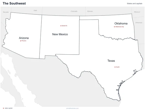
Labeled
Every state and capital named.
downloadLabeled PDF
Blank
State outlines and capital stars, with a name line, for quizzes.
downloadBlank PDFThe Southwest states
The Southwest has only four states, but they are large: Texas, Oklahoma, New Mexico and Arizona. Much of the region is dry, with deserts, canyons and high plateaus. The Grand Canyon is in Arizona. The Rio Grande forms the border between Texas and Mexico, and Texas has a long coast on the Gulf of Mexico.
States and capitals
- Arizona: Phoenix
- New Mexico: Santa Fe
- Oklahoma: Oklahoma City
- Texas: Austin
Find it on the map
- The Rio Grande along the southern edge of Texas
- The Oklahoma Panhandle
- Four Corners, where Arizona and New Mexico meet Utah and Colorado