Real cartographic data
Midwest States Map
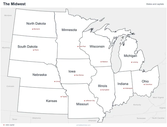
Free printable maps of the 12 states of the Midwest. The labeled map names every state and its capital. The blank map shows the outlines and capital stars for students to fill in.

Choose your version
Labeled or blank.
Both are free PDFs sized for US Letter paper.
Labeled
Every state and capital named.
downloadLabeled PDF
Blank
State outlines and capital stars, with a name line, for quizzes.
downloadBlank PDFThe Midwest states
The Midwest is the center of the country, between the Appalachian Mountains and the Rocky Mountains. Its eastern states border the Great Lakes, and its western states are part of the Great Plains. The land is mostly flat or gently rolling and is some of the best farmland in the world. The Mississippi, Missouri and Ohio rivers all flow through or along the region.
States and capitals
- Illinois: Springfield
- Indiana: Indianapolis
- Iowa: Des Moines
- Kansas: Topeka
- Michigan: Lansing
- Minnesota: Saint Paul
- Missouri: Jefferson City
- Nebraska: Lincoln
- North Dakota: Bismarck
- Ohio: Columbus
- South Dakota: Pierre
- Wisconsin: Madison
Find it on the map
- The Great Lakes along the north
- Michigan’s two peninsulas
- The Missouri River along the edges of several states