
Indiana State Report Kit
Everything a student needs to research and write a report on Indiana: the reading, the maps and the pages to fill in. Nothing else to look up.
- 3 reading pages: Indiana fun facts, History, and Land and Work
- 5 maps: landmarks, cities, county, outline, and rivers and lakes
- An 8-page My State Report booklet, from fast facts to a trip plan and a license plate to design
- A pennant to cut out and hang, two map skills sheets and a 10-question reading quiz
- Answer keys for the quiz, the fast facts and the map sheets
- One print-ready PDF, 23 pages, black and white, US Letter
Look inside
Read it, map it, write it.
The reading pages and maps hold every answer the booklet asks for. About one third of the booklet is looking things up. The rest asks students to choose, plan and explain.

What is in the Indiana kit
To read and study
- Indiana fun facts: six short true stories, By the Numbers and Did You Know
- History: the state’s story in order, with a timeline, people to know and words to know
- Land and Work: the land and climate, what the state grows, makes and mines, and how one leads to the other
- Five maps, including a rivers, lakes and neighbors map with a letter key
To fill in and make
- My State Report booklet: cover, Fast Facts, My Map, State Symbols, My Trip, Think Like a Geographer, Design a License Plate and Dig Deeper
- A pennant with the state’s name and outline, to color, cut out and hang
- Name the Cities and Name the Rivers and Lakes sheets, each with a word bank
- A 10-question reading quiz, with answer keys for everything that has one right answer
Free: the Indiana History reading page
One page on the history of Indiana for grades 3 to 5, free to print in color or black and white. It is the second reading page in the kit.
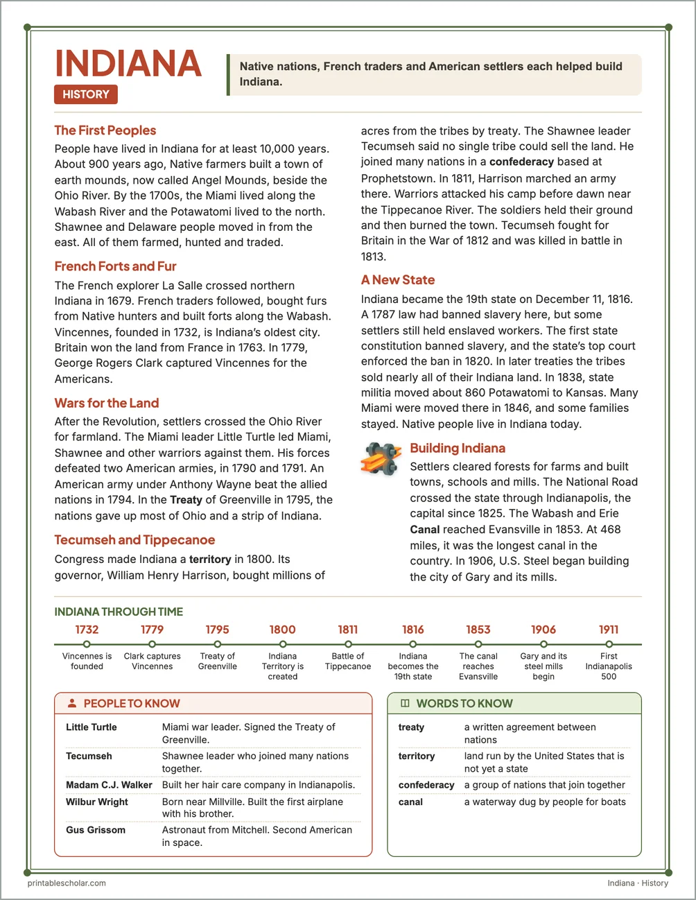
The First Peoples
People have lived in Indiana for at least 10,000 years. About 900 years ago, Native farmers built a town of earth mounds, now called Angel Mounds, beside the Ohio River. By the 1700s, the Miami lived along the Wabash River and the Potawatomi lived to the north. Shawnee and Delaware people moved in from the east. All of them farmed, hunted and traded.
French Forts and Fur
The French explorer La Salle crossed northern Indiana in 1679. French traders followed, bought furs from Native hunters and built forts along the Wabash. Vincennes, founded in 1732, is Indiana’s oldest city. Britain won the land from France in 1763. In 1779, George Rogers Clark captured Vincennes for the Americans.
Wars for the Land
After the Revolution, settlers crossed the Ohio River for farmland. The Miami leader Little Turtle led Miami, Shawnee and other warriors against them. His forces defeated two American armies, in 1790 and 1791. An American army under Anthony Wayne beat the allied nations in 1794. In the Treaty of Greenville in 1795, the nations gave up most of Ohio and a strip of Indiana.
Tecumseh and Tippecanoe
Congress made Indiana a territory in 1800. Its governor, William Henry Harrison, bought millions of acres from the tribes by treaty. The Shawnee leader Tecumseh said no single tribe could sell the land. He joined many nations in a confederacy based at Prophetstown. In 1811, Harrison marched an army there. Warriors attacked his camp before dawn near the Tippecanoe River. The soldiers held their ground and then burned the town. Tecumseh fought for Britain in the War of 1812 and was killed in battle in 1813.
A New State
Indiana became the 19th state on December 11, 1816. A 1787 law had banned slavery here, but some settlers still held enslaved workers. The first state constitution banned slavery, and the state’s top court enforced the ban in 1820. In later treaties the tribes sold nearly all of their Indiana land. In 1838, state militia moved about 860 Potawatomi to Kansas. Many Miami were moved there in 1846, and some families stayed. Native people live in Indiana today.
Building Indiana
Settlers cleared forests for farms and built towns, schools and mills. The National Road crossed the state through Indianapolis, the capital since 1825. The Wabash and Erie Canal reached Evansville in 1853. At 468 miles, it was the longest canal in the country. In 1906, U.S. Steel began building the city of Gary and its mills.
Indiana through time
- 1732 Vincennes is founded
- 1779 Clark captures Vincennes
- 1795 Treaty of Greenville
- 1800 Indiana Territory is created
- 1811 Battle of Tippecanoe
- 1816 Indiana becomes the 19th state
- 1853 The canal reaches Evansville
- 1906 Gary and its steel mills begin
- 1911 First Indianapolis 500
People to know
- Little Turtle: Miami war leader. Signed the Treaty of Greenville.
- Tecumseh: Shawnee leader who joined many nations together.
- Madam C.J. Walker: Built her hair care company in Indianapolis.
- Wilbur Wright: Born near Millville. Built the first airplane with his brother.
- Gus Grissom: Astronaut from Mitchell. Second American in space.
Free Indiana maps
Each of these maps is free to print on its own page. The kit puts them in one file with the reading pages and the booklet.