Indiana Landmarks Map
A free printable illustrated map of Indiana for kids. It shows 9 landmarks and natural places and 3 industries where they really are, along with the state symbols, 5 cities and a box of key facts. It comes in color and in ink-saving black and white, sized for US Letter paper.
downloadColor PDF downloadBlack and white PDF
Choose your version
Color or black and white.
Both are free, sized for US Letter paper, and come as a PDF to print or a PNG image for slides.
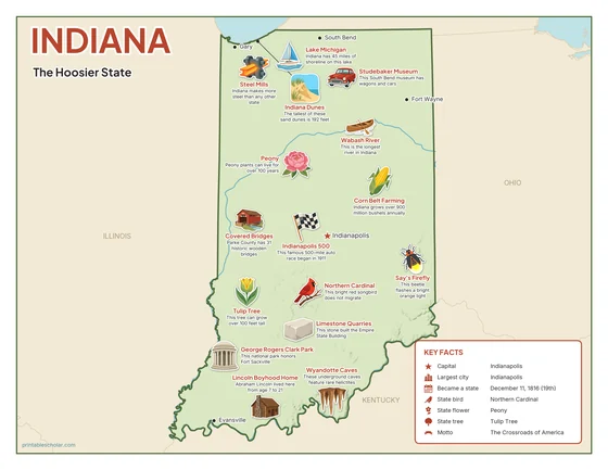
Color
The full-color map, for a wall display or a color printer.

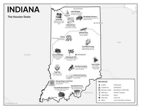
Black and white
The same map with no color or shading. Prints cleanly on a classroom printer and saves ink.

What is on the Indiana map
Every picture sits at its real location in Indiana, with a one-line fact beside it. Indianapolis, the capital, is marked with a star.
Landmarks and natural places
- Indiana Dunes: The tallest of these sand dunes is 192 feet.
- Lake Michigan: Indiana has 45 miles of shoreline on this lake.
- Studebaker Museum: This South Bend museum has wagons and cars.
- Wabash River: This is the longest river in Indiana.
- Indianapolis 500: This famous 500-mile auto race began in 1911.
- Covered Bridges: Parke County has 31 historic wooden bridges.
- George Rogers Clark Park: This national park honors Fort Sackville.
- Wyandotte Caves: These underground caves feature rare helictites.
- Lincoln Boyhood Home: Abraham Lincoln lived here from age 7 to 21.
What Indiana makes and grows
- Steel Mills: Indiana makes more steel than any other state.
- Corn Belt Farming: Indiana grows over 900 million bushels annually.
- Limestone Quarries: This stone built the Empire State Building.
State symbols
- Peony: Peony plants can live for over 100 years.
- Say’s Firefly: This beetle flashes a bright orange light.
- Northern Cardinal: This bright red songbird does not migrate.
- Tulip Tree: This tree can grow over 100 feet tall.
Indiana key facts
From the box on the map
- Nickname
- The Hoosier State
- Capital
- Indianapolis
- Largest city
- Indianapolis
- Became a state
- December 11, 1816 (19th)
- State bird
- Northern Cardinal
- State flower
- Peony
- State tree
- Tulip Tree
- Motto
- The Crossroads of America
Cities shown
- Indianapolis (capital)
- Fort Wayne
- Evansville
- South Bend
- Gary
The outline, rivers and cities are drawn from map data. Pictures of crops and industries are placed in a part of the state where each is typical.