
Minnesota State Report Kit
Everything a student needs to research and write a report on Minnesota: the reading, the maps and the pages to fill in. Nothing else to look up.
- 3 reading pages: Minnesota fun facts, History, and Land and Work
- 5 maps: landmarks, cities, county, outline, and rivers and lakes
- An 8-page My State Report booklet, from fast facts to a trip plan and a license plate to design
- A pennant to cut out and hang, two map skills sheets and a 10-question reading quiz
- Answer keys for the quiz, the fast facts and the map sheets
- One print-ready PDF, 23 pages, black and white, US Letter
Look inside
Read it, map it, write it.
The reading pages and maps hold every answer the booklet asks for. About one third of the booklet is looking things up. The rest asks students to choose, plan and explain.

What is in the Minnesota kit
To read and study
- Minnesota fun facts: six short true stories, By the Numbers and Did You Know
- History: the state’s story in order, with a timeline, people to know and words to know
- Land and Work: the land and climate, what the state grows, makes and mines, and how one leads to the other
- Five maps, including a rivers, lakes and neighbors map with a letter key
To fill in and make
- My State Report booklet: cover, Fast Facts, My Map, State Symbols, My Trip, Think Like a Geographer, Design a License Plate and Dig Deeper
- A pennant with the state’s name and outline, to color, cut out and hang
- Name the Cities and Name the Rivers and Lakes sheets, each with a word bank
- A 10-question reading quiz, with answer keys for everything that has one right answer
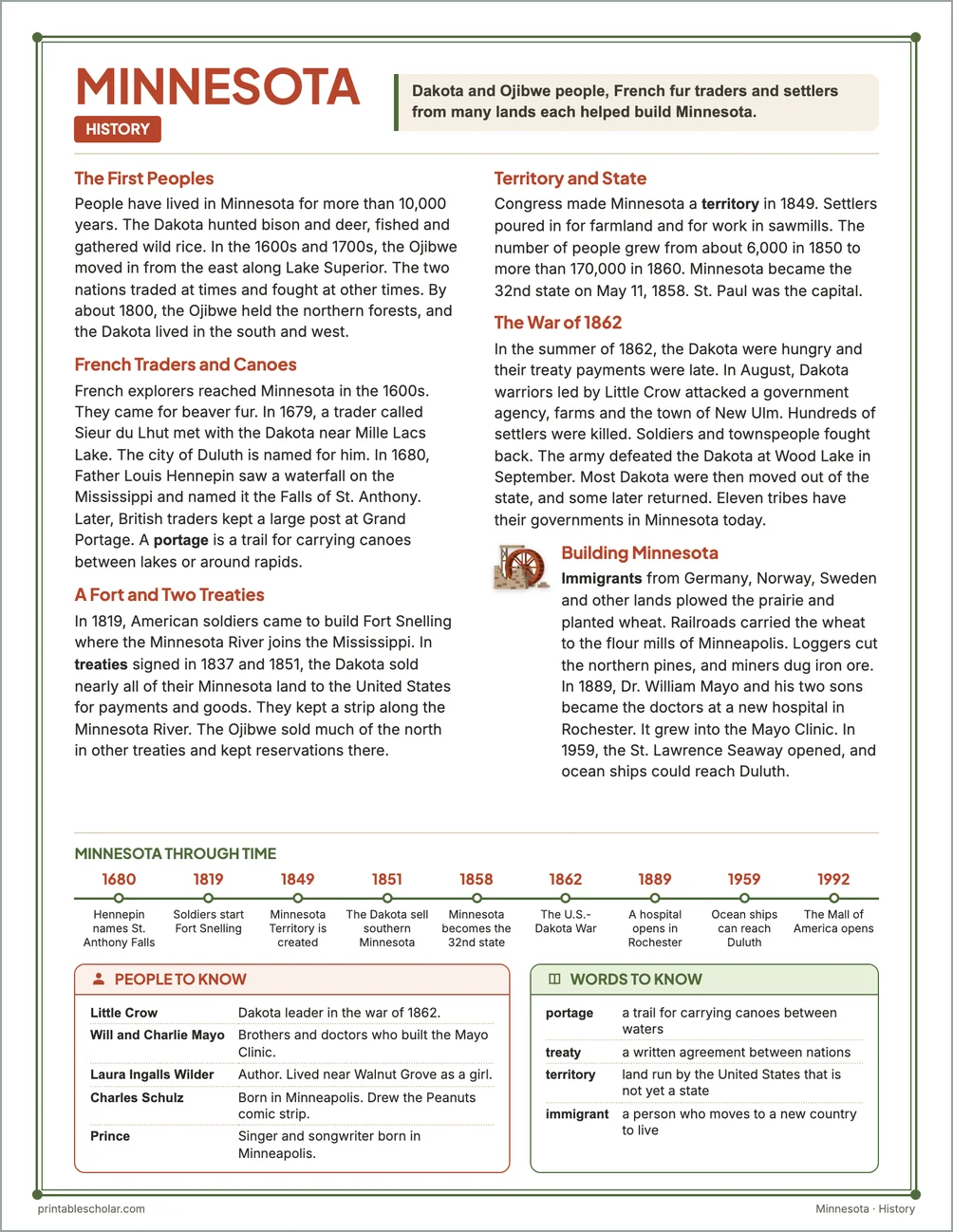
Free: the Minnesota History reading page
One page on the history of Minnesota for grades 3 to 5, free to print in color or black and white. It is the second reading page in the kit.
The First Peoples
People have lived in Minnesota for more than 10,000 years. The Dakota hunted bison and deer, fished and gathered wild rice. In the 1600s and 1700s, the Ojibwe moved in from the east along Lake Superior. The two nations traded at times and fought at other times. By about 1800, the Ojibwe held the northern forests, and the Dakota lived in the south and west.
French Traders and Canoes
French explorers reached Minnesota in the 1600s. They came for beaver fur. In 1679, a trader called Sieur du Lhut met with the Dakota near Mille Lacs Lake. The city of Duluth is named for him. In 1680, Father Louis Hennepin saw a waterfall on the Mississippi and named it the Falls of St. Anthony. Later, British traders kept a large post at Grand Portage. A portage is a trail for carrying canoes between lakes or around rapids.
A Fort and Two Treaties
In 1819, American soldiers came to build Fort Snelling where the Minnesota River joins the Mississippi. In treaties signed in 1837 and 1851, the Dakota sold nearly all of their Minnesota land to the United States for payments and goods. They kept a strip along the Minnesota River. The Ojibwe sold much of the north in other treaties and kept reservations there.
Territory and State
Congress made Minnesota a territory in 1849. Settlers poured in for farmland and for work in sawmills. The number of people grew from about 6,000 in 1850 to more than 170,000 in 1860. Minnesota became the 32nd state on May 11, 1858. St. Paul was the capital.
The War of 1862
In the summer of 1862, the Dakota were hungry and their treaty payments were late. In August, Dakota warriors led by Little Crow attacked a government agency, farms and the town of New Ulm. Hundreds of settlers were killed. Soldiers and townspeople fought back. The army defeated the Dakota at Wood Lake in September. Most Dakota were then moved out of the state, and some later returned. Eleven tribes have their governments in Minnesota today.
Building Minnesota
Immigrants from Germany, Norway, Sweden and other lands plowed the prairie and planted wheat. Railroads carried the wheat to the flour mills of Minneapolis. Loggers cut the northern pines, and miners dug iron ore. In 1889, Dr. William Mayo and his two sons became the doctors at a new hospital in Rochester. It grew into the Mayo Clinic. In 1959, the St. Lawrence Seaway opened, and ocean ships could reach Duluth.
Minnesota through time
- 1680 Hennepin names St. Anthony Falls
- 1819 Soldiers start Fort Snelling
- 1849 Minnesota Territory is created
- 1851 The Dakota sell southern Minnesota
- 1858 Minnesota becomes the 32nd state
- 1862 The U.S.-Dakota War
- 1889 A hospital opens in Rochester
- 1959 Ocean ships can reach Duluth
- 1992 The Mall of America opens
People to know
- Little Crow: Dakota leader in the war of 1862.
- Will and Charlie Mayo: Brothers and doctors who built the Mayo Clinic.
- Laura Ingalls Wilder: Author. Lived near Walnut Grove as a girl.
- Charles Schulz: Born in Minneapolis. Drew the Peanuts comic strip.
- Prince: Singer and songwriter born in Minneapolis.
Free Minnesota maps
Each of these maps is free to print on its own page. The kit puts them in one file with the reading pages and the booklet.