 Printable Scholar
Mason-Dixon Line Map
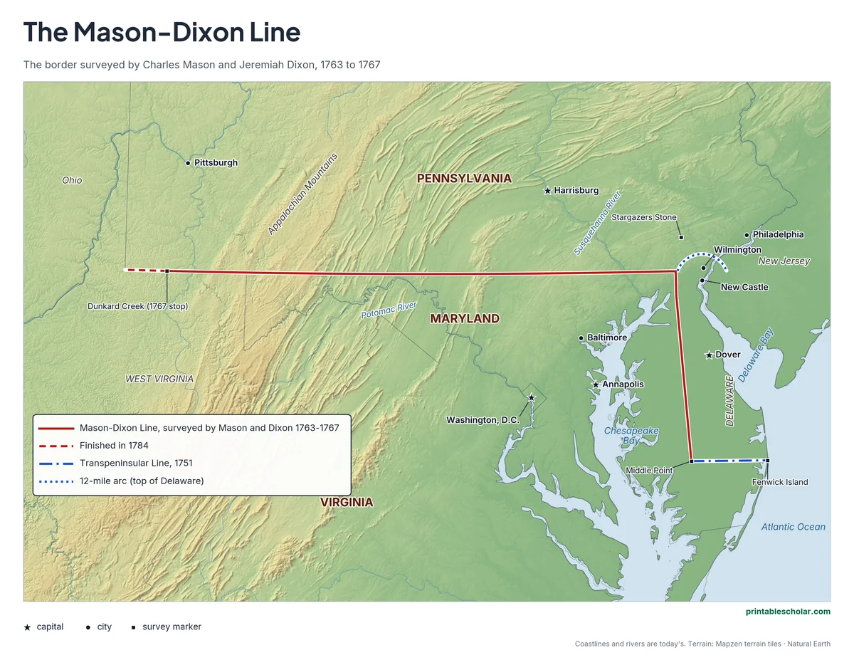
A free printable map of the Mason-Dixon Line drawn on real terrain: the border Charles Mason and Jeremiah Dixon surveyed between Pennsylvania and Maryland from 1763 to 1767, with the Delaware border lines, the 12-mile arc around New Castle and the survey markers. It comes in color, black and white, and blank.
Choose your version
Black and white, color or blank.
All three are free PDFs sized for US Letter paper.

Black and white
Everything named on a plain outline map with no terrain. No color ink needed.
downloadBlack and white PDF
Color
The survey lines, markers, states and cities named, on shaded relief.
downloadColor PDF
Blank
The black-and-white map with its routes and markers but no names, for labeling practice.
downloadBlank PDF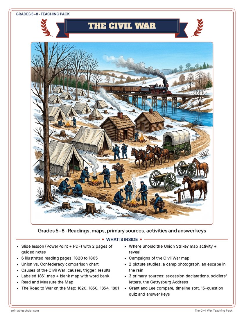
Teaching pack · Grades 5–8
Teaching the Civil War? The whole unit, ready to teach.
Two weeks of lessons in one download: slides to present, notes for students to fill in, and printable pages that use these maps and pictures.
Every slide comes with teacher notes: what to say, what to ask, and sample answers.
- 42 lesson slides (PowerPoint you can edit) and 2 pages of guided notes
- 6 illustrated reading pages, a Union vs. Confederacy chart and a causes sheet
- Maps: labeled, blank, Read and Measure the Map, four road-to-war maps (1820 to 1861), a campaigns map and a "Where should the Union strike?" decision with the reveal
- Primary sources: the secession declarations, soldiers' letters from both sides, and the Gettysburg Address, each with plain English beside it; picture studies of a real 1862 camp photograph and an 1872 Underground Railroad engraving
- Grant and Lee, a timeline sort, a 15-question quiz, a teacher guide with a two-week plan, and answer keys for everything
Every answer is in the pack. The readings, slides, maps and pictures teach everything the sheets and quiz ask, so no textbook is needed.
Get the Civil War pack for $7Teaching more than one? Get all seven US history packs (Native American Regions, the Age of Exploration, the 13 Colonies, the American Revolution, the Constitution, Westward Expansion and the Civil War) for $34: about fourteen weeks of lessons.
Get all 7 packs for $34See all seven packsOr get every history pack (24) in one download:Get all 24 for $49
One-time purchase. Instant download. Color and ink-saving black-and-white editions. Secure checkout by Stripe.
The 10-day plan
10 lessons, each planned for one class period of about 45 to 50 minutes, straight from the teacher guide. Some days are fuller than others; the note below shows how to even them out.
- Day 1Hook: Where should the Union strike?
- Day 2A divided nation and Escape in the Rain
- Day 3The road to war and its maps
- Day 4The war begins and why the states seceded
- Day 5Causes of the war and the map sheets
- Day 6Turning points and the Gettysburg Address
- Day 7Life during the war and why they fought
- Day 8Union victory, the campaigns map and the reveal
- Day 9Grant and Lee and the timeline sort
- Day 10Review and the 15-question quiz
Fitting it to your schedule: Days 7 and 8 are the fullest and Days 2 and 9 the lightest. With 10 periods, move the Campaigns of the Civil War map sheet from Day 8 to Day 9. With 8 periods, give the Day 5 causes sheet, blank map and Read and Measure the Map as homework over Days 4 and 6, give the Grant and Lee sheet as homework and open the Day 10 review with the timeline sort.
See the full day-by-day plan
- Day 1
- Hook: Where Should the Union Strike? Students read the four generals' reports, fill the needs checklist and argue for a plan. Keep the What Really Happened page for Day 8.
- Day 2
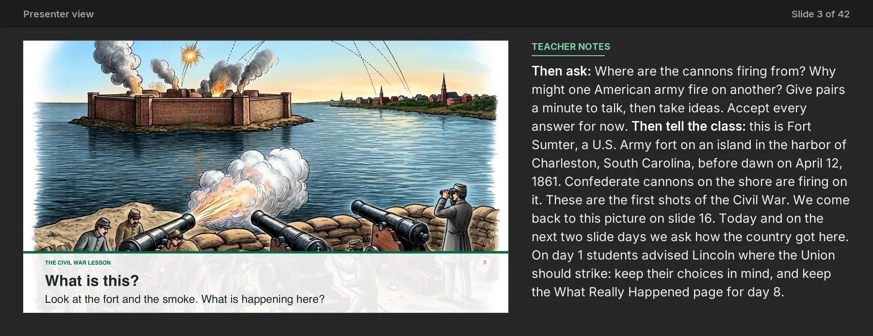
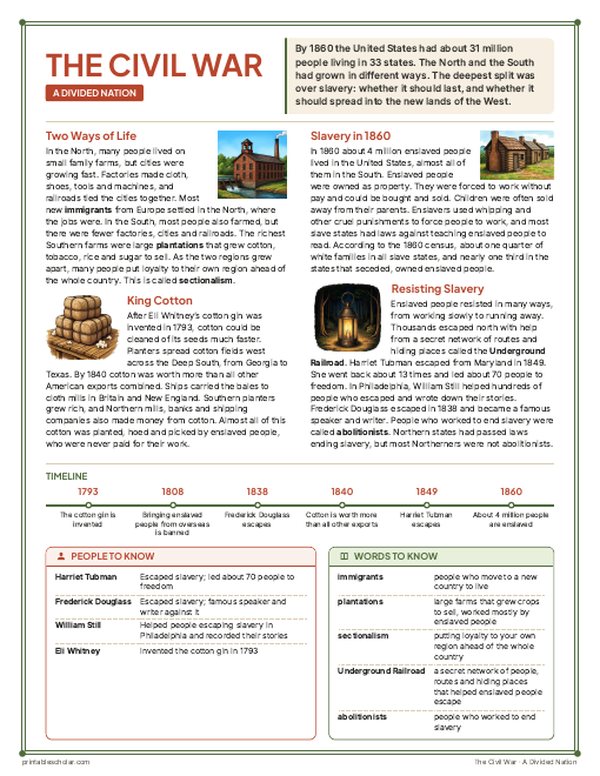
- Slides 3-8 with guided notes page 1. Reading: A Divided Nation. Picture study: Escape in the Rain.
- Day 3
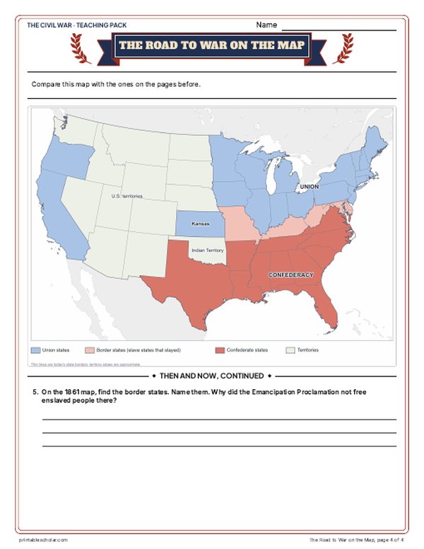
- Slides 9-13. Reading: The Road to War. The Road to War on the Map (1820, 1850, 1854, 1861) and its questions.
- Day 4
- Slides 14-19. Reading: The War Begins. Start the Union vs. Confederacy chart. Primary source: Why the States Seceded.
- Day 5
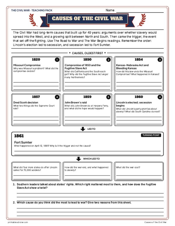
- Causes of the Civil War sheet (long-term causes, the trigger, results). Labeled map, then the blank map with the word bank and Read and Measure the Map.
- Day 6
- Slides 20-27 with guided notes page 2, with Myth vs. Fact. Reading: Turning Points. Primary source: the Gettysburg Address, read aloud in parts.
- Day 7
- Slides 28-33. Reading: Life During the War. Picture study: A Soldier's Family in Camp. Primary source: Why They Fought.
- Day 8
- Slides 34-39, with Weird but True. Reading: Union Victory. Campaigns of the Civil War map sheet. Reveal: What Really Happened; students compare it with their Day 1 choice. Finish the chart.
- Day 9
- Grant and Lee compare sheet. Timeline sort.
- Day 10
- Slides 40-42: the Who am I? riddle and the exit question; finish guided notes page 2. 15-question quiz. Use the answer keys to check every sheet.
The Mason-Dixon Line
For eighty years the colonies of Pennsylvania and Maryland argued over where one ended and the other began. Their royal charters overlapped, and settlers on the disputed land fought over farms and taxes in a small war called Cresap’s War in the 1730s. In 1763 the two families who owned the colonies, the Penns and the Calverts, hired two English scientists to settle it: Charles Mason, an astronomer, and Jeremiah Dixon, a surveyor. Working by the stars with telescopes and long measuring chains, their crews first ran the tangent line up the Delmarva Peninsula to mark Maryland’s border with Delaware, then cut the east-west line along 39 degrees 43 minutes north, clearing a path through the forest and setting a stone marker every mile, with a crown stone carrying the two families’ coats of arms every fifth mile. In 1767 they reached Dunkard Creek, about 233 miles west, where their Iroquois guides told them to stop: the land beyond belonged to the Native nations. Other surveyors finished the line to Pennsylvania’s southwest corner in 1784. Later, people used the name Mason-Dixon Line for the border between North and South, and in the years before the Civil War it marked the line between free states and slave states in the East.
On the map
- The Mason-Dixon Line: the border between Pennsylvania and Maryland, surveyed 1763 to 1767
- Dunkard Creek: where Mason and Dixon stopped in 1767
- The tangent line: the north-south part of the line, between Maryland and Delaware
- The Transpeninsular Line: Delaware’s southern border, surveyed in 1751
- The 12-mile arc: the curved northern border of Delaware, centered on New Castle
- Stargazers Stone: the marker Mason and Dixon set to fix their starting point
- Middle Point and Fenwick Island: the ends of the Transpeninsular Line
Find it on the map
- The straight line between Pennsylvania and Maryland, running west into the mountains
- The round top of Delaware, the only curved state border made from a circle
- Washington, D.C., a few miles south of the line
The survey lines are drawn from their published coordinates. Modern state lines are shown for reference. Coastlines and rivers are shown as they are today.
Frequently asked questions
What is the Mason-Dixon Line?
The border between Pennsylvania and Maryland, and part of the border of Delaware, surveyed by Charles Mason and Jeremiah Dixon from 1763 to 1767 to end a long dispute between the two colonies.
Where is the Mason-Dixon Line?
It runs east and west along 39 degrees 43 minutes north latitude, from the corner where Pennsylvania, Maryland and Delaware meet to the southwest corner of Pennsylvania, about 244 miles in all. A north-south section forms the border between Maryland and Delaware.
Why is it called the Mason-Dixon Line?
It is named for the two English surveyors who measured it, Charles Mason and Jeremiah Dixon. They used the stars and long chains to find the line and set stone markers along it.
Why is the Mason-Dixon Line important?
It settled where Pennsylvania ended and Maryland began. Later the name came to stand for the dividing line between North and South, and before the Civil War it was part of the border between free states and slave states.
Can you still see the Mason-Dixon Line?
Yes. Many of the original stone markers still stand along the border, including crown stones with the coats of arms of the Penn and Calvert families.