 Printable Scholar
Age of Exploration Map
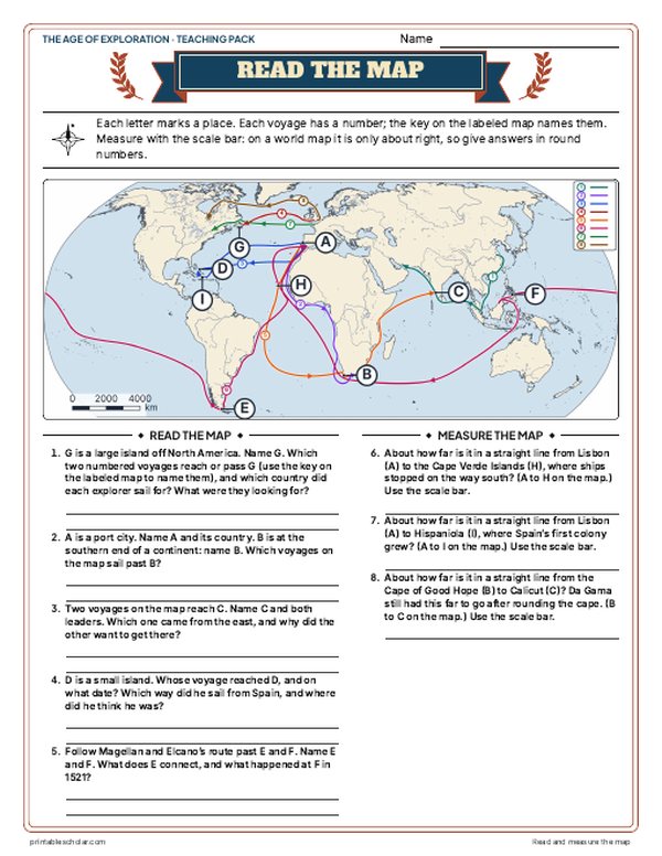
A free printable world map of eight major voyages of exploration between 1405 and 1611, each route in its own color and numbered, with the ports they sailed from and the places they reached. It comes in color, in black and white with a different line pattern for each voyage, and blank with lines to write each explorer.

Choose your version
Black and white, color or blank.
All three are free PDFs sized for US Letter paper.

Black and white
Every voyage drawn in its own line pattern and numbered, with everything named. No color ink needed.
downloadBlack and white PDF
Color
Each voyage in its own color and numbered, with the ports, places, seas and continents named.
downloadColor PDF
Blank
The numbered routes and place markers with no names, and lines to write the explorer who led each voyage.
downloadBlank PDF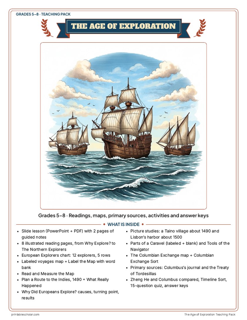
Teaching pack · Grades 5–8
Teaching the Age of Exploration? The whole unit, ready to teach.
Two weeks of lessons in one download: slides to present, notes for students to fill in, and printable pages that use these maps and pictures.
Every slide comes with teacher notes: what to say, what to ask, and sample answers.
- 50 lesson slides (PowerPoint you can edit) and 2 pages of guided notes
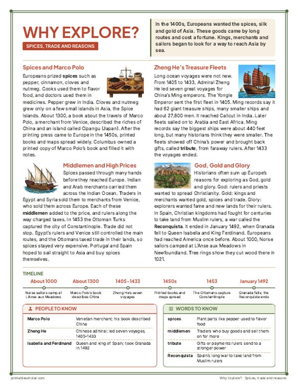
- 8 illustrated reading pages: why Europeans explored, ships and navigation, Portugal and Africa, Columbus and the Taino, around the world, Spain in the Americas, the Columbian Exchange and the northern explorers, plus a 12-explorer chart
- Maps: a labeled voyages map, a blank map with word bank, Read and Measure the Map, Plan a Route to the Indies (1490) with What Really Happened, and the Columbian Exchange map
- Activities: picture studies of a Taino village and Lisbon's harbor, parts of a caravel, tools of the navigator, causes and results, Columbus's journal and the Treaty of Tordesillas as primary sources, Zheng He and Columbus compared, a timeline sort and a Columbian Exchange sort
- A 15-question quiz, a teacher guide with a two-week plan, and answer keys for everything
Every answer is in the pack. The readings, slides, maps and pictures teach everything the sheets and quiz ask, so no textbook is needed.
Get the Age of Exploration pack for $7Teaching more than one? Get all seven US history packs (Native American Regions, the Age of Exploration, the 13 Colonies, the American Revolution, the Constitution, Westward Expansion and the Civil War) for $34: about fourteen weeks of lessons.
Get all 7 packs for $34See all seven packsOr get every history pack (23) in one download:Get all 23 for $49
One-time purchase. Instant download. Color and ink-saving black-and-white editions. Secure checkout by Stripe.
The Age of Exploration
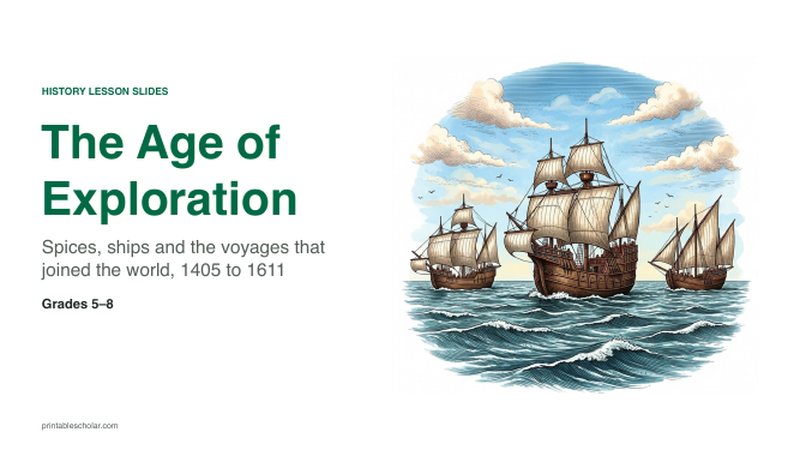
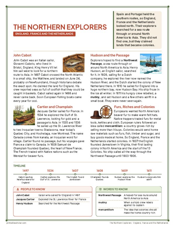
Between the early 1400s and the early 1600s, sailors crossed oceans that their own people had never crossed before. China’s Ming emperors sent Zheng He with huge treasure fleets to Southeast Asia, India, Arabia and East Africa between 1405 and 1433. In Europe, Portugal and Spain looked for a sea route to the spices of Asia that did not pass through the traders of the eastern Mediterranean. Bartolomeu Dias sailed round the southern tip of Africa in 1488, and Vasco da Gama followed that route all the way to Calicut in India in 1498. Sailing west for Spain in 1492, Christopher Columbus reached the Bahamas, Cuba and Hispaniola, the homelands of the Taino. John Cabot reached Newfoundland for England in 1497, and Jacques Cartier sailed up the St. Lawrence River for France in 1535. The expedition led by Ferdinand Magellan was the first to sail around the world, from 1519 to 1522: Magellan was killed in the Philippines, and Juan Sebastián Elcano brought the last ship home. Henry Hudson searched for a Northwest Passage to Asia in 1610 and 1611. These voyages linked the continents by sea and began the Columbian Exchange, and they also led to conquest, disease and the slave trade that changed the lives of millions of people in the Americas and Africa.
The eight voyages
- 1 Zheng He: Nanjing to Calicut and Hormuz (his seventh voyage, 1431 to 1433)
- 2 Bartolomeu Dias: Lisbon round the tip of Africa, 1487 to 1488
- 3 Christopher Columbus: Palos to the Bahamas, Cuba and Hispaniola and back, 1492 to 1493
- 4 John Cabot: Bristol to Newfoundland, 1497
- 5 Vasco da Gama: Lisbon round Africa to Calicut, 1497 to 1498
- 6 Magellan and Elcano: around the world, 1519 to 1522
- 7 Jacques Cartier: Saint-Malo up the St. Lawrence River to Hochelaga (Montreal), 1535
- 8 Henry Hudson: London to Hudson Bay and James Bay, 1610 to 1611
Find it on the map
- The wide loop da Gama sailed through the South Atlantic before turning east for the Cape of Good Hope
- The Strait of Magellan at the southern tip of South America
- Magellan’s crossing of the Pacific, which runs off the left edge of the map and comes back on the right
Routes are approximate, drawn from the main places named in the voyage accounts. Only the outward journeys are drawn, except for Columbus, whose return is shown, and Magellan and Elcano, who sailed all the way around. Where John Cabot first landed is debated; the map shows Cape Bonavista in Newfoundland. Coastlines and rivers are shown as they are today.
Frequently asked questions
What was the Age of Exploration?
The period from the early 1400s to the 1600s when sailors from China and then from Europe made long ocean voyages to lands their own people had not reached by sea. Portuguese and Spanish voyages in search of a sea route to Asian spices led to the first European voyages to India and to the Americas, and to the first voyage around the world.
Was Columbus the first to reach the Americas?
No. Millions of people already lived in the Americas, and Norse sailors had reached Newfoundland about 1000, at L’Anse aux Meadows. In 1492 Columbus reached the Bahamas, where he met the Taino, and his voyages began lasting contact between Europe and the Americas.
Who was the first to sail around the world?
The expedition led by Ferdinand Magellan, which left Spain in 1519. Magellan was killed at Mactan in the Philippines in 1521, and Juan Sebastián Elcano commanded the one ship, the Victoria, that returned to Spain in 1522 with 18 of the crew.
Why did Europeans look for a sea route to Asia?
Spices, silk and other goods from Asia were in great demand in Europe but reached it through many traders over land and through the eastern Mediterranean, which made them expensive. A sea route would let Portugal or Spain trade directly. Rulers also hoped for gold, land and the spread of Christianity.
Are the routes on the map exact?
No. The routes are approximate, drawn through the main places named in the voyage accounts. Sailors followed the winds and currents, and for some voyages, such as John Cabot’s, historians still debate where the ships went.