Free Printable 13 Colonies Map
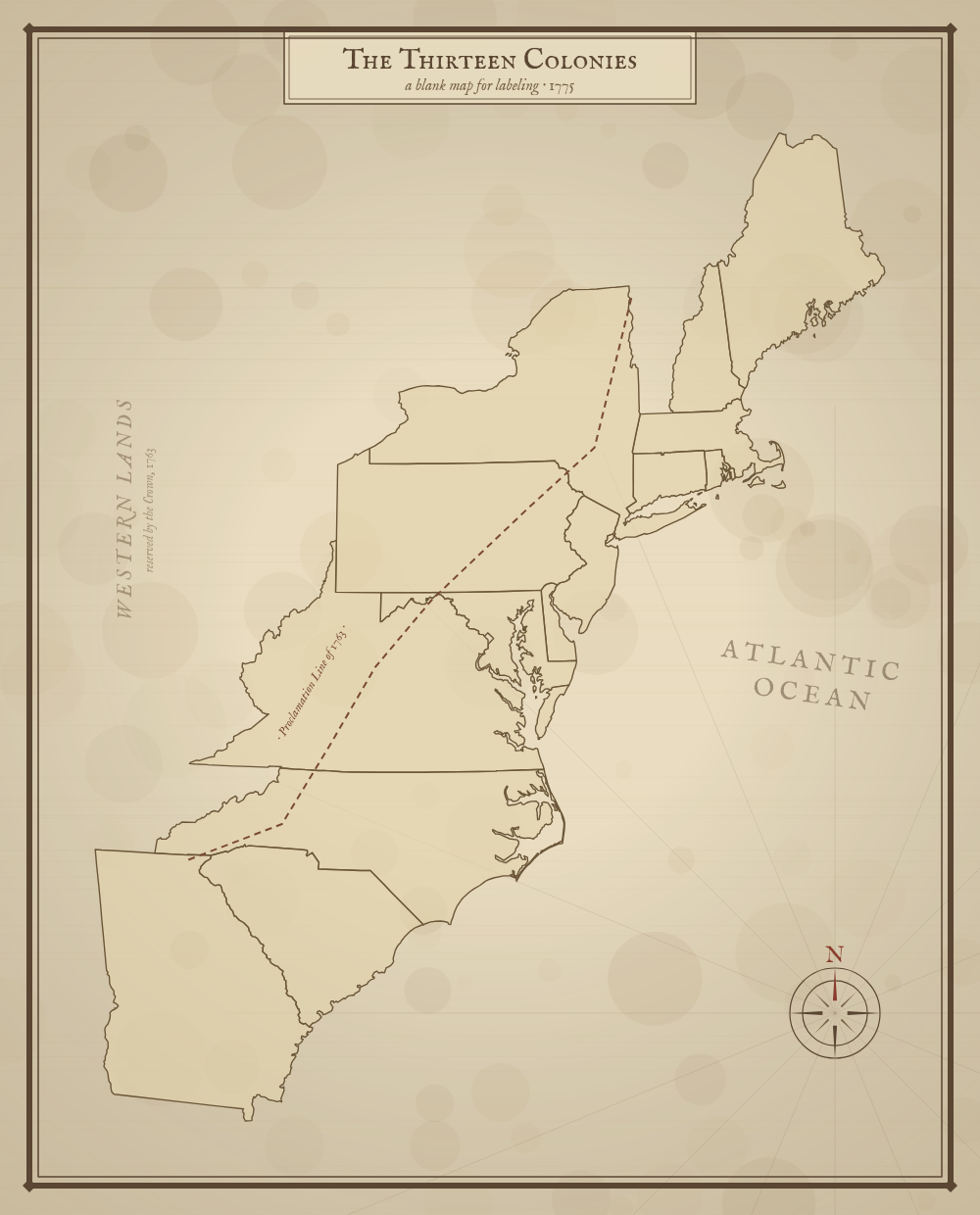
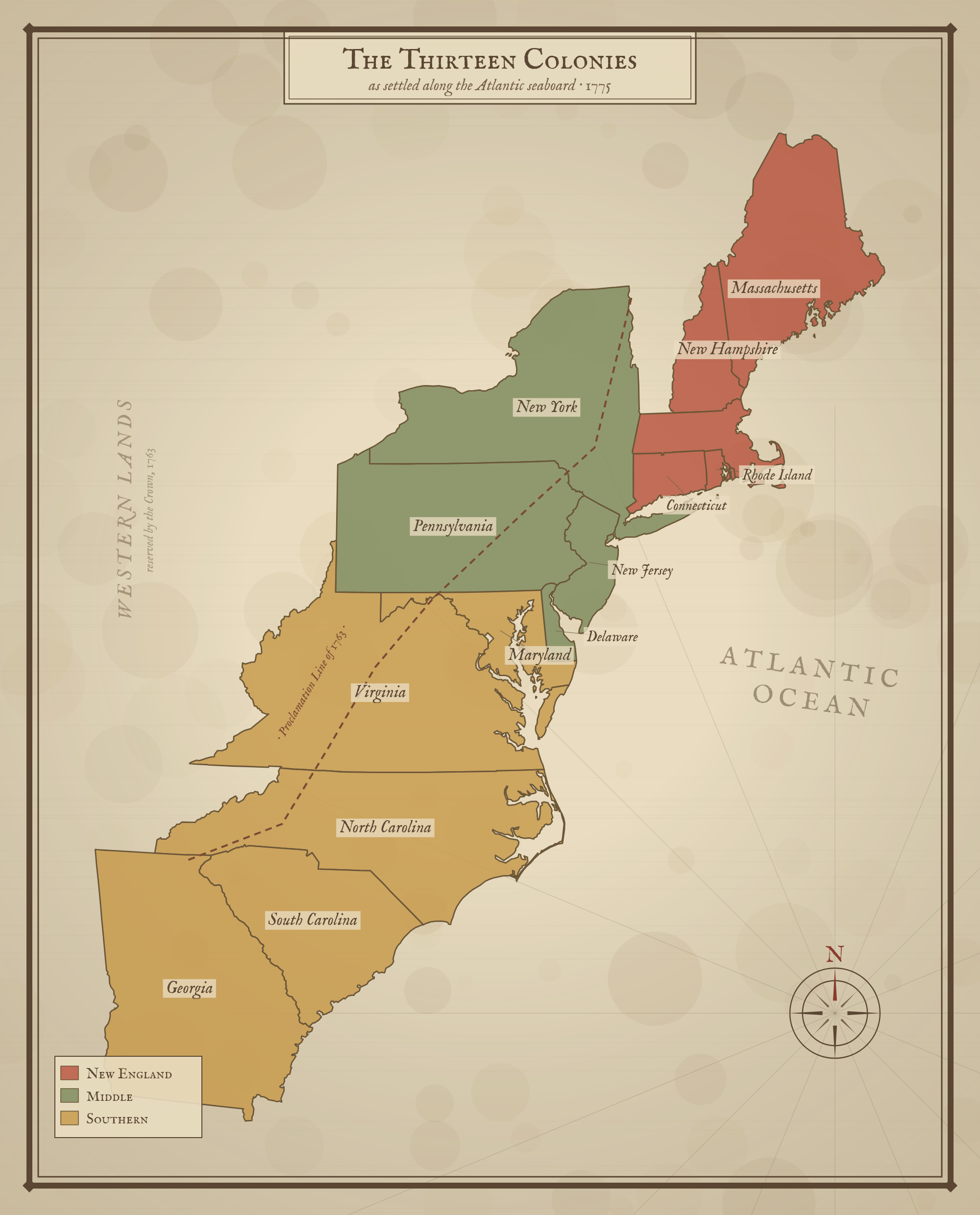
Free printable map of the 13 Colonies in a classic antique style, color-coded into the New England, Middle, and Southern regions. A historically framed classroom resource for US history lessons.
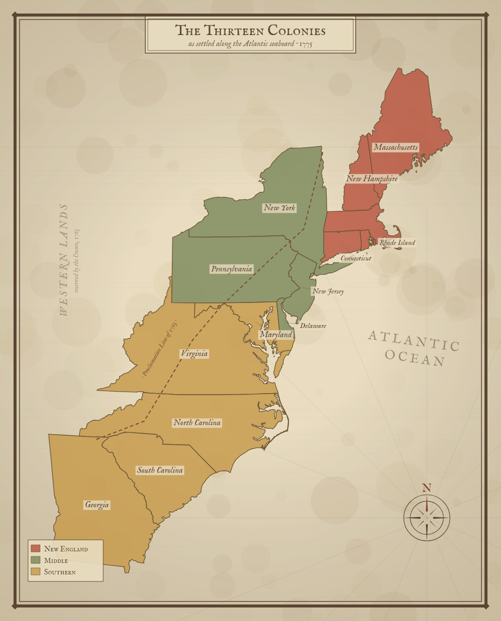
Massachusetts is shown with the District of Maine, and Virginia with present-day West Virginia, as they were in 1775. Vermont — then the disputed 'New Hampshire Grants' — was not yet one of the colonies.
About This US Map
Free printable map of the 13 Colonies in a classic antique style, color-coded into the New England, Middle, and Southern regions. A historically framed classroom resource for US history lessons.
The History Behind This Map
By 1775, Great Britain governed thirteen colonies along the Atlantic coast of North America. Historians group them into three regions that shared geography, economy, and ways of life: the New England Colonies (Massachusetts, New Hampshire, Connecticut, and Rhode Island), the Middle Colonies (New York, New Jersey, Pennsylvania, and Delaware), and the Southern Colonies (Maryland, Virginia, North Carolina, South Carolina, and Georgia).
New England relied on shipping, fishing, and small farms. The Middle Colonies grew grain and were the most religiously and ethnically diverse. The Southern Colonies built a plantation economy around tobacco, rice, and indigo — worked, in large part, by enslaved Africans.
To the west, the Proclamation Line of 1763 marked the limit of settlement set by King George III after the French and Indian War, reserving the land beyond the Appalachian Mountains for Native American nations. Colonists' resentment of that limit — and of British taxes — helped push the colonies toward revolution. They declared independence in 1776 and secured it by 1783.
How to Use
Print this map on standard US Letter paper (8.5" × 11"). Click "Download PDF" for a print-ready file that automatically fits your page in the right orientation, or "Download PNG" for the high-resolution image file.
Frequently Asked Questions
What were the 13 original colonies?
The 13 colonies were Massachusetts, New Hampshire, Rhode Island, Connecticut, New York, New Jersey, Pennsylvania, Delaware, Maryland, Virginia, North Carolina, South Carolina, and Georgia. They are usually grouped into the New England, Middle, and Southern colonies.
How are the colonies grouped on this map?
By region: New England (blue), Middle (green), and Southern (yellow). Grouping the colonies this way helps students remember their locations and compare the economies and geography of each region.
Why are modern state borders shown?
This printable places the colonies on today's state outlines so students can connect the history to the map they already know. Real colonial boundaries were less defined and changed over time.