Printable Scholar
United Kingdom Map with Cities
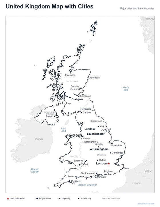
A free printable map of United Kingdom with its major cities: London, Birmingham, Manchester and 29 more. The capital is starred and its four countries are outlined. It comes labeled and blank.

Choose your version
Labeled or blank.
Both are free PDFs sized for US Letter paper.
Labeled
Cities named, the capital starred, neighboring countries in gray.
downloadLabeled PDF
Blank
The same outline and city dots with no names, for labeling practice.
downloadBlank PDFThe cities of United Kingdom
The United Kingdom is an island country off the northwest coast of Europe. It is made of four countries: England, Scotland, Wales and Northern Ireland. London, the capital and largest city, is in the southeast of England on the River Thames. Birmingham, Manchester, Liverpool and Leeds are in the middle and north of England. Edinburgh is the capital of Scotland and Glasgow its largest city. Cardiff is the capital of Wales, and Belfast is the capital of Northern Ireland, which shares a border with Ireland.
The 32 cities on the map
- Birmingham, Manchester, Leeds, Glasgow, Liverpool, London, Newcastle, Cardiff, Nottingham, Edinburgh, Belfast, Southampton, Swansea, Plymouth, Oxford, Norwich, Aberdeen, York, Dundee, Cambridge, Exeter, Carlisle, Inverness, Brighton, Leicester, Portsmouth, Hull, Chester, Scarborough, Ayr, Perth, Dover
Find it on the map
- London, the capital, in the southeast of England
- Edinburgh, Cardiff and Belfast, the capitals of Scotland, Wales and Northern Ireland
- Aberdeen and Inverness in the north of Scotland
Rockall and the British overseas territories are not shown. Boundaries and city locations are from Natural Earth. Dot sizes show roughly how large each city is.