Real cartographic data
West States Map
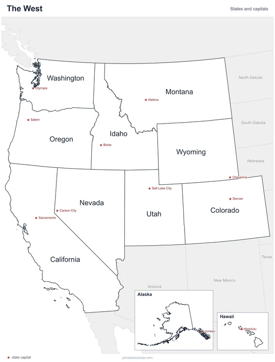
Free printable maps of the 11 states of the West. The labeled map names every state and its capital. The blank map shows the outlines and capital stars for students to fill in.

Choose your version
Labeled or blank.
Both are free PDFs sized for US Letter paper.
Labeled
Every state and capital named.
downloadLabeled PDF
Blank
State outlines and capital stars, with a name line, for quizzes.
downloadBlank PDFThe West states
The West is the largest region. It reaches from the Rocky Mountains to the Pacific Ocean and includes Alaska and Hawaii, which are shown in insets. The Rockies run through Montana, Idaho, Wyoming, Colorado and Utah. Closer to the coast are the Sierra Nevada and the Cascade Range. Between the mountain ranges lies the dry Great Basin, mostly in Nevada and Utah.
States and capitals
- Alaska: Juneau
- California: Sacramento
- Colorado: Denver
- Hawaii: Honolulu
- Idaho: Boise
- Montana: Helena
- Nevada: Carson City
- Oregon: Salem
- Utah: Salt Lake City
- Washington: Olympia
- Wyoming: Cheyenne
Find it on the map
- The straight-line borders of Wyoming and Colorado
- The long Pacific coast of California
- Alaska and Hawaii in the inset boxes