 Printable Scholar
Wyoming State Report Kit
Everything a student needs to research and write a report on Wyoming: the reading, the maps and the pages to fill in. Nothing else to look up.
- 3 reading pages: Wyoming fun facts, History, and Land and Work
- 5 maps: landmarks, cities, county, outline, and rivers and lakes
- An 8-page My State Report booklet, from fast facts to a trip plan and a license plate to design
- A pennant to cut out and hang, two map skills sheets and a 10-question reading quiz
- Answer keys for the quiz, the fast facts and the map sheets
- One print-ready PDF, 23 pages, black and white, US Letter
Teaching all 50 states? Get every kit for $39.
Look inside
Read it, map it, write it.
The reading pages and maps hold every answer the booklet asks for. About one third of the booklet is looking things up. The rest asks students to choose, plan and explain.

What is in the Wyoming kit
To read and study
- Wyoming fun facts: six short true stories, By the Numbers and Did You Know
- History: the state’s story in order, with a timeline, people to know and words to know
- Land and Work: the land and climate, what the state grows, makes and mines, and how one leads to the other
- Five maps, including a rivers, lakes and neighbors map with a letter key
To fill in and make
- My State Report booklet: cover, Fast Facts, My Map, State Symbols, My Trip, Think Like a Geographer, Design a License Plate and Dig Deeper
- A pennant with the state’s name and outline, to color, cut out and hang
- Name the Cities and Name the Rivers and Lakes sheets, each with a word bank
- A 10-question reading quiz, with answer keys for everything that has one right answer
Free: the Wyoming History reading page
One page on the history of Wyoming for grades 3 to 5, free to print in color or black and white. It is the second reading page in the kit.
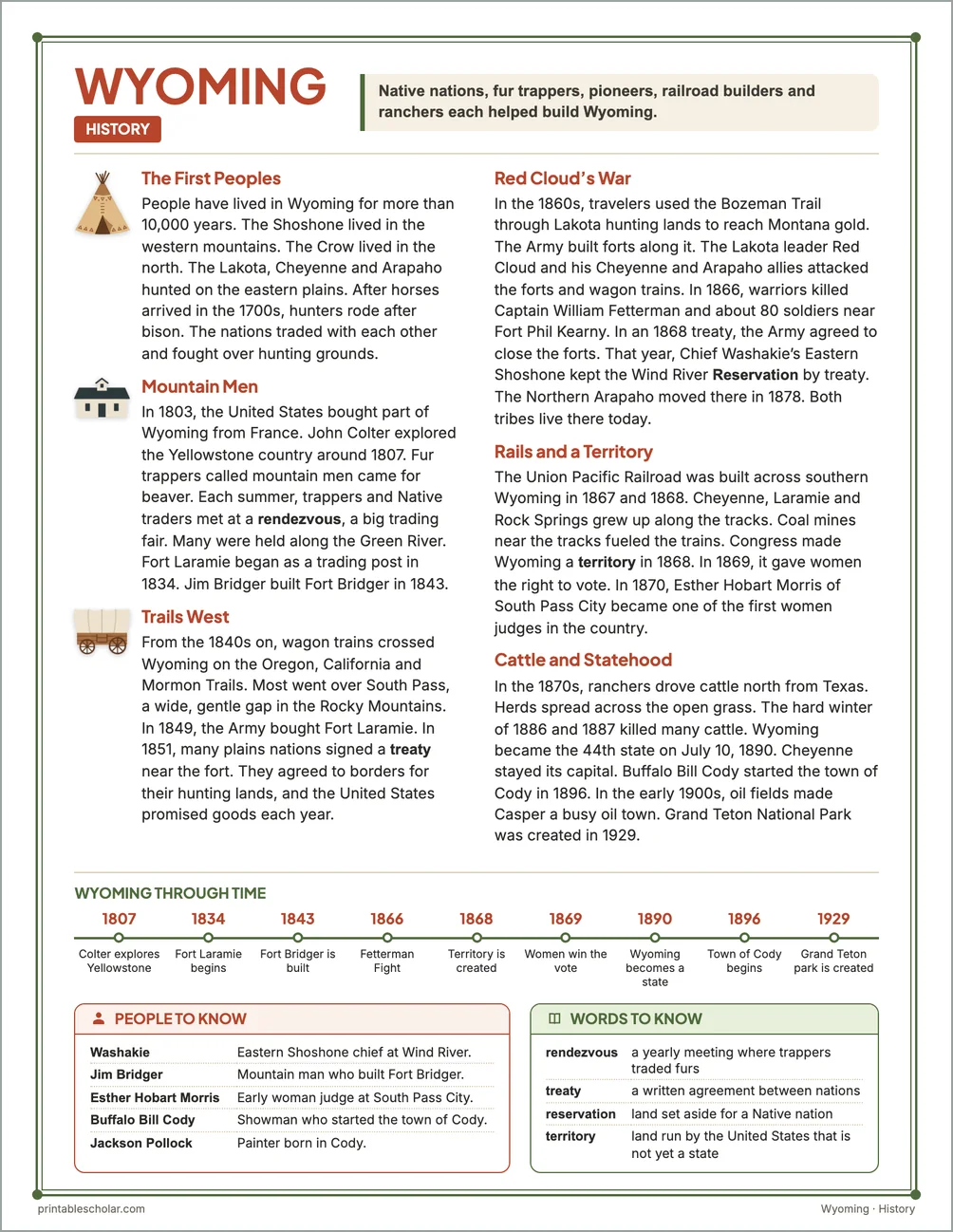
The First Peoples
People have lived in Wyoming for more than 10,000 years. The Shoshone lived in the western mountains. The Crow lived in the north. The Lakota, Cheyenne and Arapaho hunted on the eastern plains. After horses arrived in the 1700s, hunters rode after bison. The nations traded with each other and fought over hunting grounds.
Mountain Men
In 1803, the United States bought part of Wyoming from France. John Colter explored the Yellowstone country around 1807. Fur trappers called mountain men came for beaver. Each summer, trappers and Native traders met at a rendezvous, a big trading fair. Many were held along the Green River. Fort Laramie began as a trading post in 1834. Jim Bridger built Fort Bridger in 1843.
Trails West
From the 1840s on, wagon trains crossed Wyoming on the Oregon, California and Mormon Trails. Most went over South Pass, a wide, gentle gap in the Rocky Mountains. In 1849, the Army bought Fort Laramie. In 1851, many plains nations signed a treaty near the fort. They agreed to borders for their hunting lands, and the United States promised goods each year.
Red Cloud’s War
In the 1860s, travelers used the Bozeman Trail through Lakota hunting lands to reach Montana gold. The Army built forts along it. The Lakota leader Red Cloud and his Cheyenne and Arapaho allies attacked the forts and wagon trains. In 1866, warriors killed Captain William Fetterman and about 80 soldiers near Fort Phil Kearny. In an 1868 treaty, the Army agreed to close the forts. That year, Chief Washakie’s Eastern Shoshone kept the Wind River Reservation by treaty. The Northern Arapaho moved there in 1878. Both tribes live there today.
Rails and a Territory
The Union Pacific Railroad was built across southern Wyoming in 1867 and 1868. Cheyenne, Laramie and Rock Springs grew up along the tracks. Coal mines near the tracks fueled the trains. Congress made Wyoming a territory in 1868. In 1869, it gave women the right to vote. In 1870, Esther Hobart Morris of South Pass City became one of the first women judges in the country.
Cattle and Statehood
In the 1870s, ranchers drove cattle north from Texas. Herds spread across the open grass. The hard winter of 1886 and 1887 killed many cattle. Wyoming became the 44th state on July 10, 1890. Cheyenne stayed its capital. Buffalo Bill Cody started the town of Cody in 1896. In the early 1900s, oil fields made Casper a busy oil town. Grand Teton National Park was created in 1929.
Wyoming through time
- 1807 Colter explores Yellowstone
- 1834 Fort Laramie begins
- 1843 Fort Bridger is built
- 1866 Fetterman Fight
- 1868 Territory is created
- 1869 Women win the vote
- 1890 Wyoming becomes a state
- 1896 Town of Cody begins
- 1929 Grand Teton park is created
People to know
- Washakie: Eastern Shoshone chief at Wind River.
- Jim Bridger: Mountain man who built Fort Bridger.
- Esther Hobart Morris: Early woman judge at South Pass City.
- Buffalo Bill Cody: Showman who started the town of Cody.
- Jackson Pollock: Painter born in Cody.
Free Wyoming maps
Each of these maps is free to print on its own page. The kit puts them in one file with the reading pages and the booklet.