
Idaho State Report Kit
Everything a student needs to research and write a report on Idaho: the reading, the maps and the pages to fill in. Nothing else to look up.
- 3 reading pages: Idaho fun facts, History, and Land and Work
- 5 maps: landmarks, cities, county, outline, and rivers and lakes
- An 8-page My State Report booklet, from fast facts to a trip plan and a license plate to design
- A pennant to cut out and hang, two map skills sheets and a 10-question reading quiz
- Answer keys for the quiz, the fast facts and the map sheets
- One print-ready PDF, 23 pages, black and white, US Letter
Look inside
Read it, map it, write it.
The reading pages and maps hold every answer the booklet asks for. About one third of the booklet is looking things up. The rest asks students to choose, plan and explain.

What is in the Idaho kit
To read and study
- Idaho fun facts: six short true stories, By the Numbers and Did You Know
- History: the state’s story in order, with a timeline, people to know and words to know
- Land and Work: the land and climate, what the state grows, makes and mines, and how one leads to the other
- Five maps, including a rivers, lakes and neighbors map with a letter key
To fill in and make
- My State Report booklet: cover, Fast Facts, My Map, State Symbols, My Trip, Think Like a Geographer, Design a License Plate and Dig Deeper
- A pennant with the state’s name and outline, to color, cut out and hang
- Name the Cities and Name the Rivers and Lakes sheets, each with a word bank
- A 10-question reading quiz, with answer keys for everything that has one right answer
Free: the Idaho History reading page
One page on the history of Idaho for grades 3 to 5, free to print in color or black and white. It is the second reading page in the kit.
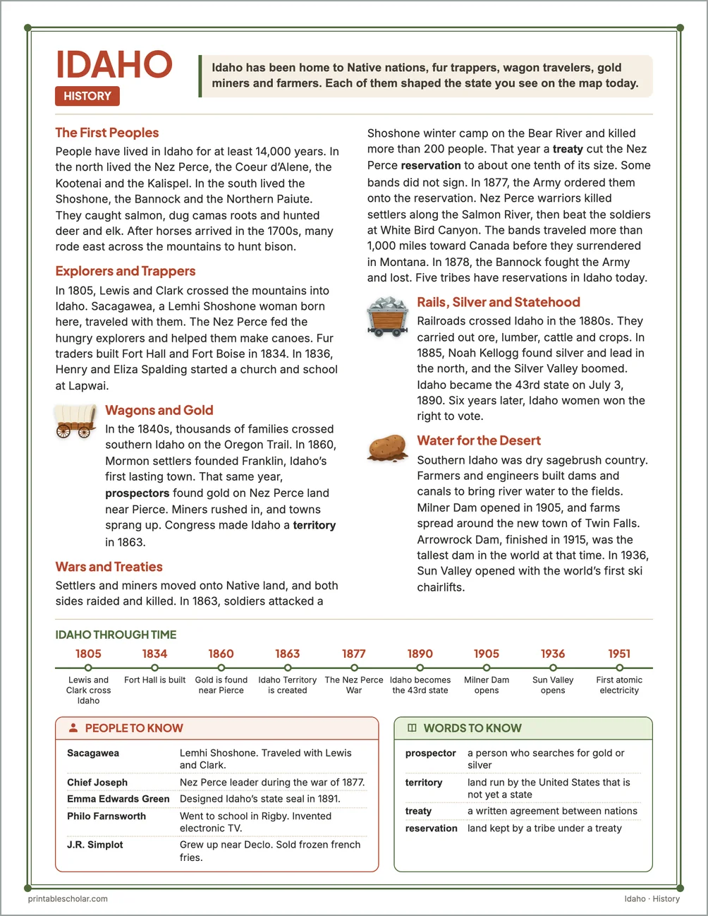
The First Peoples
People have lived in Idaho for at least 14,000 years. In the north lived the Nez Perce, the Coeur d’Alene, the Kootenai and the Kalispel. In the south lived the Shoshone, the Bannock and the Northern Paiute. They caught salmon, dug camas roots and hunted deer and elk. After horses arrived in the 1700s, many rode east across the mountains to hunt bison.
Explorers and Trappers
In 1805, Lewis and Clark crossed the mountains into Idaho. Sacagawea, a Lemhi Shoshone woman born here, traveled with them. The Nez Perce fed the hungry explorers and helped them make canoes. Fur traders built Fort Hall and Fort Boise in 1834. In 1836, Henry and Eliza Spalding started a church and school at Lapwai.
Wagons and Gold
In the 1840s, thousands of families crossed southern Idaho on the Oregon Trail. In 1860, Mormon settlers founded Franklin, Idaho’s first lasting town. That same year, prospectors found gold on Nez Perce land near Pierce. Miners rushed in, and towns sprang up. Congress made Idaho a territory in 1863.
Wars and Treaties
Settlers and miners moved onto Native land, and both sides raided and killed. In 1863, soldiers attacked a Shoshone winter camp on the Bear River and killed more than 200 people. That year a treaty cut the Nez Perce reservation to about one tenth of its size. Some bands did not sign. In 1877, the Army ordered them onto the reservation. Nez Perce warriors killed settlers along the Salmon River, then beat the soldiers at White Bird Canyon. The bands traveled more than 1,000 miles toward Canada before they surrendered in Montana. In 1878, the Bannock fought the Army and lost. Five tribes have reservations in Idaho today.
Rails, Silver and Statehood
Railroads crossed Idaho in the 1880s. They carried out ore, lumber, cattle and crops. In 1885, Noah Kellogg found silver and lead in the north, and the Silver Valley boomed. Idaho became the 43rd state on July 3, 1890. Six years later, Idaho women won the right to vote.
Water for the Desert
Southern Idaho was dry sagebrush country. Farmers and engineers built dams and canals to bring river water to the fields. Milner Dam opened in 1905, and farms spread around the new town of Twin Falls. Arrowrock Dam, finished in 1915, was the tallest dam in the world at that time. In 1936, Sun Valley opened with the world’s first ski chairlifts.
Idaho through time
- 1805 Lewis and Clark cross Idaho
- 1834 Fort Hall is built
- 1860 Gold is found near Pierce
- 1863 Idaho Territory is created
- 1877 The Nez Perce War
- 1890 Idaho becomes the 43rd state
- 1905 Milner Dam opens
- 1936 Sun Valley opens
- 1951 First atomic electricity
People to know
- Sacagawea: Lemhi Shoshone. Traveled with Lewis and Clark.
- Chief Joseph: Nez Perce leader during the war of 1877.
- Emma Edwards Green: Designed Idaho’s state seal in 1891.
- Philo Farnsworth: Went to school in Rigby. Invented electronic TV.
- J.R. Simplot: Grew up near Declo. Sold frozen french fries.
Free Idaho maps
Each of these maps is free to print on its own page. The kit puts them in one file with the reading pages and the booklet.