Ancient Egypt Map
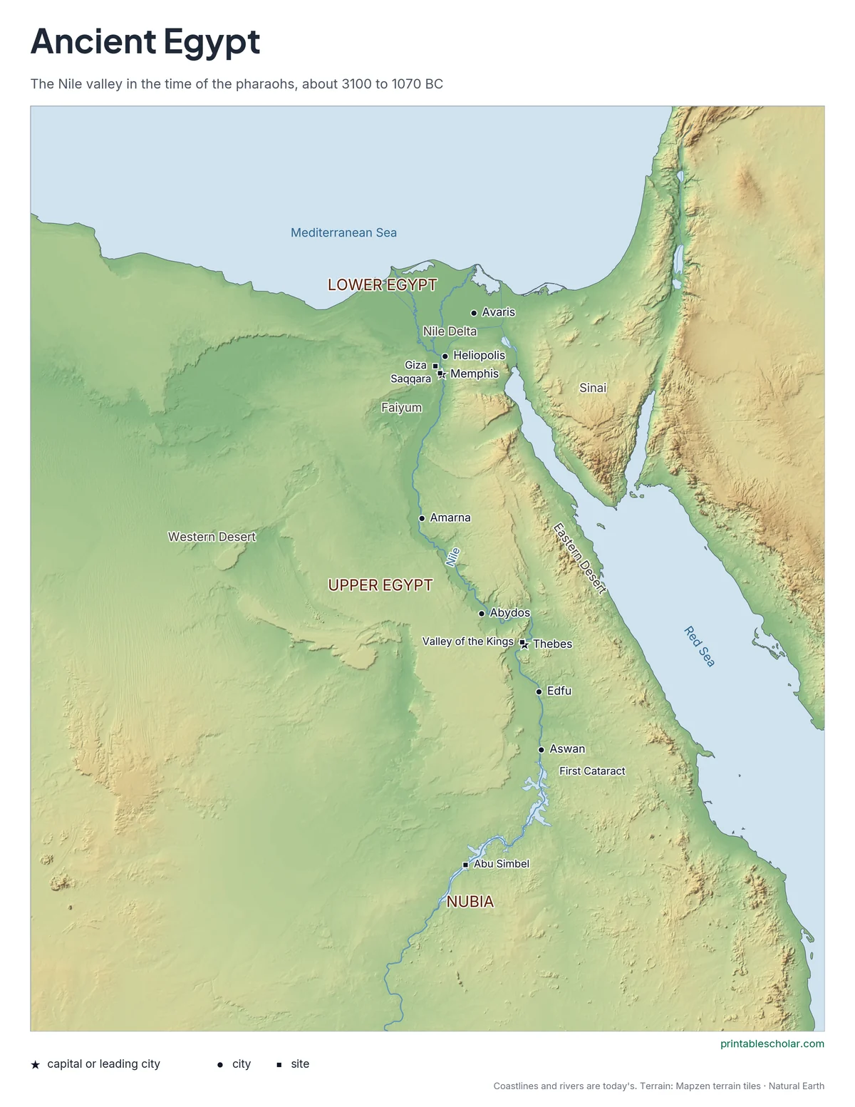
A free printable map of ancient Egypt drawn on real terrain, with the Nile, Upper and Lower Egypt, and the main cities and monuments of the pharaohs. It comes labeled and blank.
Choose your version
Labeled or blank.
Both are free PDFs sized for US Letter paper.

Labeled
Cities, regions, rivers and seas named.
downloadLabeled PDF
Blank
The same terrain and markers with no names, for labeling practice.
downloadBlank PDFThe geography of ancient Egypt
Ancient Egypt was a long, narrow country along the Nile River, with desert on both sides. The Nile flows north, so the southern part of the country, upstream, was called Upper Egypt, and the northern part, around the delta, was Lower Egypt. The two were united around 3100 BC. Each year the river flooded and left rich black soil on its banks, which made farming possible. Memphis, near the point where the valley meets the delta, was the first capital. Thebes, far to the south, became the capital later. South of the First Cataract, a stretch of rapids at Aswan, lay Nubia.
On the map
- Memphis: the first capital
- Thebes: later capital, near the Valley of the Kings
- Giza: the Great Pyramids
- Amarna: the capital built by Akhenaten
- Abu Simbel: temples of Ramses II
- Aswan: the First Cataract and the southern border
Find it on the map
- The green Nile Delta fanning out at the Mediterranean
- The thin strip of the Nile valley through the desert
- The Red Sea to the east
Coastlines and rivers are shown as they are today. The large lake in the south is the modern reservoir behind the Aswan High Dam; it did not exist in ancient times.