Printable Scholar
Early Human Migration Map
A free printable world map of how modern humans (Homo sapiens) spread out of Africa to the rest of the world, drawn on the land as it was during the last Ice Age, with the main routes, the dates scientists estimate for them and famous early human sites. It comes in color, in black and white, and blank.

Choose your version
Black and white, color or blank.
All three are free PDFs sized for US Letter paper.

Black and white
Everything named on a plain map, each route in its own line pattern and the ice sheets hatched. No color ink needed.
downloadBlack and white PDF
Color
Each route in its own color and numbered, with its date, the Ice Age land and ice sheets, early human sites and early farming centers named.
downloadColor PDF
Blank
The numbered routes and markers with no names, and lines to write where each route went.
downloadBlank PDF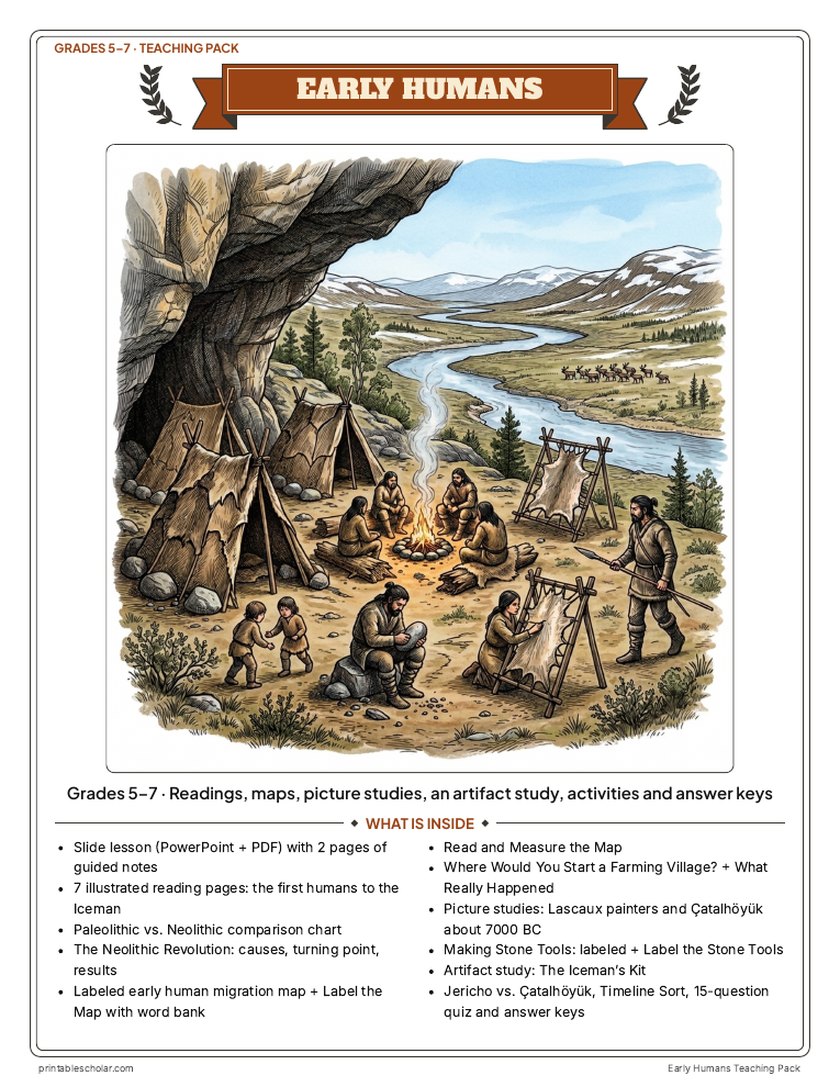
Teaching pack · Grades 5–7
Teaching Early Humans? The whole unit, ready to teach.
Two weeks of lessons in one download: slides to present, notes for students to fill in, and printable pages that use these maps and pictures.
Every slide comes with teacher notes: what to say, what to ask, and sample answers.
- 49 lesson slides (PowerPoint you can edit) and 2 pages of guided notes
- 7 illustrated reading pages: the first humans, out of Africa, life in the Old Stone Age, cave art and beliefs, the first farmers, early villages, and Ötzi the Iceman, plus a Paleolithic vs. Neolithic chart
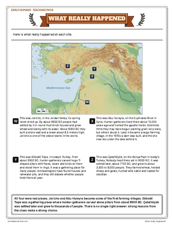
- Maps: a labeled early human migration map with Ice Age coastlines, a blank map with word bank, Read and Measure the Map, and Where Would You Start a Farming Village? with What Really Happened
- Activities: picture studies of the Lascaux painters and Çatalhöyük, Making Stone Tools (labeled and blank), the Neolithic Revolution (causes and results), an artifact study of the Iceman's kit, Jericho vs. Çatalhöyük, and a timeline sort in years ago and BC
- A 15-question quiz, a teacher guide with a two-week plan, and answer keys for everything
Every answer is in the pack. The readings, slides, maps and pictures teach everything the sheets and quiz ask, so no textbook is needed.
Get the Early Humans pack for $7Teaching more than one? Get all seven ancient history packs (Early Humans, Egypt, Mesopotamia, Greece, Rome, China and India) for $34: about fourteen weeks of lessons.
Get all 7 packs for $34See all seven packsOr get every history pack (23) in one download:Get all 23 for $49
One-time purchase. Instant download. Color and ink-saving black-and-white editions. Secure checkout by Stripe.


How modern humans spread around the world
Modern humans, Homo sapiens, first lived in Africa; some of the oldest known fossils come from Jebel Irhoud in Morocco and Omo Kibish in Ethiopia. Scientists estimate that groups of people left Africa between about 70,000 and 50,000 years ago. The map shows one widely used route, across the narrow Bab el-Mandeb strait at the south end of the Red Sea and along the coasts of Arabia, Iran and India to Southeast Asia, and a second possible route through the Sinai; scientists still debate which way people went, and there may have been several departures. By about 50,000 years ago people had crossed the sea by boat to Australia. About 45,000 years ago people reached Europe, and soon after China and Siberia. People crossed into the Americas over Beringia, the dry land that then joined Asia and North America, by about 20,000 years ago or earlier, and reached Monte Verde in southern Chile about 14,500 years ago. All of these dates are estimates from fossils, tools, footprints and DNA, and new finds keep changing them. The coastlines look different from today because so much water was frozen in the great ice sheets that the sea was about 120 meters (400 feet) lower, so land bridges and wide coastal plains stood where there is sea today. Much later, after the Ice Age ended, people in several parts of the world began farming, starting in the Fertile Crescent more than 11,000 years ago; the wheat symbols mark these early farming centers.
Places on the map
- Jebel Irhoud (Morocco) and Omo Kibish (Ethiopia): some of the oldest known fossils of modern humans
- Hadar (Lucy) and Olduvai Gorge and Laetoli: much older fossils and footprints of earlier human relatives in East Africa
- Blombos Cave (South Africa): early carved ochre and shell beads
- Lake Mungo (Australia): some of the oldest human remains in Australia
- Tianyuan Cave (China): an early modern human from East Asia
- Lascaux (France): famous Ice Age cave paintings
- White Sands (New Mexico): human footprints from the Ice Age
- Monte Verde (Chile): a camp in South America about 14,500 years ago
Find it on the map
- Beringia, the land bridge between Siberia and Alaska
- Sunda and Sahul, where Southeast Asia and Australia reached much farther into the sea than today
- The Bab el-Mandeb strait at the south end of the Red Sea
- The ice sheets over northern North America and northern Europe
The land is shown as it was about 20,000 years ago, at the coldest part of the last Ice Age, worked out from today’s ground and sea floor (land then is everything above 120 meters below today’s sea level); today’s coastline is the thin line. Ice sheets are drawn after published reconstructions (Dalton et al. 2020, Hughes et al. 2016) and kept simple. Routes and dates are approximate: they are scientists’ estimates and are still debated.
Frequently asked questions
When did modern humans leave Africa?
Scientists estimate that the groups whose descendants spread around the world left Africa between about 70,000 and 50,000 years ago. Some earlier groups left too, and there may have been more than one departure. The dates come from fossils, stone tools and DNA, and they are still debated.
How did people reach Australia?
By boat. Even when the sea was lowest, deep water always separated Southeast Asia from Australia and New Guinea, so people had to cross open sea from island to island. They had reached Australia by about 50,000 years ago; Lake Mungo is one of the oldest sites there.
How did people reach the Americas?
During the Ice Age, Siberia and Alaska were joined by dry land called Beringia. Scientists think people crossed it and then moved south along the Pacific coast, partly by boat, outside the great ice sheets. Footprints at White Sands in New Mexico suggest people were in North America by about 20,000 years ago or earlier, and Monte Verde in Chile was lived in about 14,500 years ago.
Why was the sea lower during the Ice Age?
So much water was frozen into huge ice sheets on the land that the sea was about 120 meters (400 feet) lower than today about 20,000 years ago. Shallow sea floor became dry land, joining Asia to North America, Britain to Europe and New Guinea to Australia. When the ice melted, the sea rose and covered these lands again.