Southeast Asia Map
Free printable maps of Southeast Asia: a labeled map of its 11 countries, a blank outline map, and a physical map in labeled and blank versions.
Southeast Asia is the 11 countries between India, China and Australia.

Choose your version
Four maps of Southeast Asia.
All free PDFs sized for US Letter paper.

Labeled
Every country named. Small countries are numbered with a key.
downloadLabeled PDF
Blank
Country outlines only, with a name line, for quizzes and coloring.
downloadBlank PDF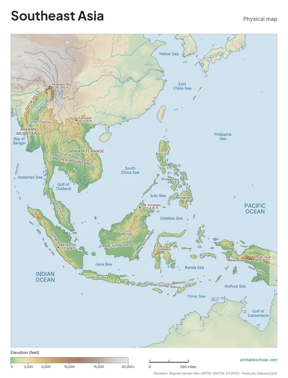
Physical
Shaded relief with mountains, deserts, rivers and peaks named.
downloadPhysical PDF
Physical, blank
The same terrain with no names, for labeling practice.
downloadBlank physical PDFThe geography of Southeast Asia
Southeast Asia has two parts. The mainland is a peninsula of mountain ranges and river valleys running south from China, with the long, narrow Malay Peninsula at its tip. The Mekong, Irrawaddy and Chao Phraya rivers flow through fertile lowlands to the sea. The rest of the region is islands, more than 20,000 of them, in Indonesia, the Philippines, Malaysia, Brunei and Timor-Leste. Many are volcanic, and Borneo, Sumatra and New Guinea are among the largest islands in the world.
Countries on this map
- Brunei
- Cambodia
- Indonesia
- Laos
- Malaysia
- Myanmar
- Philippines
- Singapore
- Thailand
- Timor-Leste
- Vietnam
Major rivers
- Mekong
- Irrawaddy
- Chao Phraya
- Salween
- Red
Find it on the map
- The Malay Peninsula reaching south from the mainland
- Borneo, the large island in the center
- The Philippines in the northeast
Built from real data, not stock images.
Country borders, coastlines, rivers and feature names come from Natural Earth. The terrain on the physical maps is drawn from a global elevation model built from NASA SRTM and other public surveys.
Read full methodology arrow_forward