 Printable Scholar
Crusades Map
A free printable map of the Crusades drawn on real terrain, showing the crusader states at their greatest extent, about 1140, and the routes of the First Crusade, the Third Crusade by land and by sea, and the Fourth Crusade. It comes in color, black and white, and blank.

Choose your version
Black and white, color or blank.
All three are free PDFs sized for US Letter paper.

Black and white
Everything named on a plain outline map with no terrain. No color ink needed.
downloadBlack and white PDF
Color
The crusader states, the routes, cities and battles named, on shaded relief.
downloadColor PDF
Blank
The black-and-white map with its routes and markers but no names, for labeling practice.
downloadBlank PDF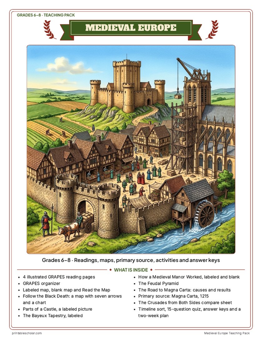
Teaching pack · Grades 6–8
Teaching Medieval Europe? The whole unit, ready to teach.
Two weeks of lessons in one download: slides to present, notes for students to fill in, and printable pages that use these maps and pictures.
Every slide comes with teacher notes: what to say, what to ask, and sample answers.
- 47 lesson slides (PowerPoint you can edit) and 2 pages of guided notes
- 4 illustrated reading pages and a GRAPES organizer
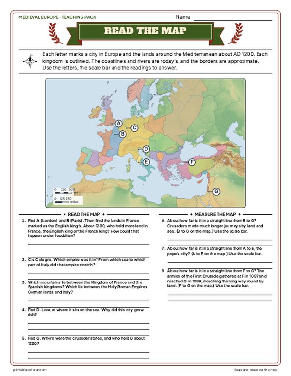
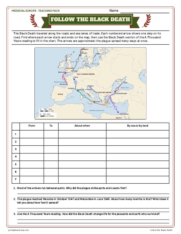
- Maps: Europe about 1200 labeled and blank, Read and Measure the Map, and "Follow the Black Death": trace the plague from Caffa to Bergen on a real map and fill in the chart
- Activities: Parts of a Castle (labeled), the real Bayeux Tapestry, how a medieval manor worked (labeled and blank), the feudal pyramid, the road to Magna Carta, Magna Carta as a primary source, the Crusades from both sides, and a timeline sort
- A 15-question quiz, a teacher guide with a two-week plan, and answer keys for everything
Every answer is in the pack. The readings, slides, maps and pictures teach everything the sheets and quiz ask, so no textbook is needed.
Get the Medieval Europe pack for $7Teaching more than one? Get all six medieval world packs (West Africa, the Silk Road, the Byzantines, Medieval Europe, Feudal Japan and the Ottomans) for $29, with a bonus chart comparing all six: about twelve weeks of lessons.
Get all 6 packs for $29See all six packsOr get every history pack (24) in one download:Get all 24 for $49
One-time purchase. Instant download. Color and ink-saving black-and-white editions. Secure checkout by Stripe.
The 10-day plan
10 lessons, each planned for one class period of about 45 to 50 minutes, straight from the teacher guide. Some days are fuller than others; the note below shows how to even them out.
- Day 1Lands, kingdoms and the medieval Europe map
- Day 2The manor, towns and guilds
- Day 3Feudal society and an oath of fealty
- Day 4Parts of a castle and a guild masterpiece
- Day 5Religion, achievements and a flying buttress
- Day 6Magna Carta: its causes, its text, a class charter
- Day 7After Rome and the Bayeux Tapestry
- Day 8The Crusades from both sides
- Day 9The Black Death and the end of the Middle Ages
- Day 10Review and the 15-question quiz
Fitting it to your schedule: Days 1, 2 and 6 are the fullest and Days 4 and 8 the lightest. With 10 periods, move Read and Measure the Map from Day 1 to Day 4. With 8 periods, do the castle picture study on Day 3 in place of the oath of fealty and skip the guild masterpiece; then read the Crusades section at the end of Day 7 in place of the tapestry strip and give The Crusades from Both Sides compare sheet as homework.
See the full day-by-day plan
- Day 1
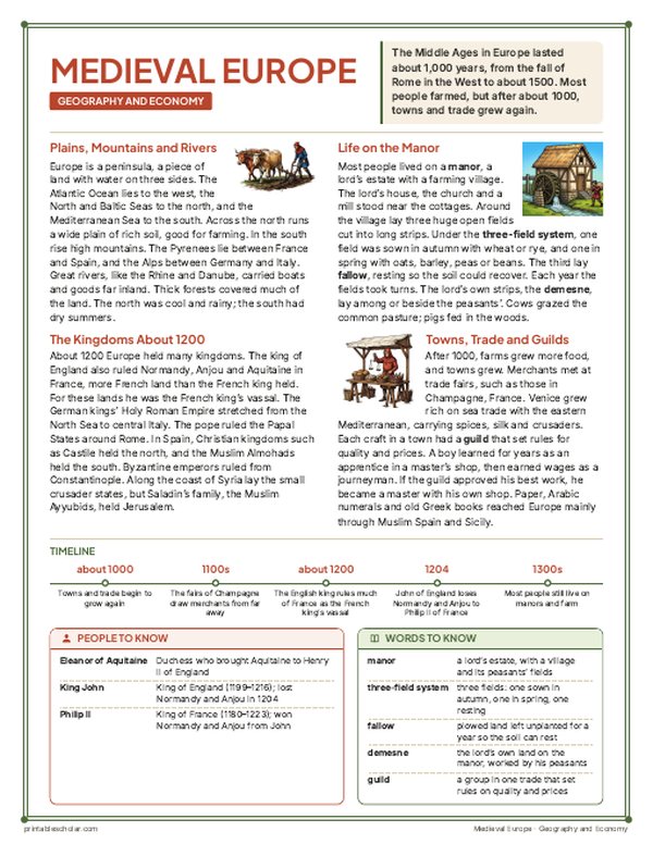
- Geography slides (1 to 9), with guided notes page 1. Reading 1: Geography and Economy, the first two sections (lands and kingdoms). Labeled map with its What happened strip; blank map with the word bank; Read and Measure the Map, with the three distances.
- Day 2
- Reading 1, the economy sections (the manor; towns, trade and guilds). How a Medieval Manor Worked (labeled), then Label the Medieval Manor with its questions. Rotate the fields. Fill the G and E boxes of the GRAPES organizer.
- Day 3
- Politics and society slides (10 to 17), guided notes page 1 continued. Reading 3: Politics and Social Structure. The Feudal Pyramid. An oath of fealty. Fill the P and S boxes.
- Day 4
- Picture study: Parts of a Castle (labeled), with its Look closely questions. Guild masterpiece.
- Day 5
- Religion and achievements slides (18 to 24), with guided notes page 2. Reading 2: Religion and Achievements. Fill the R and A boxes. Build a flying buttress.
- Day 6
- The Road to Magna Carta (causes and results). Magna Carta slides (25 to 29), then the primary source: Magna Carta, 1215, read aloud with the plain-English column and the hard words, and the document questions. A class charter.
- Day 7
- Slides 30 to 33 (Charlemagne, the Norman Conquest and the Bayeux Tapestry), guided notes page 2 continued. Reading 4: A Thousand Years, the first section (After Rome). Picture study: The Bayeux Tapestry. Tapestry strip.
- Day 8
- Crusades slides (34 to 38). Reading 4, the Crusades section, its People to Know and Timeline. The Crusades from Both Sides compare sheet.
- Day 9
- Black Death slides (39 to 44). Reading 4, the Black Death section: Follow the Black Death (fill the chart from the map and the reading, then the questions). Then the last section, The End of the Middle Ages.
- Day 10
- The Who am I? riddle and the exit question (slides 45 to 47). Timeline sort with the Reading the years box, check the GRAPES organizer, then the 15-question quiz.
The Crusades
The Crusades were a series of wars from 1096 to 1291 in which armies from Western Europe set out to take and hold Jerusalem and the lands around it, which Christians called the Holy Land. In 1095 Pope Urban II called for the First Crusade at a church council in Clermont, France, answering a call for help from the Byzantine emperor, whose lands were under attack by the Seljuk Turks. Armies of knights and ordinary people marched across Europe to Constantinople, crossed into Anatolia, won battles at Nicaea and Dorylaeum, besieged Antioch, and captured Jerusalem in 1099. They set up four crusader states along the coast: the County of Edessa, the Principality of Antioch, the County of Tripoli and the Kingdom of Jerusalem. Edessa fell in 1144. In 1187 the sultan Saladin defeated the crusaders at the Battle of Hattin and took Jerusalem. In the Third Crusade, Richard I of England sailed to the Holy Land and won back Acre and the coast, while the Holy Roman Emperor Frederick I marched overland and drowned in a river in Anatolia. The Fourth Crusade never reached the Holy Land: its army, in debt to Venice, attacked Zara and then captured Constantinople in 1204. The last crusader city, Acre, fell in 1291.
On the map
- Clermont, 1095: where Pope Urban II called for the First Crusade
- Constantinople: capital of the Byzantine Empire, captured in the Fourth Crusade, 1204
- Nicaea and Dorylaeum, 1097: early battles of the First Crusade
- The four crusader states: Edessa, Antioch, Tripoli and Jerusalem
- Hattin, 1187: where Saladin defeated the crusaders
- Acre: the main crusader port, captured in the Third Crusade and the last city lost, in 1291
Find it on the map
- The First Crusade marching overland across Europe and Anatolia
- Richard I’s ships sailing past Sicily and Crete to Acre
- The Fourth Crusade turning toward Constantinople instead of the Holy Land
The crusader state borders are approximate. Routes are drawn through the main towns and ports each army passed and are approximate. Coastlines and rivers are shown as they are today.
Frequently asked questions
What were the Crusades?
A series of wars between 1096 and 1291 in which armies from Western Europe tried to take and hold Jerusalem and the lands around it. They also included campaigns elsewhere, such as the Fourth Crusade, which captured Constantinople in 1204.
What were the crusader states?
Four lands set up by the First Crusade along the eastern Mediterranean: the County of Edessa, the Principality of Antioch, the County of Tripoli and the Kingdom of Jerusalem. They were at their largest about 1140, before Edessa fell in 1144.
How many Crusades were there?
Historians usually number nine major Crusades to the Holy Land between 1096 and 1272, plus many smaller ones. The First, Third and Fourth are the most often taught, and their routes are on this map.
Who won the Crusades?
The First Crusade captured Jerusalem in 1099, but the crusaders lost it to Saladin in 1187 and never held it for long again. Acre, their last city in the Holy Land, fell to the Mamluks of Egypt in 1291.
How do students use the blank map?
The blank map keeps the routes, the crusader states and the city and battle markers with no names. Students label the cities, battles and crusader states and match each route to its Crusade. The labeled map is the answer key.