 Printable Scholar
New England, Middle and Southern Colonies: The 13 Colonies Regions
The 13 colonies are taught in three regions. New England (Massachusetts, New Hampshire, Rhode Island and Connecticut) was in the north, the Middle Colonies (New York, New Jersey, Pennsylvania and Delaware) in the middle, and the Southern Colonies (Maryland, Virginia, North Carolina, South Carolina and Georgia) in the south. Land and climate shaped how people lived in each one.
Free to print
A map of the three regions, and a chart to compare them
PDFs sized for US Letter paper, in color and black and white.
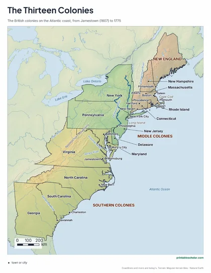
Map of the 13 colonies by region
New England, the Middle Colonies and the Southern Colonies on a relief map, with the main towns, rivers and mountains named.
Download PDF Black and white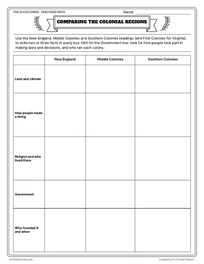
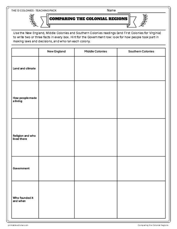
Comparing the Colonial Regions
A blank chart: land and climate, making a living, religion and who lived there, government, and who founded each region. The filled-in chart is below.
Download PDF Black and white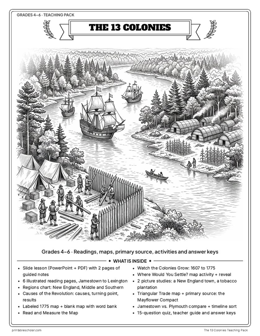
Teaching pack · Grades 4–6
Teaching the 13 Colonies? The whole unit, ready to teach.
Two weeks of lessons in one download: slides to present, notes for students to fill in, and printable pages that use these maps and pictures.
- 27 lesson slides (PowerPoint you can edit, teacher notes on every slide) and 2 pages of guided notes
- 6 illustrated reading pages, from Jamestown to Lexington and Concord, with the Comparing the Colonial Regions chart and a Causes of the Revolution sheet
- Maps: the colonies in 1775, a blank map, Read and Measure the Map, Watch the Colonies Grow (1607 to 1775), and Where Would You Settle? with the reveal
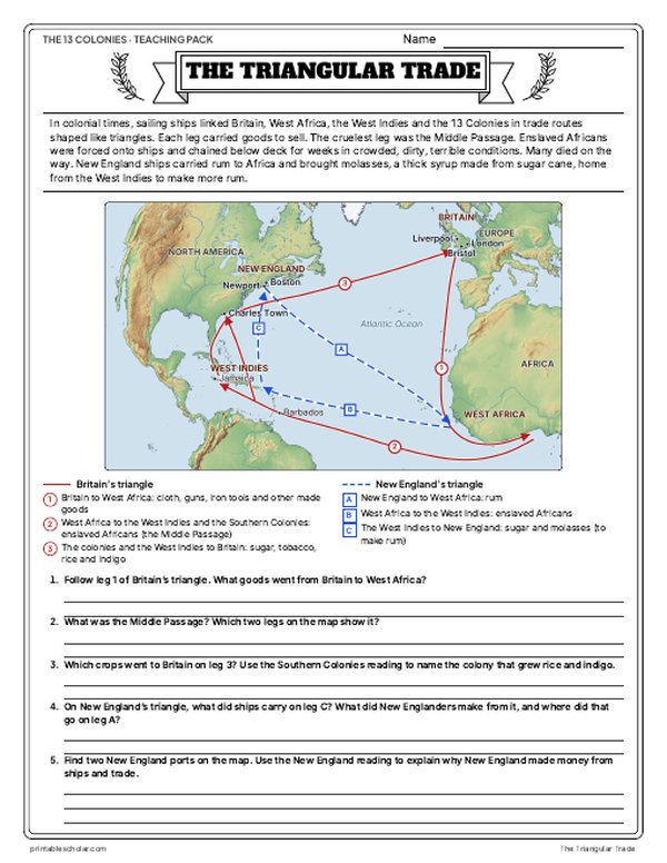
- Activities: two picture studies, the Triangular Trade map, the Mayflower Compact as a primary source, Jamestown vs. Plymouth and a timeline sort
- A 15-question quiz, a teacher guide with a two-week plan, and answer keys for everything
Every answer is in the pack. The readings, slides, maps and pictures teach everything the sheets and quiz ask, so no textbook is needed.
Get the 13 Colonies pack for $7One-time purchase. Instant download. Color and ink-saving black-and-white editions. Secure checkout by Stripe.
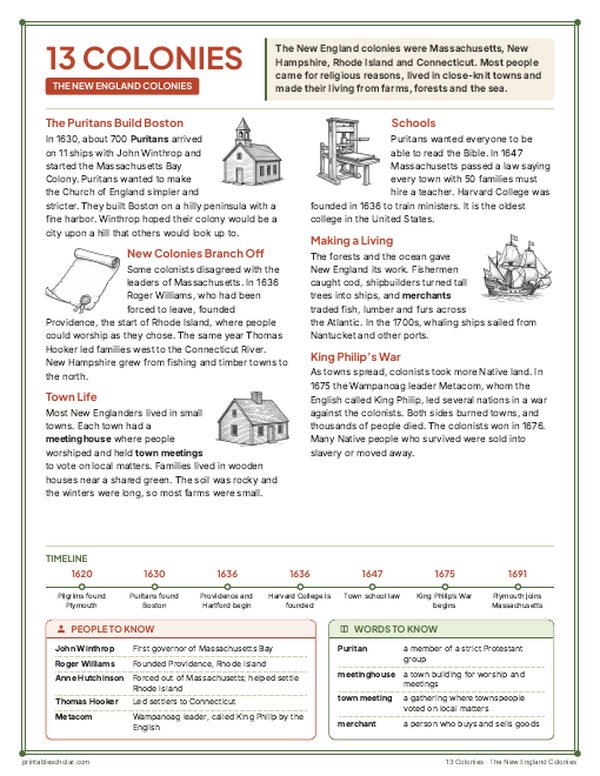
The three regions of the 13 colonies
New England
Massachusetts, New Hampshire, Rhode Island and Connecticut. The soil was rocky and the winters were long, so farms were small. Most people came for religious reasons, among them the Pilgrims at Plymouth (1620) and the Puritans who built Boston (1630), and they lived in close-knit towns. Each town held town meetings in its meetinghouse to vote on local matters. The forests and the sea gave New England its work: fishing for cod, building ships, and trading fish, lumber and furs across the Atlantic.
The Middle Colonies
New York, New Jersey, Pennsylvania and Delaware. Good soil and longer summers than New England let farmers grow so much wheat, corn and oats that these were called the breadbasket colonies. Mills ground the grain into flour, and ships carried it from New York and Philadelphia to other colonies and the West Indies. The Dutch ran New Netherland until the English took it in 1664 and renamed it New York. William Penn, a Quaker, founded Pennsylvania in 1681 and welcomed people of every faith. Dutch, English, Swedish, German and Scots-Irish immigrants all settled in the region.
The Southern Colonies
Maryland, Virginia, North Carolina, South Carolina and Georgia. Warm weather, long growing seasons and rich soil suited big farms called plantations, spread out along rivers that ships could sail up. They grew tobacco in Virginia and Maryland, and rice and indigo in South Carolina. Much of the work was done by enslaved Africans: by 1750, about two of every five people in the Southern Colonies were enslaved. Virginia’s House of Burgesses (1619) was the first elected assembly in English America.
Why the regions were different
Land and climate came first. Rocky soil and a coast with fine harbors turned New Englanders to the sea, rich farmland made the Middle Colonies a breadbasket, and the South’s long growing seasons made plantation crops pay. The chart puts the three regions side by side, row by row.
Comparing the colonial regions: the chart filled in
The answer key for the chart above, two or three facts in every box.
| New England | Middle Colonies | Southern Colonies | |
|---|---|---|---|
| Land and climate | Rocky soil and long winters, so farms were small; thick forests; a coast with fine harbors like Boston’s. | Good soil and longer summers than New England; wide rivers such as the Hudson. | Warm weather, long growing seasons and rich soil; big rivers that ships could sail up. |
| How people made a living | Fishing for cod, building ships from tall trees, trading fish, lumber and furs as merchants; whaling in the 1700s; small farms. | Growing wheat, corn and oats (the breadbasket colonies); mills ground flour; ships carried flour from New York and Philadelphia to other colonies and the West Indies. | Plantations grew tobacco to sell (Virginia, Maryland), rice and indigo (South Carolina); pine forests gave tar and pitch (North Carolina); on plantations, most of the work was done by enslaved Africans. |
| Religion and who lived there | Puritans who wanted a simpler, stricter church; Pilgrims at Plymouth; Rhode Island let people worship as they chose; people lived in close-knit towns. | Many peoples: Dutch, English, Swedish, German and Scots-Irish immigrants; Quakers, Lutherans, Catholics and Jews; enslaved Africans, especially in New York. | Virginia’s official church was the Church of England (Anglican); Maryland was a place for Catholics (Toleration Act, 1649); wealthy planters, many small farmers, indentured servants and enslaved Africans (about 2 of every 5 people by 1750). |
| Government | Town meetings in the meetinghouse, where townspeople voted on local matters; the Mayflower Compact (1620), signed by the men on the Mayflower. | New Netherland had a Dutch governor (Peter Stuyvesant) until the English took over in 1664; William Penn’s Pennsylvania had an elected assembly that made its laws (Charter of Privileges, 1701); Delaware got its own assembly in 1704. | Virginia’s House of Burgesses (1619), the first elected assembly in English America; Williamsburg was Virginia’s capital after 1699. |
| Who founded it and when | Pilgrims, Plymouth 1620; John Winthrop and the Puritans, Boston 1630; Roger Williams, Providence 1636; Thomas Hooker, Connecticut 1636. | The Dutch, New Netherland (New Amsterdam 1625); the English, New York 1664; William Penn, Pennsylvania 1681 (Philadelphia 1682); Swedes, New Sweden 1638 (later Delaware); New Jersey from New Netherland, 1664. | Virginia Company, Jamestown 1607; Lord Baltimore, Maryland 1634; eight English lords, Carolina 1663 (Charles Town 1670); James Oglethorpe, Georgia 1732 (Savannah 1733). |
Frequently asked questions
What were the three regions of the 13 colonies?
New England (Massachusetts, New Hampshire, Rhode Island and Connecticut), the Middle Colonies (New York, New Jersey, Pennsylvania and Delaware) and the Southern Colonies (Maryland, Virginia, North Carolina, South Carolina and Georgia).
Why were the Middle Colonies called the breadbasket colonies?
Farmers there grew so much wheat, corn and oats. Mills ground the grain into flour, and ships carried it from New York and Philadelphia to other colonies and the West Indies.
How did people in the New England colonies make a living?
From the forests and the sea: fishing for cod, building ships from tall trees, and trading fish, lumber and furs as merchants. Whaling grew in the 1700s. Farms were small because the soil was rocky.
What crops did the Southern Colonies grow?
Tobacco in Virginia and Maryland, and rice and indigo in South Carolina. North Carolina’s pine forests gave tar and pitch for ships.
Which was the last of the 13 colonies?
Georgia. It got its charter in 1732, and James Oglethorpe and about 114 colonists founded Savannah in 1733.