Printable Scholar
US Mountain Ranges Map
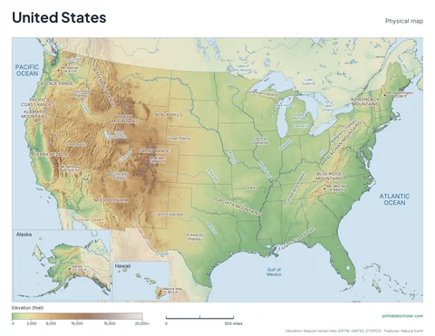
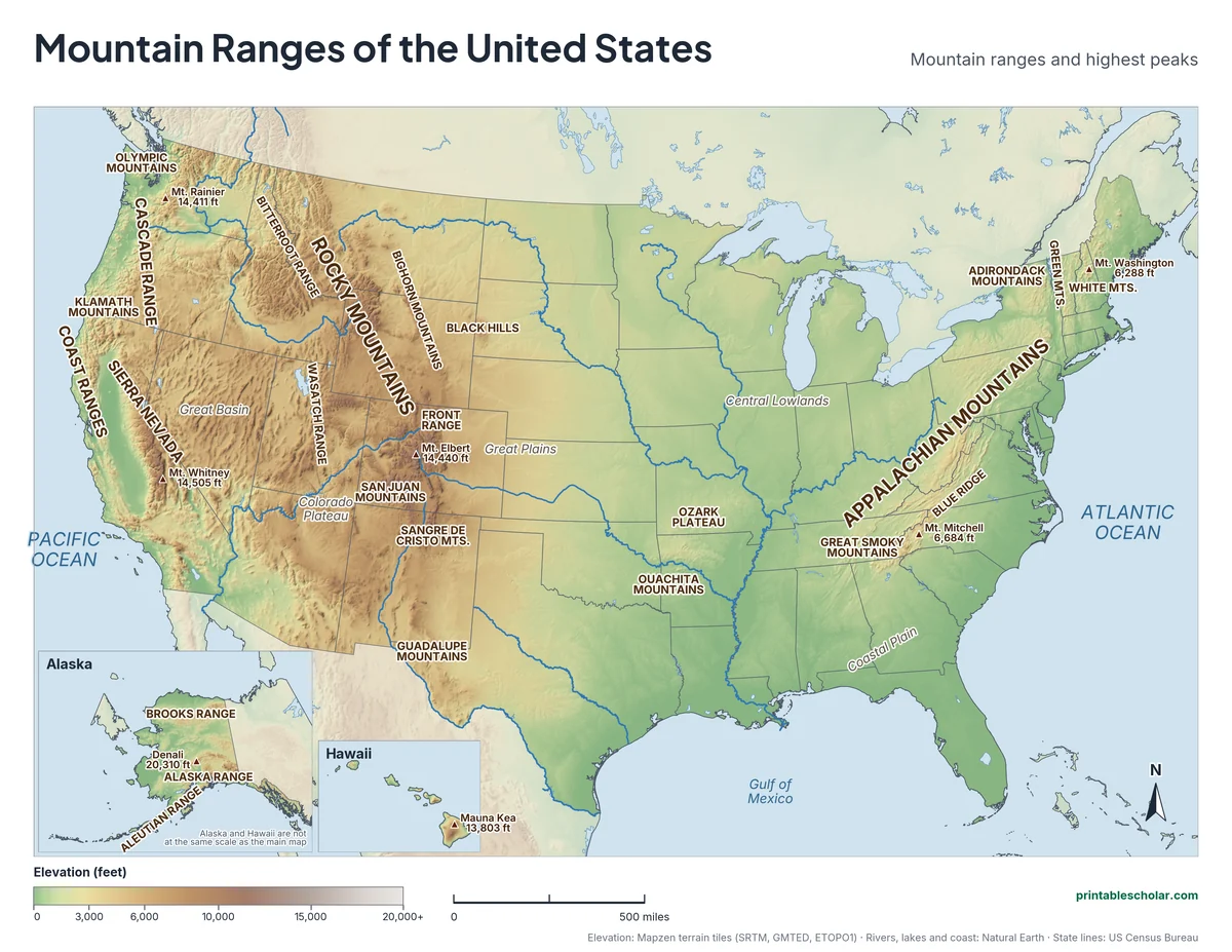
A free printable map of the mountain ranges of the United States, drawn from real elevation data. It names the Rocky Mountains, the Appalachian Mountains, the Sierra Nevada, the Cascade Range and 20 smaller ranges, plus the highest peaks and the big plains and plateaus between them. It comes in black and white or color, and as a blank map with a word bank.
Choose your version
Black and white, color or blank.
All three are free PDFs sized for US Letter paper.

Black and white
26 mountain ranges and 7 peaks named on gray shaded relief. No color ink needed.
downloadBlack and white PDF
Color
The same map in elevation colors, green lowlands to brown peaks.
downloadColor PDF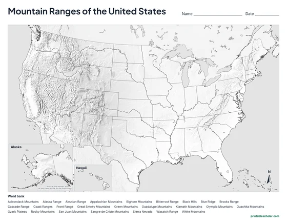
Blank
Shaded relief with no names and an alphabetical word bank. Black and white.
downloadBlank PDFThe mountain ranges of the United States
The United States has two great mountain systems. In the West, the Rocky Mountains run about 3,000 miles from Canada through Montana, Wyoming, Colorado and New Mexico. In the East, the Appalachian Mountains run from Maine to Alabama. The Appalachians are much older. They were once as tall as the Rockies, but hundreds of millions of years of wind, rain and ice have worn them down to rounded ridges. The highest point in the East, Mt. Mitchell in North Carolina, is 6,684 feet.
The Rockies are made of many smaller ranges with their own names. The Front Range rises right behind Denver. The San Juan Mountains fill southwestern Colorado, the Sangre de Cristo Mountains reach into New Mexico, and the Wasatch Range stands above Salt Lake City. Colorado alone has more than 50 peaks over 14,000 feet, including Mt. Elbert, the highest in the Rockies at 14,440 feet.
Closer to the Pacific are two more chains. The Sierra Nevada runs down eastern California and holds Mt. Whitney, at 14,505 feet the highest point in the lower 48 states. The Cascade Range runs north from California through Oregon and Washington and is a line of volcanoes, including Mt. Rainier and Mount St. Helens. Low Coast Ranges line the ocean itself.
Between the mountains lie wide flat or high lands: the Great Plains east of the Rockies, the dry Great Basin of Nevada and Utah, and the Colorado Plateau, cut by the Grand Canyon. The tallest mountain in North America is not in the lower 48 at all. Denali, in Alaska’s Alaska Range, rises to 20,310 feet.
Highest peaks on the map
- Denali, Alaska: 20,310 ft
- Mt. Whitney, California: 14,505 ft
- Mt. Elbert, Colorado: 14,440 ft
- Mt. Rainier, Washington: 14,411 ft
- Mauna Kea, Hawaii: 13,803 ft
- Mt. Mitchell, North Carolina: 6,684 ft
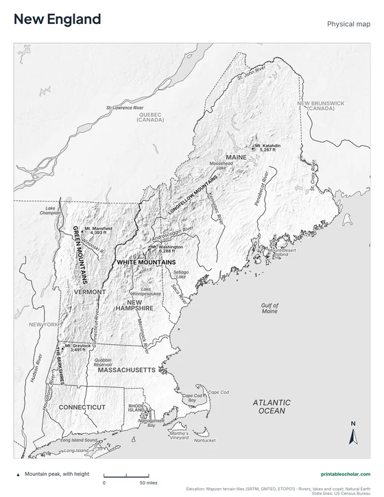
- Mt. Washington, New Hampshire: 6,288 ft
Find it on the map
- The Rocky Mountains running from Montana down into New Mexico
- The Appalachians, lower and older, from New England to Alabama
- Mt. Whitney and Mt. Elbert, the two highest peaks in the lower 48
Elevation is from the Mapzen terrain tiles (SRTM, GMTED, ETOPO1). Rivers, lakes and coastlines are from Natural Earth; state lines from the US Census Bureau. Peak heights are from the US Geological Survey. Range label positions are approximate.
Frequently asked questions
What are the major mountain ranges in the United States?
The Rocky Mountains and the Appalachian Mountains are the two great systems. The Sierra Nevada, Cascade Range and Coast Ranges are in the far West, and the Brooks Range and Alaska Range are in Alaska.
What is the longest mountain range in the United States?
The Rocky Mountains, which run about 3,000 miles from British Columbia in Canada to New Mexico. About half of that length is in the United States.
What is the highest mountain in the United States?
Denali in Alaska, at 20,310 feet, is the highest in North America. In the lower 48 states the highest is Mt. Whitney in California’s Sierra Nevada, at 14,505 feet.
Why are the Appalachian Mountains lower than the Rockies?
Because they are much older. The Appalachians formed more than 250 million years ago and have been worn down by erosion ever since. The Rockies are about 80 million years old or less, so they are still tall and sharp.
How do students use the blank map?
The blank map shows the land shaded by height with no names, and an alphabetical word bank of 26 ranges. Students find each range from the shading and write its name. The labeled map is the answer key.