Printable Scholar
New England Physical Map
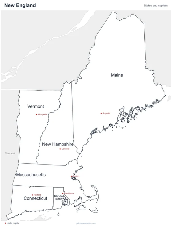
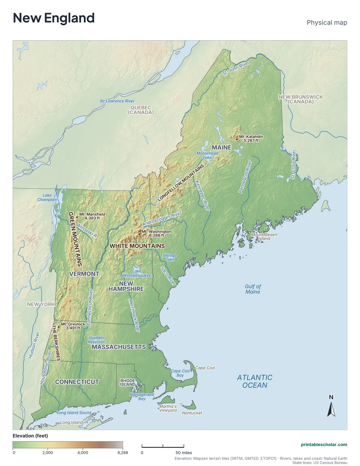
A free printable physical map of New England with its natural features named: 11 rivers, the White Mountains, Green Mountains, Longfellow Mountains and Berkshires, four peaks, the big lakes, Cape Cod, the islands and the bays. It comes in black and white or color, and as a blank map with peak markers and a word bank.
Choose your version
Black and white, color or blank.
All three are free PDFs sized for US Letter paper.

Black and white
Rivers, mountains, peaks, lakes, islands and bays named on gray shaded relief. No color ink needed.
downloadBlack and white PDF
Color
The same map in elevation colors with blue water.
downloadColor PDF
Blank
No names, with peak markers and an alphabetical word bank. Black and white.
downloadBlank PDFRivers and mountains of New England
New England’s mountains are the northern end of the Appalachians. The Green Mountains run down the middle of Vermont and continue into Massachusetts as the Berkshires. The White Mountains of New Hampshire are the highest, topped by Mt. Washington at 6,288 feet, famous for some of the worst weather on Earth. In Maine the mountains spread northeast as the Longfellow Mountains, ending at Mt. Katahdin, where the Appalachian Trail ends.
The Connecticut River is the longest river in New England, about 410 miles. It starts near the Canadian border, forms the line between Vermont and New Hampshire, and flows south through Massachusetts and Connecticut into Long Island Sound. Maine’s big rivers, the Penobscot, Kennebec and Androscoggin, run from the northern woods to the Gulf of Maine. The Merrimack powered some of the first big factories in the country, in mill towns like Lowell.
Glaciers shaped the whole region. Thick ice covered New England until about 15,000 years ago, scraping the mountains round, scooping out thousands of lakes and leaving behind rocky soil, boulders and sand. Cape Cod, Martha’s Vineyard and Nantucket are piles of sand and gravel the glaciers left at their edge. Lake Champlain, Moosehead Lake and Lake Winnipesaukee are the largest lakes.
Highest peaks
- Mt. Washington, New Hampshire: 6,288 ft
- Mt. Katahdin, Maine: 5,267 ft
- Mt. Mansfield, Vermont: 4,393 ft
- Mt. Greylock, Massachusetts: 3,491 ft
Find it on the map
- The Connecticut River along the Vermont-New Hampshire border
- Mt. Washington in the White Mountains, the highest point in the Northeast
- The hook of Cape Cod and the islands south of it
Elevation is from the Mapzen terrain tiles (SRTM). Rivers, lakes and coastlines are from Natural Earth; state lines from the US Census Bureau. Peak heights are from the US Geological Survey.
Frequently asked questions
What are the main physical features of New England?
The Appalachian Mountains (the White Mountains, Green Mountains, Berkshires and Longfellow Mountains), the Connecticut River valley, a rocky Atlantic coast with many bays, Cape Cod, and lakes such as Lake Champlain and Moosehead Lake.
What is the longest river in New England?
The Connecticut River, about 410 miles from the Canadian border to Long Island Sound. It forms the border between Vermont and New Hampshire.
What is the highest mountain in New England?
Mt. Washington in the White Mountains of New Hampshire, at 6,288 feet. It is also the highest peak in the northeastern United States.
What mountains are in New England?
All of New England’s mountains are part of the Appalachians: the White Mountains in New Hampshire and Maine, the Green Mountains in Vermont, the Berkshires in western Massachusetts and the Longfellow Mountains in Maine.
How do students use the blank map?
The blank map shows the states, rivers, lakes and peak markers with no names, and an alphabetical word bank. Students label the six states, the rivers, mountains, lakes and coast. The labeled map is the answer key.