Printable Scholar
Mississippi River Map
A free printable map of the Mississippi River from its source at Lake Itasca, Minnesota, to the Gulf of Mexico. It shows the ten states along the river, its main tributaries, including the Missouri and the Ohio, and the big river cities. Black and white, color, and a blank map with a word bank.

Choose your version
Black and white, color or blank.
All three are free PDFs sized for US Letter paper.
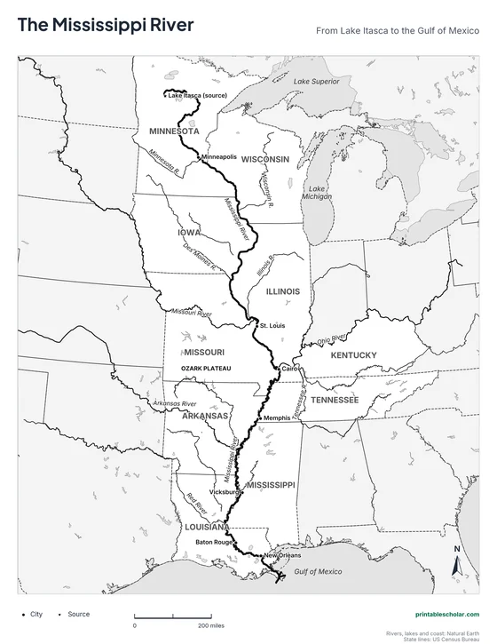
Black and white
The river, ten states, seven tributaries and eight cities named. No color ink needed.
downloadBlack and white PDF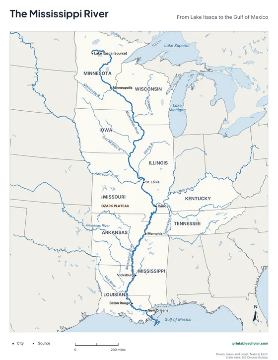
Color
The same map with the rivers and water in blue.
downloadColor PDF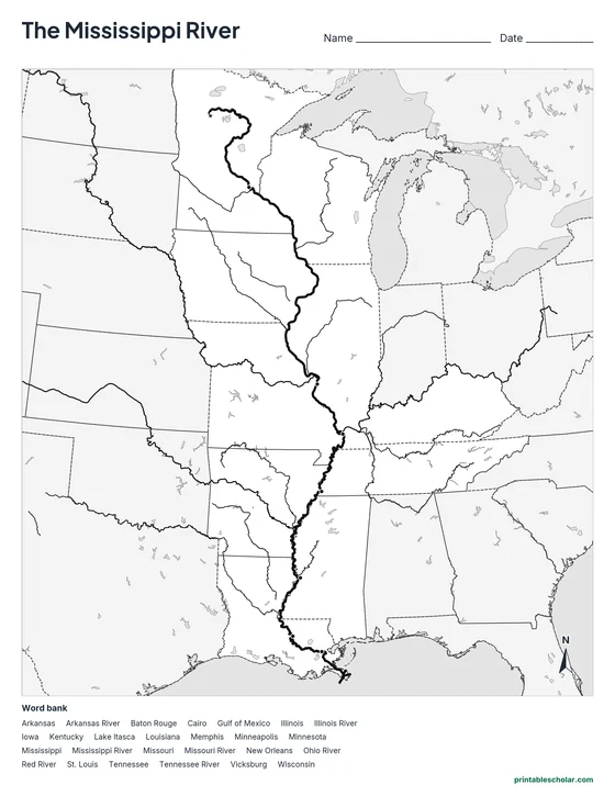
Blank
The same river, states and city dots with no names, and a word bank.
downloadBlank PDFAmerica’s great river
The Mississippi River begins as a small stream flowing out of Lake Itasca in northern Minnesota, so narrow that you can walk across it on stepping stones. From there it runs about 2,340 miles south to the Gulf of Mexico below New Orleans. Its name comes from the Ojibwe words for "great river." A drop of water that leaves Lake Itasca takes about three months to reach the Gulf.
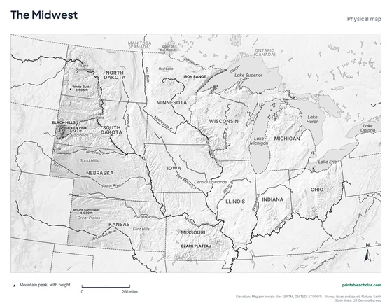
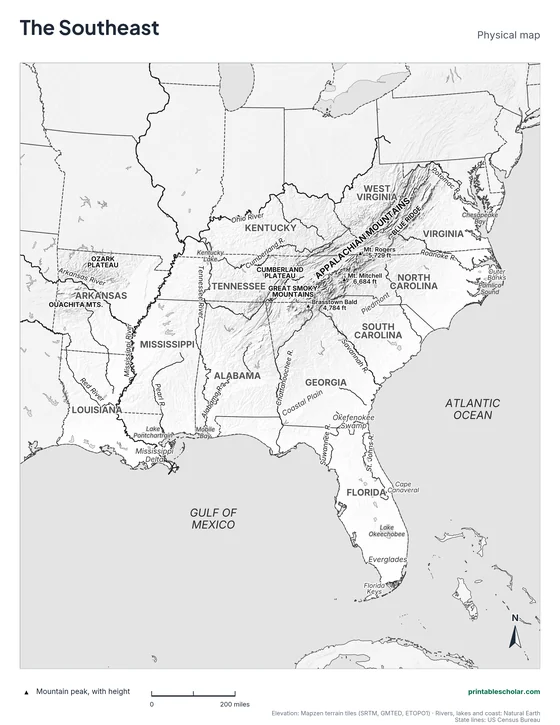
Ten states touch the river: Minnesota, Wisconsin, Iowa, Illinois, Missouri, Kentucky, Tennessee, Arkansas, Mississippi and Louisiana. For most of its length the river forms the border between states, so each side of the river usually belongs to a different state.
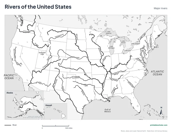
Hundreds of rivers flow into the Mississippi. The Missouri River, the longest river in the United States, joins it just north of St. Louis. The Ohio River joins it at Cairo, Illinois, and adds more water than the whole Mississippi has carried until then. The Arkansas and Red Rivers join farther south. Together these rivers drain water from all or part of 31 states and two Canadian provinces, about 41 percent of the 48 connected states.
The river has carried people and goods for thousands of years. Native nations built towns along it, steamboats made it a highway in the 1800s, and Mark Twain wrote about growing up beside it. Today barges carry grain, coal and other cargo up and down the river, and locks and dams let them pass the shallow stretches of the upper river.
River facts
- Source: Lake Itasca, Minnesota
- Mouth: the Gulf of Mexico, below New Orleans, Louisiana
- Length: about 2,340 miles
- Biggest tributaries: the Missouri and the Ohio
- States along the river: 10
Find it on the map
- Where the Missouri River joins the Mississippi, just north of St. Louis
- Cairo, Illinois, where the Ohio River flows in
- The river’s many bends in Mississippi and Louisiana
Rivers, lakes and coast: Natural Earth. State lines: US Census Bureau. Length from the US Geological Survey.
Frequently asked questions
Where does the Mississippi River start and end?
It starts at Lake Itasca in northern Minnesota and ends at the Gulf of Mexico, about 100 miles below New Orleans, Louisiana.
What 10 states does the Mississippi River touch?
Minnesota, Wisconsin, Iowa, Illinois, Missouri, Kentucky, Tennessee, Arkansas, Mississippi and Louisiana.
How long is the Mississippi River?
About 2,340 miles. Measurements differ a little because the river changes course over time. Together with the Missouri River it forms one of the longest river systems in the world.
Which way does the Mississippi River flow?
South. It starts in Minnesota and flows south to the Gulf of Mexico, so on a map the water moves from the top of the page to the bottom.
What are the main tributaries of the Mississippi River?
The two biggest are the Missouri River, which joins near St. Louis, and the Ohio River, which joins at Cairo, Illinois. Others include the Minnesota, Wisconsin, Illinois, Des Moines, Arkansas, Red and (through the Ohio) Tennessee Rivers.
How do students use the blank map?
The blank map shows the same river, tributaries, state lines and city dots with no names, and a word bank. Students label the ten states, the rivers and the cities. The labeled map is the answer key.