Printable Scholar
Continents and Oceans Map
A free printable world map of the seven continents and five oceans. It comes labeled in black and white or in color, as a blank worksheet with a word bank, and with a ten-question quiz and answer key. Every map is drawn from real geographic data and sized for US Letter paper.
Choose your version
Black and white, color or blank.
All three are free PDFs sized for US Letter paper.
Black and white
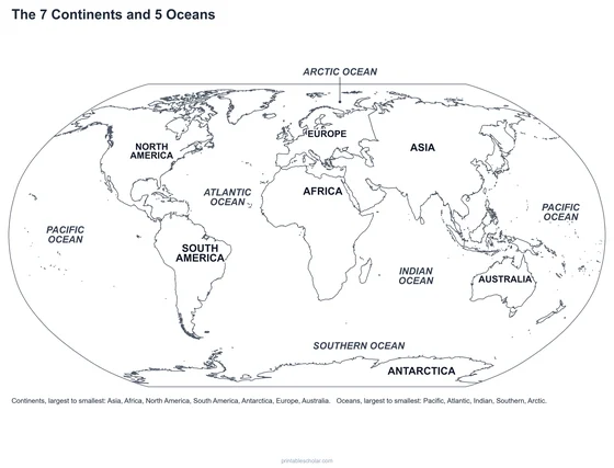
The 7 continents and 5 oceans named on a plain outline map. No color ink needed.
downloadBlack and white PDF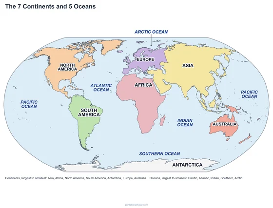
Color
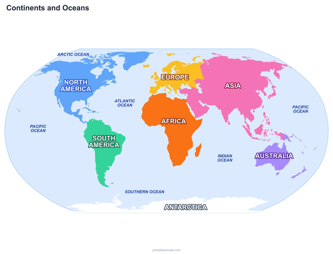
The same map with each continent in its own color and blue oceans.
downloadColor PDF
Blank worksheet
Numbered continents, lettered oceans, blanks and a word bank.
downloadBlank worksheet PDFCheck what they know
Continents and oceans quiz
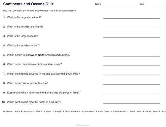
Ten questions answered from the map, with an answer key for the quiz and the worksheet.
Continents and Oceans Quiz
Three pages: the labeled map, ten questions with a word bank, and the answer key for the quiz and the blank worksheet.
downloadQuiz and key PDFThe seven continents and five oceans
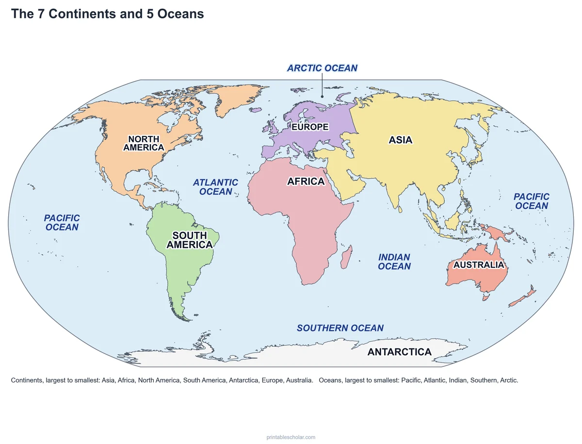
A continent is one of Earth’s seven great areas of land: Asia, Africa, North America, South America, Antarctica, Europe and Australia. Asia is the largest, with almost a third of all the land on Earth and more than half of all the people. Australia is the smallest, and it is the only continent that is also a single country.
Most continents are separated by oceans, but not all. Europe and Asia sit on one huge piece of land, and the line between them is drawn along the Ural Mountains and the Caspian and Black Seas. North and South America meet at the narrow Isthmus of Panama, and Africa touches Asia at the Sinai Peninsula, next to the Suez Canal.
The five oceans are really one connected world ocean that covers about 71 percent of Earth’s surface. The Pacific is the largest and deepest: it is bigger than all the land on Earth put together. Next come the Atlantic, the Indian and the Southern Ocean, which circles Antarctica. The Arctic Ocean, around the North Pole, is the smallest and is covered by sea ice for much of the year.
Largest to smallest
- Continents: Asia, Africa, North America, South America, Antarctica, Europe, Australia
- Oceans: Pacific, Atlantic, Indian, Southern, Arctic
Find it on the map
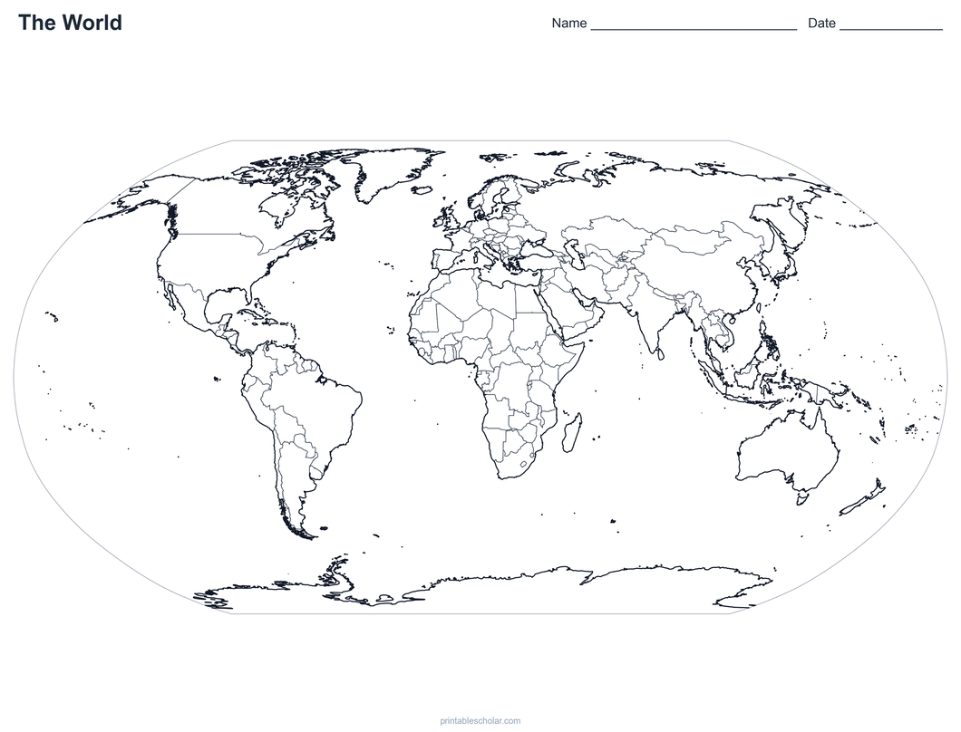
- The Pacific Ocean, so wide it shows on both sides of the map
- Where Europe ends and Asia begins
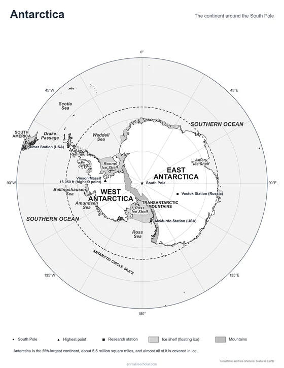
- Antarctica, stretched along the bottom of the map
Coastlines and borders: Natural Earth. Continents follow the usual US classroom grouping: Europe and Asia meet at the Ural Mountains, and New Zealand and the Pacific islands are shown with Australia.
Frequently asked questions
What are the 7 continents?
Asia, Africa, North America, South America, Antarctica, Europe and Australia, from largest to smallest.
What are the 5 oceans?
The Pacific, Atlantic, Indian, Southern and Arctic Oceans, from largest to smallest. The Southern Ocean, around Antarctica, is the newest to be named on maps.
Is it 4 oceans or 5?
Older maps show four oceans. Many geographers, the National Geographic Society and the US Board on Geographic Names now also name the Southern Ocean, the cold water that circles Antarctica, so most classrooms now teach five.
Which continent is the biggest?
Asia. It is larger than North America and South America together and holds more than half of the world’s people.
Is Australia a continent or a country?
Both. Australia is the smallest continent and the only one that is a single country. On this map, New Zealand and the Pacific islands are colored with Australia, as many classrooms group them as Oceania.
Why does Antarctica look so big on the map?
A flat map has to stretch the round Earth, and the stretching is greatest near the poles. Antarctica is really a little smaller than South America. Look at a globe to see its true size.
How do students use the worksheet and quiz?
On the blank map, students write the name of each numbered continent and lettered ocean, using the word bank. The quiz has ten questions they answer from the map. The answer key covers both.