West Africa Map
Free printable maps of West Africa: a labeled map of its 16 countries, a blank outline map, and a physical map in labeled and blank versions.
West Africa is the 16 countries from Mauritania and Senegal east to Niger and Nigeria.

Choose your version
Four maps of West Africa.
All free PDFs sized for US Letter paper.

Labeled
Every country named. Small countries are numbered with a key.
downloadLabeled PDF
Blank
Country outlines only, with a name line, for quizzes and coloring.
downloadBlank PDF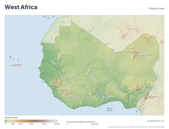
Physical
Shaded relief with mountains, deserts, rivers and peaks named.
downloadPhysical PDF
Physical, blank
The same terrain with no names, for labeling practice.
downloadBlank physical PDFThe geography of West Africa
West Africa runs in bands from north to south. The Sahara covers the north, in Mauritania, Mali and Niger. South of it is the Sahel, a belt of dry grassland, and then savanna. Rainforest once covered most of the coast along the Gulf of Guinea. The land is mostly low plateau, with highlands in Guinea, where the Niger River begins, and the Aïr Mountains in Niger. The Niger flows in a great arc through the region to its delta in Nigeria.
Countries on this map
- Benin
- Burkina Faso
- Cabo Verde
- Côte d’Ivoire
- Gambia
- Ghana
- Guinea
- Guinea-Bissau
- Liberia
- Mali
- Mauritania
- Niger
- Nigeria
- Senegal
- Sierra Leone
- Togo
Major rivers
- Niger
- Senegal
- Volta
- Gambia
- Benue
Find it on the map
- The great bend of the Niger River
- Lake Volta in Ghana
- The Sahara across the north
Built from real data, not stock images.
Country borders, coastlines, rivers and feature names come from Natural Earth. The terrain on the physical maps is drawn from a global elevation model built from NASA SRTM and other public surveys.
Read full methodology arrow_forward