Rhode Island Landmarks Map
A free printable illustrated map of Rhode Island for kids. It shows 8 landmarks and natural places and 3 industries where they really are, along with the state symbols, 5 cities and a box of key facts. It comes in color and in ink-saving black and white, sized for US Letter paper.
downloadColor PDF downloadBlack and white PDF
Choose your version
Color or black and white.
Both are free, sized for US Letter paper, and come as a PDF to print or a PNG image for slides.
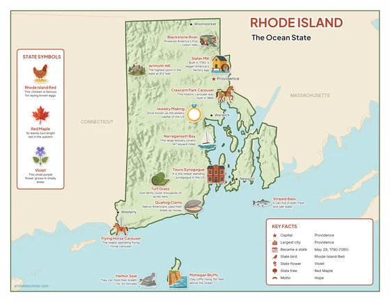
Color
The full-color map, for a wall display or a color printer.

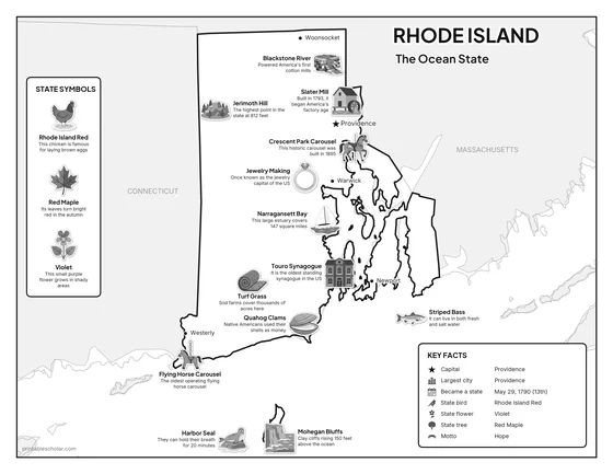
Black and white
The same map with no color or shading. Prints cleanly on a classroom printer and saves ink.

What is on the Rhode Island map
Every picture sits at its real location in Rhode Island, with a one-line fact beside it. Providence, the capital, is marked with a star.
Landmarks and natural places
- Jerimoth Hill: The highest point in the state at 812 feet.
- Mohegan Bluffs: Clay cliffs rising 150 feet above the ocean.
- Narragansett Bay: This large estuary covers 147 square miles.
- Blackstone River: Powered America’s first cotton mills.
- Slater Mill: Built in 1793, it began America’s factory age.
- Touro Synagogue: It is the oldest standing synagogue in the US.
- Crescent Park Carousel: This historic carousel was built in 1895.
- Flying Horse Carousel: The oldest operating flying horse carousel.
What Rhode Island makes and grows
- Quahog Clams: Native Americans used their shells as money.
- Jewelry Making: Once known as the jewelry capital of the US.
- Turf Grass: Sod farms cover thousands of acres here.
State symbols
- Rhode Island Red: This chicken is famous for laying brown eggs.
- Red Maple: Its leaves turn bright red in the autumn.
- Violet: This small purple flower grows in shady areas.
- Harbor Seal: They can hold their breath for 20 minutes.
- Striped Bass: It can live in both fresh and salt water.
Rhode Island key facts
From the box on the map
- Nickname
- The Ocean State
- Capital
- Providence
- Largest city
- Providence
- Became a state
- May 29, 1790 (13th)
- State bird
- Rhode Island Red
- State flower
- Violet
- State tree
- Red Maple
- Motto
- Hope
Cities shown
- Providence (capital)
- Warwick
- Newport
- Woonsocket
- Westerly
The outline, rivers and cities are drawn from map data. Pictures of crops and industries are placed in a part of the state where each is typical.