Latin America Map
Free printable maps of Latin America: a labeled map of its 23 countries, a blank outline map, and a physical map in labeled and blank versions.
Latin America means the parts of the Americas where Spanish, Portuguese or French is the main language: Mexico, Central America, most of South America and several Caribbean countries. Lists differ on which small countries to include.

Choose your version
Four maps of Latin America.
All free PDFs sized for US Letter paper.

Labeled
Every country named. Small countries are numbered with a key.
downloadLabeled PDF
Blank
Country outlines only, with a name line, for quizzes and coloring.
downloadBlank PDF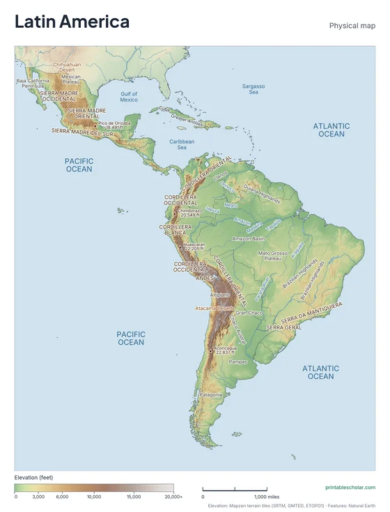
Physical
Shaded relief with mountains, deserts, rivers and peaks named.
downloadPhysical PDF
Physical, blank
The same terrain with no names, for labeling practice.
downloadBlank physical PDFThe geography of Latin America
Latin America stretches from Mexico’s border with the United States to the southern tip of South America. Mountains run down its whole western side: the Sierra Madre ranges in Mexico, the highlands of Central America, and the Andes, the longest mountain range on land. East of the Andes, the Amazon Basin holds the world’s largest rainforest. Highlands rise in Brazil and the Guianas, and grasslands spread across the Llanos in the north and the Pampas in the south.
Countries and territories on this map
- Argentina
- Belize
- Bolivia
- Brazil
- Chile
- Colombia
- Costa Rica
- Cuba
- Dominican Republic
- Ecuador
- El Salvador
- French Guiana
- Guatemala
- Guyana
- Haiti
- Honduras
- Mexico
- Nicaragua
- Panama
- Paraguay
- Peru
- Puerto Rico
- Suriname
- Uruguay
- Venezuela
Major rivers
- Amazon
- Paraná
- Orinoco
- Rio Grande
- São Francisco
- Magdalena
Find it on the map
- The Andes along the Pacific coast
- The Amazon Basin in the north of South America
- The narrow land bridge of Central America
Built from real data, not stock images.
Country borders, coastlines, rivers and feature names come from Natural Earth. The terrain on the physical maps is drawn from a global elevation model built from NASA SRTM and other public surveys.
Read full methodology arrow_forward