Printable Scholar
Free Printable Political Map of the United States
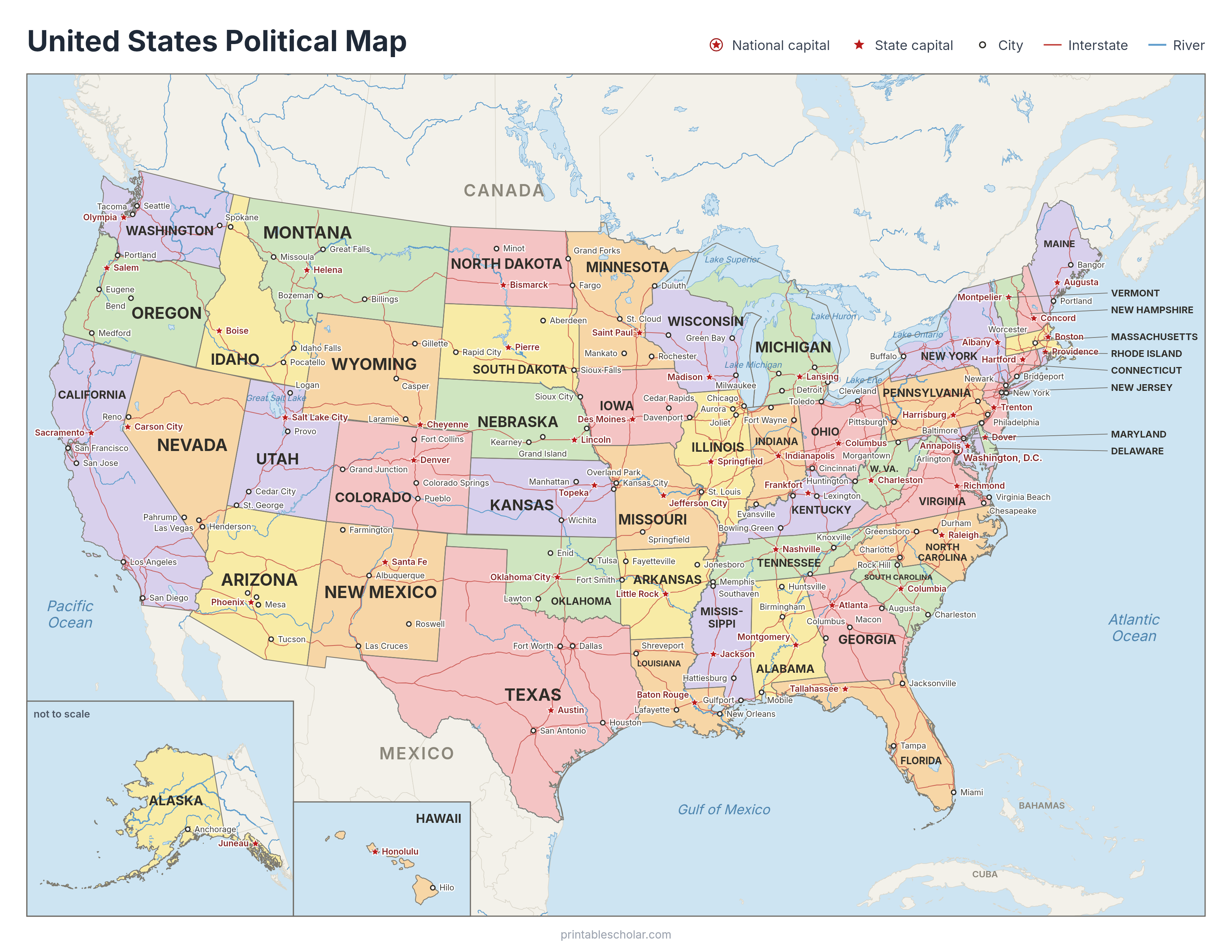
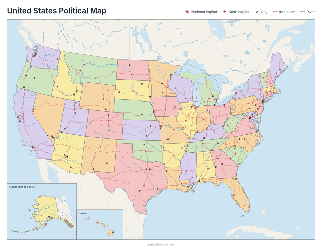
Free printable political map of the United States in color: all 50 states with their names and capitals, major cities, Interstate highways, rivers and the Great Lakes, with Canada and Mexico around the edges and Alaska and Hawaii in insets. Prints on US Letter paper.
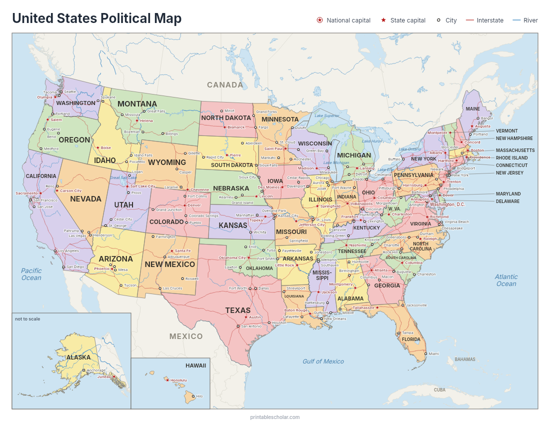
Comparing map types? See the physical map of the United States (mountains, plains and rivers).
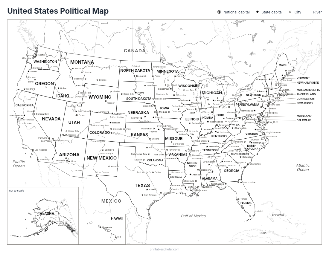
Black and white version for coloring in: the same map with state, capital and city names, without the Interstates.
No-names version: the same color map without state or city names, for map quizzes and labeling practice.
Test yourself: US Map Quiz We name a state, you click it on the map. All 50 states or one region at a time, with a score and timer. Free, no sign-up. Play the map quiz → Teaching the 50 states?
Our 50 States Map Book has an illustrated map and a page of true stories for every state, in one printable book for grades 3 to 5.
Look inside the book →
About This US Map
Free printable political map of the United States in color: all 50 states with their names and capitals, major cities, Interstate highways, rivers and the Great Lakes, with Canada and Mexico around the edges and Alaska and Hawaii in insets. Prints on US Letter paper.
What is a political map?
A political map shows the lines people have drawn: the borders of countries and states, and the places people live, from capitals to large cities. Each state is filled in its own color so its shape stands out, and no two neighboring states share a color.
This map also shows the Interstate highways and major rivers, which help explain where cities grew. The state capitals are marked with red stars, and Washington, D.C., the national capital, with a star in a circle.
Political map vs. physical map
A physical map shows the land itself: mountains, plains, deserts and rivers, usually shaded by height. A political map shows how people have divided the land into countries and states. Put the two side by side and students can see why borders and cities fall where they do: many state lines follow rivers, like the Mississippi, and many big cities sit on a coast, a river or a lake.
For a lesson, hand out this map with our US physical map and ask students to find three borders that follow a river and three cities that grew beside water.
How to Use
Print this map on standard US Letter paper (8.5" × 11"). Click "Download PDF" for a print-ready file that automatically fits your page in the right orientation, or "Download PNG" for the high-resolution image file.
Frequently Asked Questions
What does this political map show?
All 50 states in color with their names, every state capital (red star), Washington, D.C., two to four major cities in each state, the Interstate highways, major rivers and lakes, and Canada, Mexico, the Bahamas and Cuba around the edges. Alaska and Hawaii are shown in insets.
Is there a version without names?
Yes. The no-names PDF is the same color map with no state or city names, for quizzes and labeling practice. Use the named map as the answer key.
Is there a black and white version?
Yes. The black and white PDF is line art of the same map for coloring in. A common assignment is to color each state so that no two neighbors share a color.
What paper size does it print on?
US Letter (8.5 x 11 inches), landscape. The PDF is sized to fit the page, and the PNG is a 300 dpi image for slides or larger prints.