Texas Landmarks Map
A free printable illustrated map of Texas for kids. It shows 8 landmarks and natural places and 4 industries where they really are, along with the state symbols, 6 cities and a box of key facts. It comes in color and in ink-saving black and white, sized for US Letter paper.
downloadColor PDF downloadBlack and white PDF
Choose your version
Color or black and white.
Both are free, sized for US Letter paper, and come as a PDF to print or a PNG image for slides.
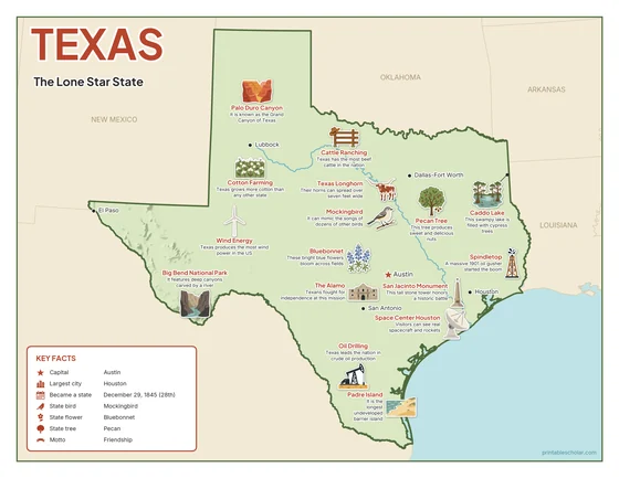
Color
The full-color map, for a wall display or a color printer.

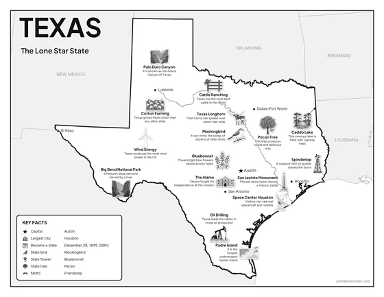
Black and white
The same map with no color or shading. Prints cleanly on a classroom printer and saves ink.

What is on the Texas map
Every picture sits at its real location in Texas, with a one-line fact beside it. Austin, the capital, is marked with a star.
Landmarks and natural places
- Big Bend National Park: It features deep canyons carved by a river.
- Palo Duro Canyon: It is known as the Grand Canyon of Texas.
- Padre Island: It is the longest undeveloped barrier island.
- Caddo Lake: This swampy lake is filled with cypress trees.
- Space Center Houston: Visitors can see real spacecraft and rockets.
- The Alamo: Texans fought for independence at this mission.
- San Jacinto Monument: This tall stone tower honors a historic battle.
- Spindletop: A massive 1901 oil gusher started the boom.
What Texas makes and grows
- Oil Drilling: Texas leads the nation in crude oil production.
- Cotton Farming: Texas grows more cotton than any other state.
- Wind Energy: Texas produces the most wind power in the US.
- Cattle Ranching: Texas has the most beef cattle in the nation.
State symbols
- Mockingbird: It can mimic the songs of dozens of other birds.
- Bluebonnet: These bright blue flowers bloom across fields.
- Pecan Tree: This tree produces sweet and delicious nuts.
- Texas Longhorn: Their horns can spread over seven feet wide.
Texas key facts
From the box on the map
- Nickname
- The Lone Star State
- Capital
- Austin
- Largest city
- Houston
- Became a state
- December 29, 1845 (28th)
- State bird
- Mockingbird
- State flower
- Bluebonnet
- State tree
- Pecan
- Motto
- Friendship
Cities shown
- Austin (capital)
- Houston
- San Antonio
- Dallas-Fort Worth
- El Paso
- Lubbock
The outline, rivers and cities are drawn from map data. Pictures of crops and industries are placed in a part of the state where each is typical.