South Dakota Landmarks Map
A free printable illustrated map of South Dakota for kids. It shows 8 landmarks and natural places and 3 industries where they really are, along with the state symbols, 5 cities and a box of key facts. It comes in color and in ink-saving black and white, sized for US Letter paper.
downloadColor PDF downloadBlack and white PDF
Choose your version
Color or black and white.
Both are free, sized for US Letter paper, and come as a PDF to print or a PNG image for slides.
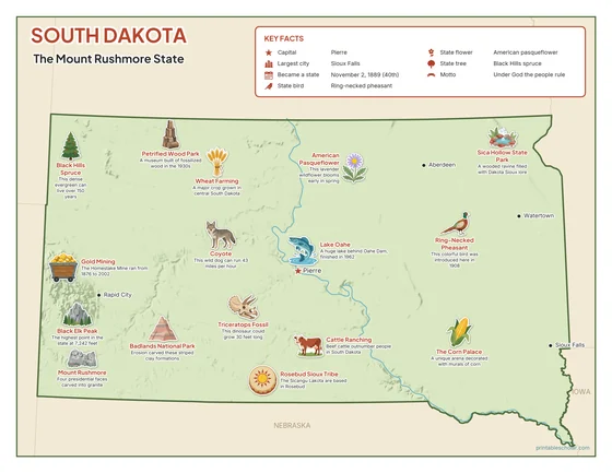
Color
The full-color map, for a wall display or a color printer.

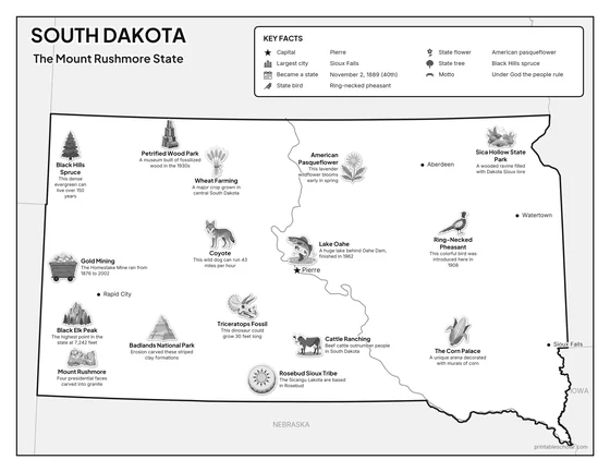
Black and white
The same map with no color or shading. Prints cleanly on a classroom printer and saves ink.

What is on the South Dakota map
Every picture sits at its real location in South Dakota, with a one-line fact beside it. Pierre, the capital, is marked with a star.
Landmarks and natural places
- Badlands National Park: Erosion carved these striped clay formations.
- Black Elk Peak: The highest point in the state at 7,242 feet.
- Lake Oahe: A huge lake behind Oahe Dam, finished in 1962.
- Sica Hollow State Park: A wooded ravine filled with Dakota Sioux lore.
- Mount Rushmore: Four presidential faces carved into granite.
- The Corn Palace: A unique arena decorated with murals of corn.
- Petrified Wood Park: A museum built of fossilized wood in the 1930s.
- Rosebud Sioux Tribe: The Sicangu Lakota are based in Rosebud.
What South Dakota makes and grows
- Wheat Farming: A major crop grown in central South Dakota.
- Gold Mining: The Homestake Mine ran from 1876 to 2002.
- Cattle Ranching: Beef cattle outnumber people in South Dakota.
State symbols
- Black Hills Spruce: This dense evergreen can live over 150 years.
- American Pasqueflower: This lavender wildflower blooms early in spring.
- Ring-Necked Pheasant: This colorful bird was introduced here in 1908.
- Coyote: This wild dog can run 43 miles per hour.
- Triceratops Fossil: This dinosaur could grow 30 feet long.
South Dakota key facts
From the box on the map
- Nickname
- The Mount Rushmore State
- Capital
- Pierre
- Largest city
- Sioux Falls
- Became a state
- November 2, 1889 (40th)
- State bird
- Ring-necked pheasant
- State flower
- American pasqueflower
- State tree
- Black Hills spruce
- Motto
- Under God the people rule
Cities shown
- Pierre (capital)
- Sioux Falls
- Rapid City
- Aberdeen
- Watertown
The outline, rivers and cities are drawn from map data. Pictures of crops and industries are placed in a part of the state where each is typical.