Oklahoma Landmarks Map
A free printable illustrated map of Oklahoma for kids. It shows 8 landmarks and natural places and 3 industries where they really are, along with the state symbols, 6 cities and a box of key facts. It comes in color and in ink-saving black and white, sized for US Letter paper.
downloadColor PDF downloadBlack and white PDF
Choose your version
Color or black and white.
Both are free, sized for US Letter paper, and come as a PDF to print or a PNG image for slides.
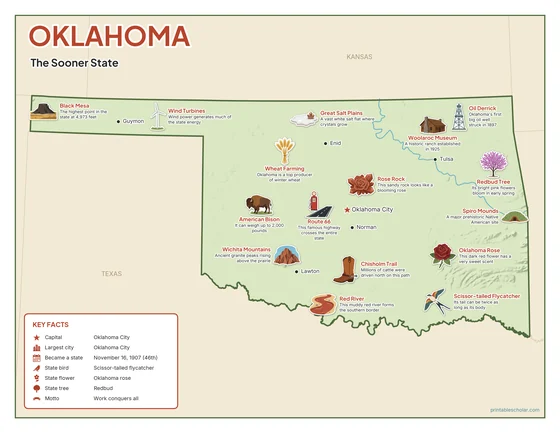
Color
The full-color map, for a wall display or a color printer.

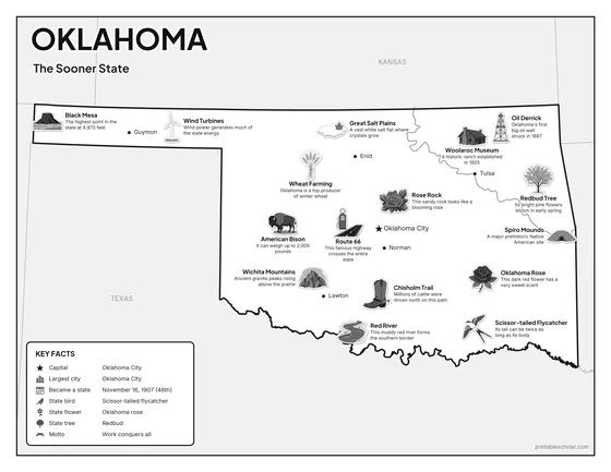
Black and white
The same map with no color or shading. Prints cleanly on a classroom printer and saves ink.

What is on the Oklahoma map
Every picture sits at its real location in Oklahoma, with a one-line fact beside it. Oklahoma City, the capital, is marked with a star.
Landmarks and natural places
- Black Mesa: The highest point in the state at 4,973 feet.
- Wichita Mountains: Ancient granite peaks rising above the prairie.
- Red River: This muddy red river forms the southern border.
- Great Salt Plains: A vast white salt flat where crystals grow.
- Route 66: This famous highway crosses the entire state.
- Chisholm Trail: Millions of cattle were driven north on this path.
- Spiro Mounds: A major prehistoric Native American site.
- Woolaroc Museum: A historic ranch established in 1925.
What Oklahoma makes and grows
- Oil Derrick: Oklahoma’s first big oil well struck in 1897.
- Wheat Farming: Oklahoma is a top producer of winter wheat.
- Wind Turbines: Wind power generates much of the state energy.
State symbols
- Scissor-tailed Flycatcher: Its tail can be twice as long as its body.
- Oklahoma Rose: This dark red flower has a very sweet scent.
- Redbud Tree: Its bright pink flowers bloom in early spring.
- American Bison: It can weigh up to 2,000 pounds.
- Rose Rock: This sandy rock looks like a blooming rose.
Oklahoma key facts
From the box on the map
- Nickname
- The Sooner State
- Capital
- Oklahoma City
- Largest city
- Oklahoma City
- Became a state
- November 16, 1907 (46th)
- State bird
- Scissor-tailed flycatcher
- State flower
- Oklahoma rose
- State tree
- Redbud
- Motto
- Work conquers all
Cities shown
- Oklahoma City (capital)
- Tulsa
- Norman
- Lawton
- Enid
- Guymon
The outline, rivers and cities are drawn from map data. Pictures of crops and industries are placed in a part of the state where each is typical.