New York Landmarks Map
A free printable illustrated map of New York for kids. It shows 8 landmarks and natural places and 4 industries where they really are, along with the state symbols, 5 cities and a box of key facts. It comes in color and in ink-saving black and white, sized for US Letter paper.
downloadColor PDF downloadBlack and white PDF
Choose your version
Color or black and white.
Both are free, sized for US Letter paper, and come as a PDF to print or a PNG image for slides.
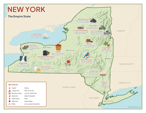
Color
The full-color map, for a wall display or a color printer.

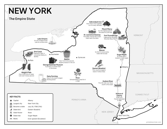
Black and white
The same map with no color or shading. Prints cleanly on a classroom printer and saves ink.

What is on the New York map
Every picture sits at its real location in New York, with a one-line fact beside it. Albany, the capital, is marked with a star.
Landmarks and natural places
- Niagara Falls: Over 3,000 tons of water rush over it every second.
- Mount Marcy: It is the highest point in the state at 5,344 feet.
- Lake Ontario: It is the smallest Great Lake by surface area.
- Hudson River: This 315-mile river flows south to the ocean.
- Erie Canal: Opened in 1825, it connected Albany to Buffalo.
- Statue of Liberty: A gift from France dedicated in 1886.
- George Eastman Museum: A pioneer of roll film lived in Rochester.
- Fort Ticonderoga: Captured by the Green Mountain Boys in 1775.
What New York makes and grows
- Apples: New York is the second-largest producer in the US.
- Dairy Farming: Dairy is the state’s largest farming sector.
- Adirondack Iron: Vast mines once supplied iron for early railroads.
- St. Lawrence Seaway: This deep channel lets ocean ships reach the lakes.
State symbols
- Eastern Bluebird: This colorful songbird nests in hollow trees.
- Sugar Maple: Its sweet sap is boiled to make maple syrup.
- Rose: Schoolchildren voted for it in 1891.
- Beaver: Its thick fur drove early trade with Europe.
New York key facts
From the box on the map
- Nickname
- The Empire State
- Capital
- Albany
- Largest city
- New York City
- Became a state
- July 26, 1788 (11th)
- State bird
- Eastern Bluebird
- State flower
- Rose
- State tree
- Sugar Maple
- Motto
- Ever upward (Excelsior)
Cities shown
- Albany (capital)
- New York City
- Buffalo
- Rochester
- Syracuse
The outline, rivers and cities are drawn from map data. Pictures of crops and industries are placed in a part of the state where each is typical.